Community Corner
Heavy Rain and Strong Winds Expected in Malvern
A strong cold front will produce periods of moderate to heavy rain into Thursday, with cool conditions on the way for this weekend.

By Steven DiMartino
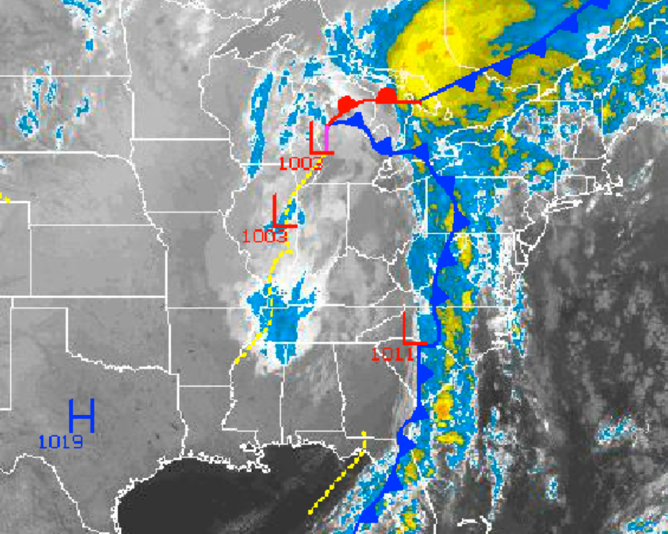
A strong cold front will approach from the west with periods of moderate to heavy rain Wednesday evening into Thursday, along with very strong wind gusts in embedded thunderstorms. The cold front will mark the start of a cooler weather pattern that will feature temperatures falling to below normal levels once again by the end of this weekend.
Wednesday, clouds will increase through the day with isolated showers becoming widely scattered by the afternoon. The showers will be capable of brief, heavy downpours. Winds will be from the southeast at 5 to 15 mph, increasing to 10 to 20 mph by the afternoon. Temperatures will be well above normal with highs in the mid to upper 70s.
Find out what's happening in Malvernfor free with the latest updates from Patch.
Wednesday night on through Thursday, the cold front will slowly move through the Philadelphia metropolitan area, with periods of moderate to heavy rainfall. Embedded thunderstorms will feature intense downpours, wind gusts over 40 mph, and occasional lightning. Rainfall amounts will range from one to two inches with locally higher amounts at times. Localized flash flooding, visibility below 2 miles, and wind damage will be a threat through the period along with very poor driving conditions. Winds will veer from the southeast to the west at 10 to 20 mph. Temperatures will remain above normal with lows in the lower to mid 60s and highs in the lower to mid 70s.
High pressure will be in control on Friday and Saturday with clearing skies and mild conditions. Winds will be from the west at 5 to 15 mph. Temperatures will remain above normal through the period. Temperatures on Friday will range from the upper 40s to lower 50s for lows and upper 60s to lower 70s for highs. Temperatures on Saturday will range from the upper 40s to lower 50s for lows and mid to upper 60s for highs.
Find out what's happening in Malvernfor free with the latest updates from Patch.
A cold front will move through the region on Saturday night with scattered clouds but no rainfall is expected. Behind this cold front though, a fresh Polar air mass will build into the region leading to temperatures falling to below normal levels by Sunday morning. Low temperatures on Sunday will range from the upper 30s to lower 40s over the interior.
High pressure will be in control for Monday and Tuesday with clear skies to scattered cloud cover. Rather cool weather conditions will be in place for the period. Low temperatures will range from the lower to mid 30s over the interior and upper 30s to lower 40s along the coast. High temperatures will range from the mid to upper 50s throughout thePhiladelphia metropolitan area.
Get more local news delivered straight to your inbox. Sign up for free Patch newsletters and alerts.