By Steven DiMartino
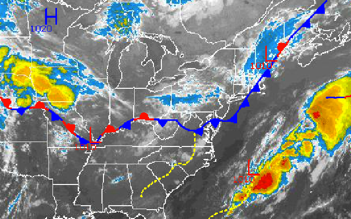
While the cold front has exited into the Atlantic Ocean already this morning, a strong disturbance over the Great Lakes will keep the threat for widely scattered showers and thunderstorms alive through this evening. Excellent weather conditions are expected through Saturday but unsettled conditions return for the second half of the weekend.
Today, as the cold front continues to drive into the Atlantic Ocean, a strong disturbance behind the cold front will keep the threat for widely scattered showers and thunderstorms alive through this evening for the Philadelphia and New York City metropolitan areas. The thunderstorms will be capable of very heavy downpours, wind gusts over 30 mph, small hail, and frequent lightning. The best potential for thunderstorms will be over southeastern Pennsylvania, southern New Jersey, and central New Jersey. Winds will be from the northwest at 5 to 15 mph. Temperatures will rise into the mid 80s throughout the Philadelphia and New York City metropolitan areas.
Find out what's happening in Malvernfor free with the latest updates from Patch.
Tonight, the widely scattered showers and thunderstorms will exit after midnight followed by clearing skies. Winds will be from the northwest at 5 to 10 mph. Temperatures will fall into the mid to upper 50s over the northern interior and lower to mid 60s along the coast and in urban locations.
High pressure will be in control tomorrow on through Saturday with clear skies to scattered cloud cover. Winds will veer from the northwest to the north at 5 to 10 mph. Temperatures on Thursday will range from the lower to mid 80s. Temperatures on Friday morning will range from the lower to mid 50s over the interior and upper 50s to lower 60s along the coast for lows. High temperatures on Friday afternoon will range from the lower to mid 80s. Temperatures on Saturday will range from the upper 50s to lower 60s for lows and lower to mid 80s for highs.
Find out what's happening in Malvernfor free with the latest updates from Patch.
An area of low pressure will meander off the Mid Atlantic coast on Sunday, Monday, and Tuesday leading to overcast skies and a threat for showers. Dry conditions can be expected on Sunday with winds veering to the east at 10 to 20 mph. Showers will be a threat on Monday and Tuesday with some heavy downpours possible. Temperatures will range from the lower to mid 60s for lows and upper 70s to lower 80s for highs.
Get more local news delivered straight to your inbox. Sign up for free Patch newsletters and alerts.