Weather
Snow, Increased Cold In Philly-Area Forecast
It's been 324 days since measurable snowfall in most of the greater Philadelphia region. It could end this week.


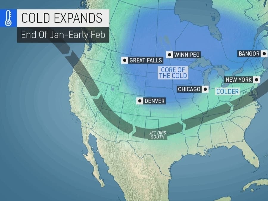
EASTERN PA — This week brings with it yet another forecasted storm that once again has the potential to snap the greater Philadelphia area's historic snow drought.
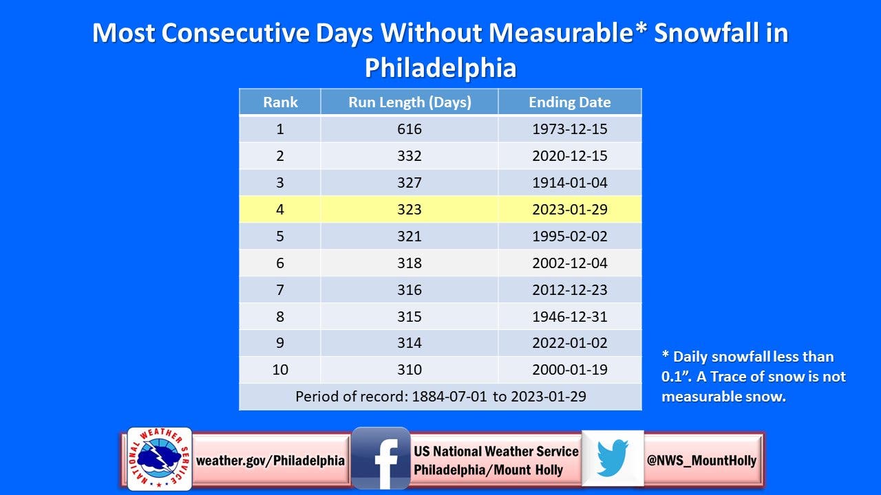
The region has now gone 324 days without measurable snowfall, the fifth most in history, according to the National Weather Service.
The next snow chance will come overnight Tuesday into Wednesday morning. Snow could fall after 2 a.m. and before 8 a.m. Up to half an inch is possible, but the line between some snow and no snow at all is razor thin, according to forecasters.
Find out what's happening in Norristownfor free with the latest updates from Patch.
The potential snowfall will highlight a stretch of declining temperatures leading into "dangerously cold" windchills over the weekend, according to AccuWeather.
While nearly all of South Jersey is likely to see accumulation, only a thin patch including parts of berks, Chester, Delaware, Motngomery, Bucks, and Philadelphia counties is within the measurable snow zone, according to the National Weather Service's radar.
Find out what's happening in Norristownfor free with the latest updates from Patch.
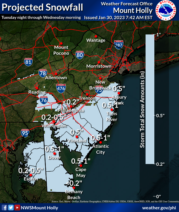
There's about a 50 percent chance of preciptiation.
The National Weather Service's Mt. Holly, New Jersey station teased suspense.
"We do have a shot at some snow Tues night/Wed morning," they said. "Could that streak (of snowless days) be broken then? All we need is 0.1" snow."
Here's where the Philadelphia area's current snow drought stands in recorded history. Measurable snowfall is considered at least a tenth of an inch.
Here's the full forecast:
Monday
Partly sunny, with a high near 54. Calm wind becoming southwest around 5 mph in the afternoon.
Monday night
Increasing clouds, with a low around 36. Southwest wind 5 to 10 mph becoming northwest after midnight.
Tuesday
Mostly cloudy, with a high near 40. Northwest wind 5 to 10 mph.
Tuesday night
A chance of snow, mainly after 2am. Mostly cloudy, with a low around 29. North wind around 5 mph. Chance of precipitation is 50 percent. New snow accumulation of less than a half inch possible.
Wednesday
A chance of snow before 8am. Mostly sunny, with a high near 36. North wind 5 to 10 mph. Chance of precipitation is 50 percent. New snow accumulation of less than a half inch possible.
Wednesday night
Partly cloudy, with a low around 26.
Get more local news delivered straight to your inbox. Sign up for free Patch newsletters and alerts.


