Weather
Another Day Of Rain, But No Snow, As Major Storm Passes Philly Area
While the massive cross-country snow and ice storm is paralyzing parts of the nation, it appears that Philly will void the worst.


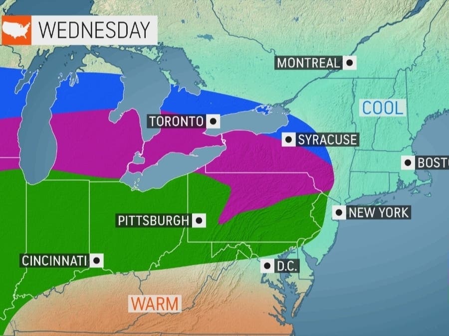
EASTERN PA — After rain, heavy wind, some scattered thunderstorms in the region on Tuesday, it appears that the biggest impacts of the major cross-country front have passed. Another day of rain is on tap for the greater Philadelphia area, but it does not appear that it will be a heavy downpour, according to forecasters.
There's a high likelihood of rain throughout the day, mainly before 4 p.m., the National Weather Service said. Rain could continue into the overnight hours, particularly after 1 a.m.
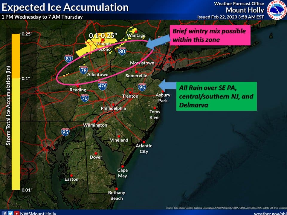
Some ice will accumulate in the northeastern part of the state, while a "brief wintry mix" could impact the Poconos and down as far south as parts of Berks County. But the bulk of southeastern Pennsylvania will only see rain.
Find out what's happening in Norristownfor free with the latest updates from Patch.
The storm will be followed by a drastic temperature reversal. The high will be 70 in Philadelphia on Thursday, a near 30-degree increase from Wednesday night's forecasted low of 41.
The same storm front could dump up to 18 inches of snow on parts of the midwest, according to AccuWeather, while leaving parts of New York state and New England submerged as well.
Find out what's happening in Norristownfor free with the latest updates from Patch.
Here's the full forecast for the remainder of the week:
Wednesday
Rain, mainly before 4pm. High near 45. Southeast wind around 5 mph. Chance of precipitation is 90 percent. New precipitation amounts of less than a tenth of an inch possible.
Wednesday night
A chance of rain, mainly after 1am. Areas of fog after 1am. Otherwise, cloudy, with a low around 41. East wind 5 to 10 mph becoming southwest after midnight. Chance of precipitation is 50%. New precipitation amounts of less than a tenth of an inch possible.
Thursday
Mostly sunny, with a high near 70. West wind around 10 mph, with gusts as high as 20 mph.
Thursday night
Mostly clear, with a low around 43. Breezy, with a south wind 5 to 10 mph becoming west 15 to 20 mph after midnight. Winds could gust as high as 30 mph.
Friday
Sunny, with a high near 45. Breezy, with a west wind 20 to 25 mph.
Friday night
Mostly clear, with a low around 23.
Saturday
A chance of snow showers after 1pm. Mostly cloudy, with a high near 36. Chance of precipitation is 40%.
Saturday night
Mostly cloudy, with a low around 28.
Sunday
Mostly sunny, with a high near 52. Breezy.
Sunday night
Mostly clear, with a low around 30
Get more local news delivered straight to your inbox. Sign up for free Patch newsletters and alerts.


