Weather
Halloween Weekend Storm Headed For Eastern PA: Latest Timeline
For the second time this week, the region faces heavy rain, powerful winds, and potential flooding.


PENNSYLVANIA — For the second time this week, a powerful storm will slam into southeastern Pennsylvania and the surrounding region. It will bring with it heavy rain, strong wind gusts, and the potential for flooding in a region whose infrastructure is still recovering from the impacts of Hurricane Ida and other recent weather events.
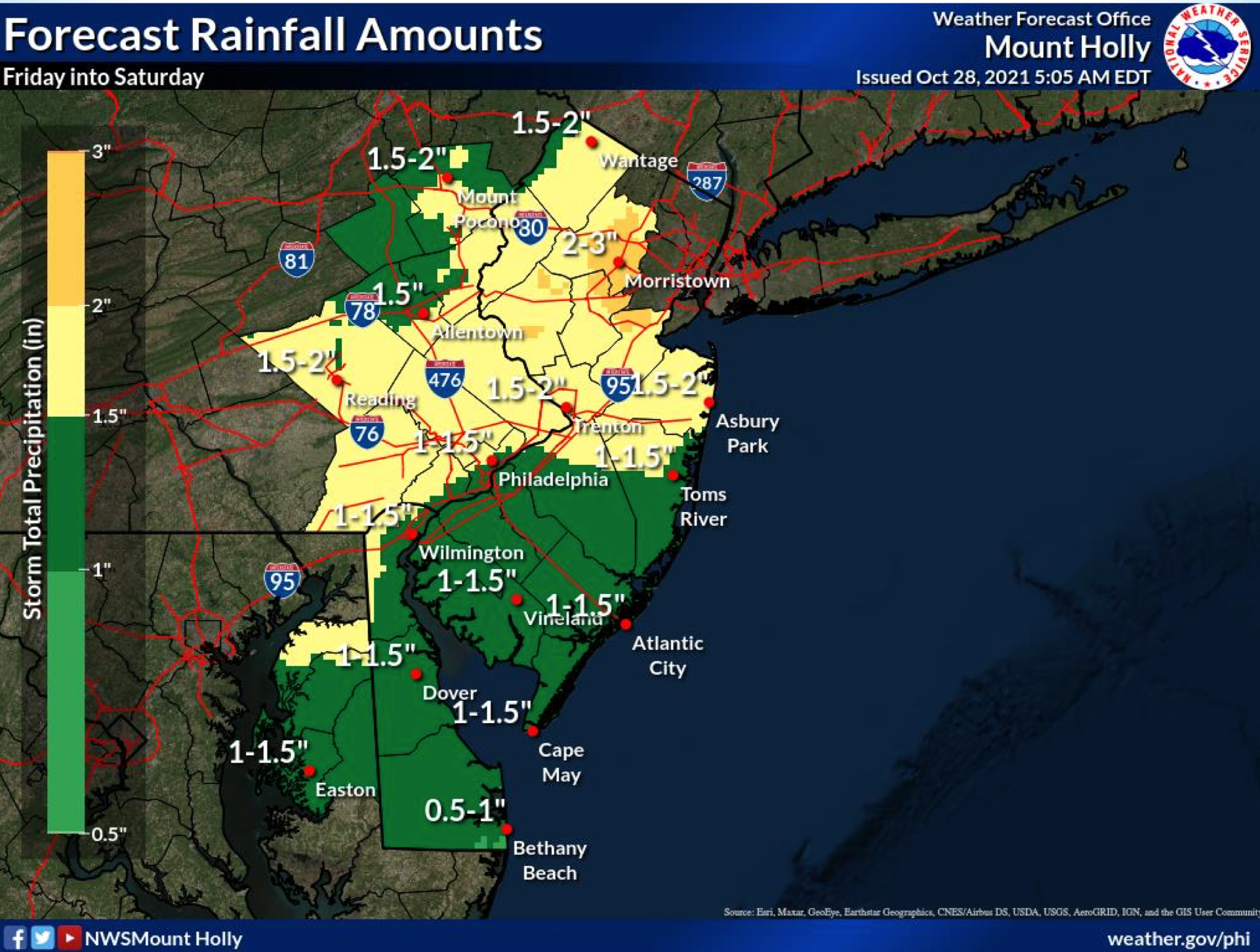
Between an inch and a half and 2 inches of rain is forecasted for the area, with locally higher amounts of up to 2 to 4 inches.
"Periods of heavy rain are possible Friday afternoon through Friday," the National Weather Service said. "This could result in flooding of small streams and creeks, and areas of poor drainage. River levels may begin to rise again."
Find out what's happening in Norristownfor free with the latest updates from Patch.
Wind gusts of 15 to 30 miles per hour could increase to 45 miles per hour by later Friday in the Philadelphia area. Tree and wire damage is possible.
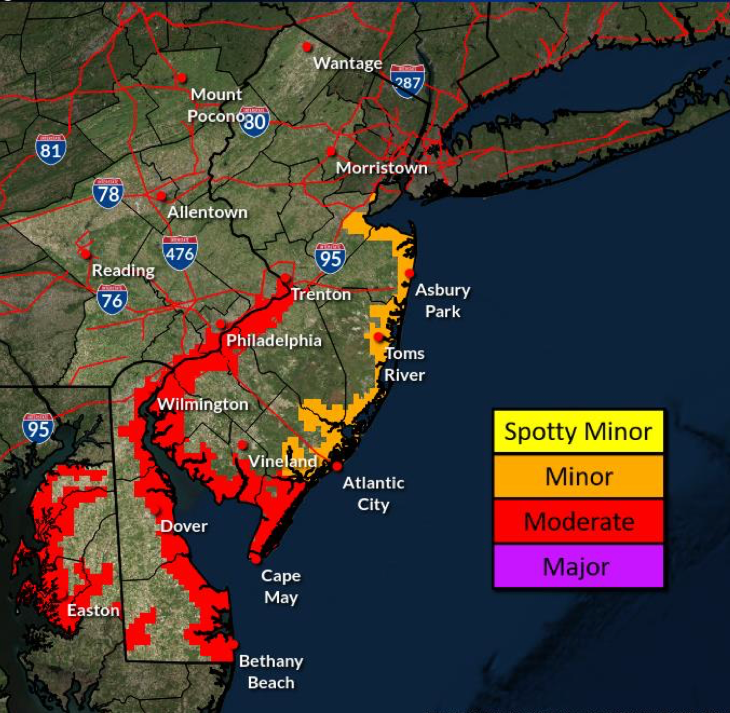
A Coastal Flood Watch has been issued for Philadelphia and Lower Bucks counties, which indicates that "one to two feet of inundation above ground level possible in low- lying areas near shorelines and tidal waterways."
Find out what's happening in Norristownfor free with the latest updates from Patch.
"Moderate" flooding is possible for the Delaware River watershed, including along the Schuylkill River. While the Schuylkill is expected to rise at least a foot in Norristown and Philadelphia, according to the Weather Service's Advanced Hyrdrolic Prediction Service, it is not currently predicted to reach its flood stage in either area.
As a comparison, during the height of Ida, the Schuylkill reached an all-time historic high of 26.85 feet in Norristown. The river currently sat at 8.48 feet on Thursday morning, and is predicted to rise to 9.7 Friday evening.
The full forecast for the area is included below:
Thursday
Mostly sunny, with a high near 62. East wind around 5 mph.
Thursday night
Mostly cloudy, with a low around 51. East wind 5 to 10 mph.
Friday
Showers, mainly after 2pm. High near 60. East wind 10 to 15 mph, with gusts as high as 25 mph. Chance of precipitation is 80%. New precipitation amounts between a quarter and half of an inch possible.
Friday night
Showers. The rain could be heavy at times. Low around 55. East wind 10 to 15 mph, with gusts as high as 30 mph. Chance of precipitation is 90%. New precipitation amounts between three quarters and one inch possible.
Saturday
Showers likely, mainly before 8am. Mostly cloudy, with a high near 66. East wind around 5 mph becoming south in the afternoon. Chance of precipitation is 60%. New precipitation amounts between a tenth and quarter of an inch possible.
Saturday night
A slight chance of showers before 2am. Mostly cloudy, with a low around 52. Chance of precipitation is 20%.
Get more local news delivered straight to your inbox. Sign up for free Patch newsletters and alerts.


