Weather
Flooding, 50 MPH Winds, Power Outages Possible In Philly Area: Latest Forecast
Drenching precipitation is expected, and a "flash freeze" could make travel conditions lethal statewide, forecasters said. Timing and more.


EASTERN PA — The major winter storm that is bringing all types of severe impacts in a large swath across the nation remains on track to hit the greater Philadelphia area Thursday. Widespread travel delays, both on the roads and at airports, are anticipated the days before Christmas.
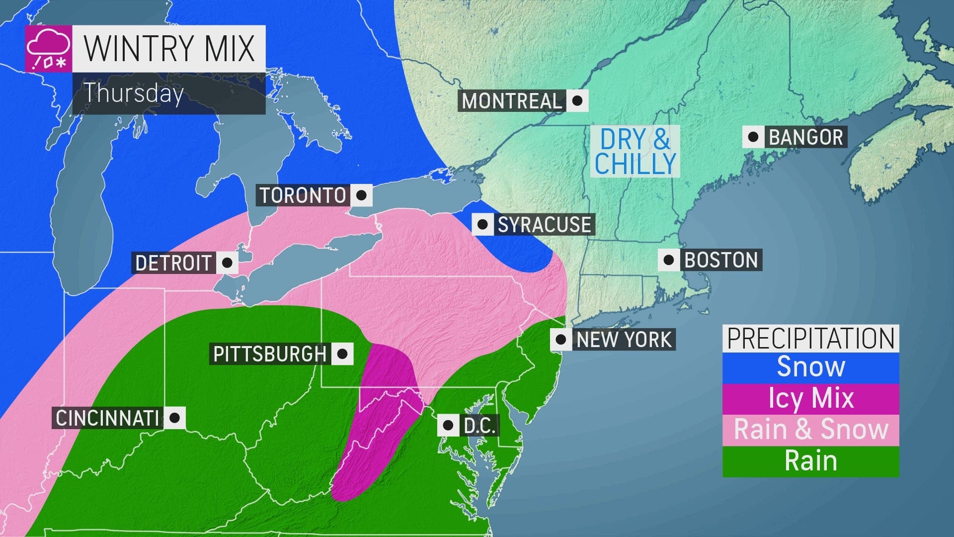
Anywhere from 1 to 3 inches of mostly rain — with perhaps some wintry mix — will fall starting late Thursday morning, the National Weather Service said. A flood watch has been issued for nearly all of eastern Pennsylvania from 1 p.m. Thursday through Friday morning.
"Excessive runoff may result in flooding of rivers, creeks, streams, and other low-lying and flood-prone locations," the National Weather Service added. "Creeks and streams may rise out of their banks. Flooding may occur in poor drainage and urban areas."
Find out what's happening in Norristownfor free with the latest updates from Patch.
Powerful wind gusts of 20 to 30 miles per hour Thursday could increase to 40 to 50 miles per hour by Friday, potentially leading to downed trees and power outages, according to forecasters. While the storm is falling as a blizzard across the midwest, "most of the storm's precipitation (in the mid-Atlantic) will occur in the form of drenching rain due to warming south to southeasterly winds," AccuWeather said.
Very minimal snow accumulation, or none at all, is expected, forecasters said. The storm is only the beginning, however, as a "dramatic" flash freeze is likely to set in for much of the northeast after the rain, AccuWeather said. Lows for much of the Philly area will be in the low teens or single digits on Friday and Saturday nights, with wind chills plummeting below zero in many places.
Find out what's happening in Norristownfor free with the latest updates from Patch.
"Any rain or snow that falls prior to the start of the holiday weekend is at risk of rapidly freezing, which will threaten treacherous conditions for traveling and walking," the outlet said.
The state is expecting a huge turnout for motorists and big traffic along with it, despite the anticipated winter storm and flash freeze. Some 5.4 million motorists are expected to travel the Turnpike around Christmas and New Years, covering the time period from Dec. 23 to Jan. 2. It's nearly identical to the number that traveled during a very busy 2021 holiday season, according to the Turnpike's projections.
Pennsylvania Department of Transportation crews are working hard to prepare for the storm across the state. Roadways are being salted. Officials are urging residents to avoid travel if possible.
"But if travel is necessary, use caution, reduce speeds and be aware of changing weather conditions," the agency said in a statement. "Salt is not a silver bullet, and drivers may encounter icy spots on the roadway. With freezing temperatures, roads that look wet may actually be icy, and extra caution is needed when approaching bridges and highway ramps where ice can form without warning."
The snow that falls to the west will impact those who are looking to travel to and from the area. Specifically, blizzard conditions are expected in Illinois, Indiana, Michigan, Wisconsin, Iowa, Kansas, Nebraska, and Missouri, according to the latest forecast, with snow accumulating in nearly all of New York state west of the Hudson River Valley, all of Pennsylvania west of State College, and most of Ohio.
Flights out of several of the nation's largest airports, including Chicago, Detroit, and New York City are likely to be delayed, and AccuWeather noted that "ripple-effect delays from affected aircraft and crews will be felt across the nation."
Here's the latest forecast:
Thursday
Rain, mainly after 11am. High near 50. Northeast wind 10 to 15 mph, with gusts as high as 25 mph. Chance of precipitation is 90%. New precipitation amounts between a half and three quarters of an inch possible.
Thursday night
Rain, mainly before 3am. Low around 47. Breezy, with an east wind 15 to 20 mph becoming south after midnight. Winds could gust as high as 35 mph. Chance of precipitation is 100%. New precipitation amounts between three quarters and one inch possible.
Friday
Rain before 10am, then rain and snow between 10am and 1pm, then a slight chance of snow after 1pm. Temperature falling to around 21 by 5pm. Breezy, with a west wind 20 to 25 mph, with gusts as high as 40 mph. Chance of precipitation is 80%. Little or no snow accumulation expected.
Friday night
Partly cloudy, with a low around 11. Wind chill values as low as -6. Breezy, with a west wind 20 to 25 mph, with gusts as high as 40 mph.
Saturday
Mostly sunny, with a high near 21. Breezy, with a west wind 15 to 20 mph, with gusts as high as 35 mph.
Saturday night
Partly cloudy, with a low around 15.
Christmas Day
Sunny, with a high near 26.
Sunday night
Mostly clear, with a low around 16.
Get more local news delivered straight to your inbox. Sign up for free Patch newsletters and alerts.