Weather
12K Without Power In Philly Area As Damaging Winds Hit: Latest Forecast
The storm has brought down trees and electrical wires, just hours after record-high temperatures hit the region.



SOUTHEASTERN PA — Severe wind gusts swept through the region Thursday into Friday, leaving more than 12,000 without power in southeastern Pennsylvania and bringing down trees and power lines. While early Friday may offer a brief respite, gusts up to 45 miles per hour are forecasted to continue to hit the region through late Saturday, the National Weather Service said.
Gusts of 56 miles per hour were recorded at Philadelphia International Airport just after 6 a.m. In northeast Philadelphia just moments later, gusts were at 52 miles per hour.
It's not yet clear how long it will take for power to be restored. Restoration estimates from PECO vary from a few hours to days. The company issued a warning on Friday.
Find out what's happening in Norristownfor free with the latest updates from Patch.
"High winds have passed through our service area," the company said in their advisory. "Do not touch or move downed wires and consider all downed wires as energized and extremely dangerous. Due to an increase in outage reports, the outage map may be slow to provide the latest updates."
Trees were also brought down on roads across the region overnight, causing closures and traffic delays into the morning. On PA-378 in Northampton and on Egypt Road in Trooper, a tree came down on wires. PA-100 in North Coventry Township was blocked by a fallen tree. Goshen Road in West Chester and US-1 in Haverford were among numerous other roads where authorities reported storm impacts.
Find out what's happening in Norristownfor free with the latest updates from Patch.
The storm, which also brought with it rain showers, came hours after an all-time high temperature record was set. Philadelphia International Airport reached 69 degrees, the National Weather Service said, higher than the previous record of 68 degrees for Feb. 17 set in 1976.
More potentially damaging wind is on its way, as well as colder temperatures.
"Another period of wind gusts up to 50 mph will be possible tomorrow (Saturday) afternoon into evening," the National Weather Service's regional station in Mt. Holly, New Jersey shared on Twitter. "We'll have more information on that later today."
The latest on power outages in the region is available on PECO's outage map.
Here's the full forecast for the coming long weekend:
Friday
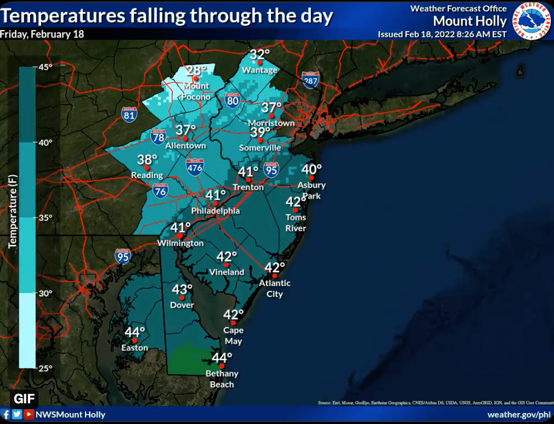
A slight chance of showers before 9am. Mostly sunny, with a temperature falling to around 42 by 4pm. Breezy, with a northwest wind 15 to 20 mph, with gusts as high as 40 mph. Chance of precipitation is 20%.
Friday night
Mostly clear, with a low around 25. Northwest wind 5 to 10 mph becoming light and variable in the evening.
Saturday
A slight chance of showers between 1pm and 4pm. Mostly sunny, with a high near 45. Breezy, with a south wind 5 to 10 mph becoming west 15 to 25 mph in the afternoon. Winds could gust as high as 45 mph. Chance of precipitation is 20%.
Saturday night
Clear, with a low around 19. Blustery, with a northwest wind 15 to 20 mph decreasing to 5 to 10 mph after midnight. Winds could gust as high as 45 mph.
Sunday
Sunny, with a high near 38. Northwest wind 5 to 10 mph becoming southwest in the afternoon.
Sunday night
Clear, with a low around 29.
Monday
Sunny, with a high near 55.
Monday night
A chance of rain after 1 a.m. Mostly cloudy, with a low around 38. Chance of precipitation is 30%.
Get more local news delivered straight to your inbox. Sign up for free Patch newsletters and alerts.