Weather
Timing, Intensity Of Freezing Rain, Ice: Philly Area Forecast
A winter weather advisory has expanded into southeastern Pennsylvania. Here's the latest on timing and what to expect:


PHILADELPHIA, PA — The winter weather advisory has expanded into much of southeastern Pennsylvania as the latest storm front through the region progresses, with forecasters warning of freezing rain and potentially dangerous roads.
Precipitation is expected to transition to freezing rain at around midday Friday in the Philadelphia area, according to the National Weather Service.
Trace amounts of ice accumulation are also possible.
Find out what's happening in Norristownfor free with the latest updates from Patch.
"Any standing water on area roads and walkways will freeze tonight as temperatures continue to plummet into the 20s and teens," the National Weather Service said in its latest briefing on the storm early Friday morning.
The good news: the potential for localized flooding with this storm has diminished, forecasters say.
Find out what's happening in Norristownfor free with the latest updates from Patch.
Things will clear up by late Friday before the chill sets in.
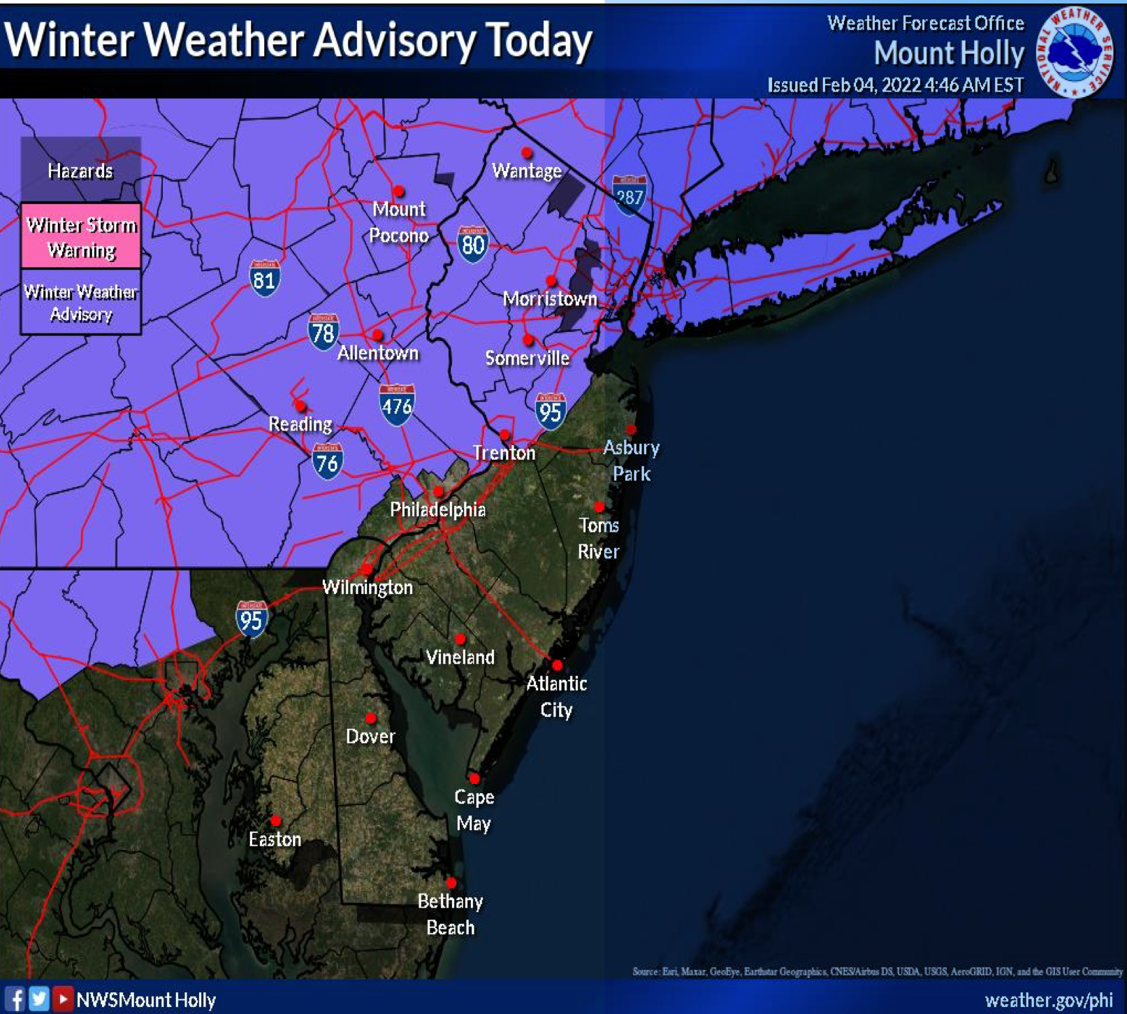
Here's the full forecast:
Friday
Periods of rain, mainly before 4pm. Temperature falling to around 33 by 4pm. North wind 10 to 15 mph. Chance of precipitation is 90%. New precipitation amounts between a quarter and half of an inch possible.
Friday night
Mostly cloudy, with a low around 23. North wind 10 to 15 mph.
Saturday
Mostly cloudy, then gradually becoming sunny, with a high near 30. Northwest wind 10 to 15 mph.
Saturday night
Mostly clear, with a low around 17. North wind around 5 mph.
Sunday
Sunny, with a high near 35. Northeast wind around 5 mph becoming south in the afternoon.
Sunday night
Partly cloudy, with a low around 24.
Get more local news delivered straight to your inbox. Sign up for free Patch newsletters and alerts.


