Weather
'Bomb Cyclone' Threatens Heavy Rain, High Winds In Philly Area
A massive weather front is expected to hit the region Saturday, bringing heavy rain, winds, and possibly even snow.


PENNSYLVANIA — A powerful winter storm front sweeping across the country is expected to turn into what forecasters call a "bomb cyclone" as it approaches the East Coast, bringing heavy rains and winds to the greater Philadelphia area.
The ominously named phenomenon called bomb cyclone, or bombogenesis, is a rapidly strengthening storm that can form when a cold air mass collides with warm air mass, according to the National Oceanic and Atmospheric Administration.
The storm is likely to arrive on Friday night with rain for southeastern Pennsylvania. Things will intensify into Saturday, with wind gusts moving up to 30 miles per hour near Philadelphia and up to 50 miles an hour farther to the north by the afternoon.
Find out what's happening in Norristownfor free with the latest updates from Patch.
Between a half and three quarters of an inch of precipitation is possible before nightfall, at which point temperatures will plummet from the 50s down to the 20s, and some snow is possible, forecasters said. It's likely to be a tenth of an inch or less.
"Confidence is growing for a significant storm that will bring wide-reaching impacts,"AccuWeather Meteorologist Alex DaSilva said in a forecast report. "Winds across the entire East Coast will be very gusty Saturday and Saturday night."
Find out what's happening in Norristownfor free with the latest updates from Patch.
The process of bombogenesis happens when a low-pressure system drops at least 24 millibars within 24 hours. Such a drop could bring sudden waves of high winds and snow, meteorologists warn.
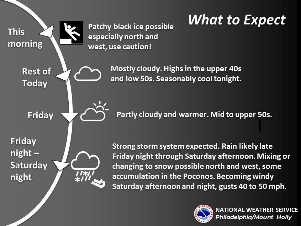
Here's the latest forecast:
Thursday
Mostly cloudy, with a high near 52. North wind around 5 mph becoming east in the afternoon.
Thursday night
Partly cloudy, with a low around 34. East wind around 5 mph becoming calm.
Friday
Mostly sunny, with a high near 58. Calm wind becoming south around 5 mph in the afternoon.
Friday night
Rain, mainly after 5am. Low around 41. Southeast wind around 5 mph. Chance of precipitation is 80%. New precipitation amounts of less than a tenth of an inch possible.
Saturday
Rain, mainly before 5pm. High near 52. Breezy, with a south wind 5 to 10 mph becoming northwest 15 to 20 mph in the afternoon. Winds could gust as high as 30 mph. Chance of precipitation is 100%. New precipitation amounts between a half and three quarters of an inch possible.
Saturday night
A chance of rain and snow before 8pm. Partly cloudy, with a low around 23. Windy. Chance of precipitation is 40%. New precipitation amounts of less than a tenth of an inch possible.
Sunday
Sunny, with a high near 39.
Sunday night
Mostly clear, with a low around 31.
Get more local news delivered straight to your inbox. Sign up for free Patch newsletters and alerts.


