Weather
Severe Thunderstorms, Large Hail, Destructive Winds In Philly Area: NWS
A severe thunderstorm watch has been issued in 40 counties in Pennsylvania as another destructive storm approaches.


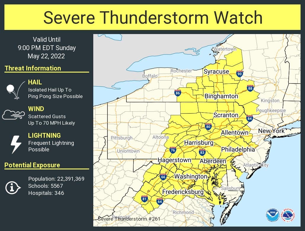
PHILADELPHIA, PA — A severe thunderstorm watch has been put in place for all of central and eastern Pennsylvania as another powerful storm front moves into the region late Sunday.
Storms "could be severe," the National Weather Service said, noting the possibility for large hail, damaging winds, and heavy rain.
The brunt of the storm is likely in the late afternoon and early evening. The watch is in effect until 9 p.m.
Find out what's happening in Norristownfor free with the latest updates from Patch.
A watch indicates that "severe thunderstorms are possible in and near the watch area," according to the NWS. "Stay informed and be ready to act if a severe thunderstorm warning is issued."
Find out what's happening in Norristownfor free with the latest updates from Patch.
Here's the full forecast, according to the National Weather Service:
Sunday
A chance of showers and thunderstorms. Some storms could be severe, with large hail, damaging winds, and heavy rain. Partly sunny, with a high near 91. Southwest wind around 10 mph. Chance of precipitation is 40%. New rainfall amounts of less than a tenth of an inch, except higher amounts possible in thunderstorms.
Sunday night
Showers and thunderstorms likely before midnight, then a slight chance of showers between midnight and 2am. Some storms could be severe, with large hail, hail, damaging winds, gusty winds, and heavy rain. Mostly cloudy, with a low around 61. West wind around 10 mph becoming north after midnight. Chance of precipitation is 60%. New precipitation amounts between a tenth and quarter of an inch, except higher amounts possible in thunderstorms.
Get more local news delivered straight to your inbox. Sign up for free Patch newsletters and alerts.


