Weather
Timeline For Severe Thunderstorms, Flooding, Heavy Winds In Philly Area
A potentially destructive storm is on the region's doorstep. Here's what to know.


EASTERN PA — A powerful storm front will interrupt a stretch of idyllic autumnal weather this week in the greater Philadelphia area, forecasters said, leading to a risk of potential flooding, damaging wind gusts, and even isolated tornadoes.
The storm front is likely to hit the area early Thursday, with a few showers possible late Wednesday, forecasters said. The most powerful severe weather is likely later on Thursday.
Things will clear up by Friday, the National Weather Service says.
Find out what's happening in Norristownfor free with the latest updates from Patch.
Thunderstorms have the potential to bring with them severe downpours that could lead to flooding in certain places, AccuWeather says.
Wind gusts could be powerful enough to destroy tree limbs and spark power outages. 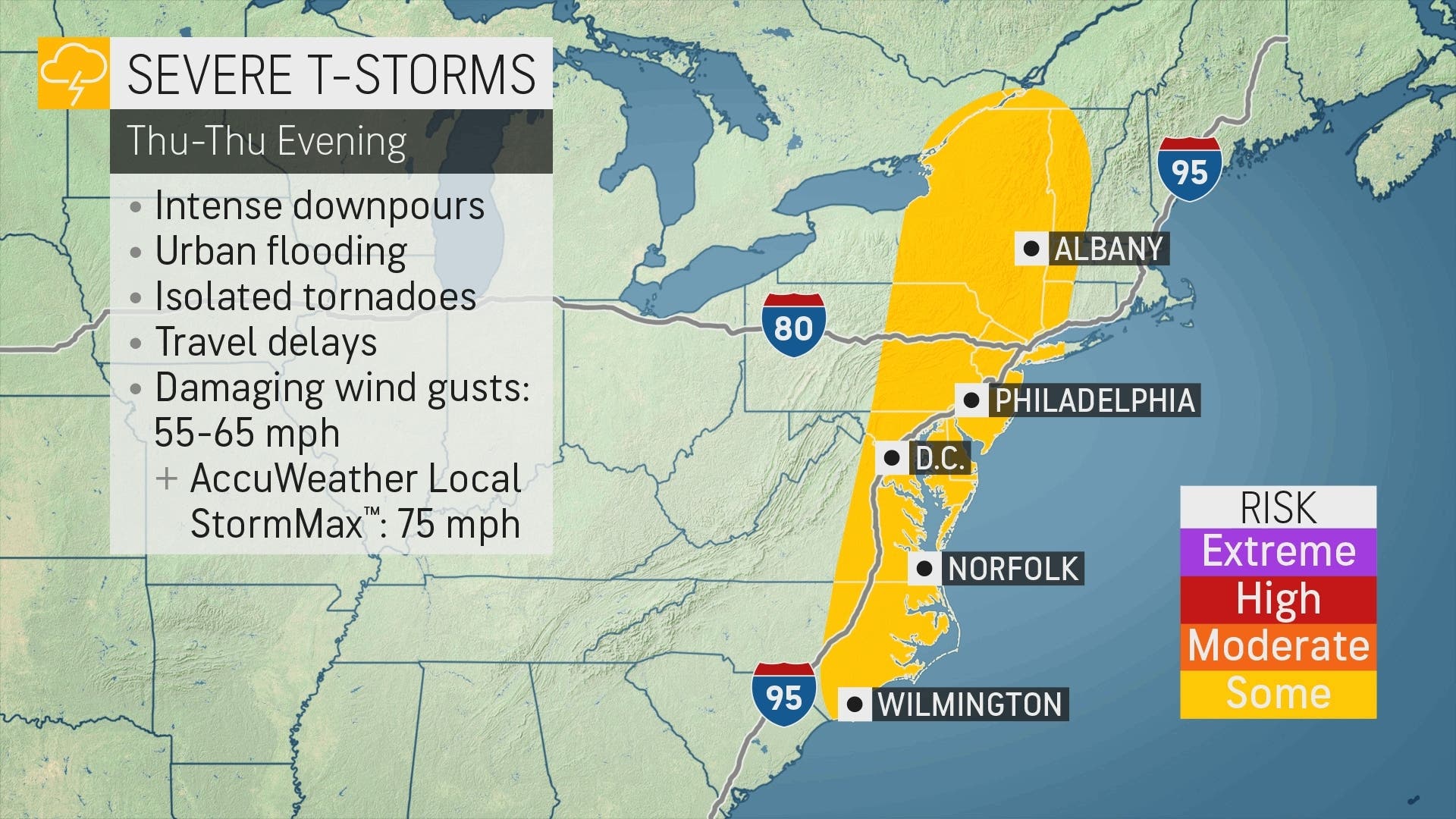
Find out what's happening in Norristownfor free with the latest updates from Patch.
The strongest rainstorms are likely to fall north and west of the I-95 corridor, forecasters said. The area north of Allentown is at higher risk for the greatest damages.
AccuWeather expects 1-2 inches of rain to fall in the greater Philadelphia area.

Here's the latest forecast:
Wednesday
Increasing clouds, with a high near 71. South wind 5 to 10 mph.
Wednesday night
A slight chance of showers after 3am. Patchy fog before 1am, then patchy fog after 2am. Otherwise, mostly cloudy, with a low around 59. South wind around 5 mph. Chance of precipitation is 20%.
Thursday
Showers likely, then showers and possibly a thunderstorm after 2pm. Some of the storms could produce gusty winds and heavy rain. Patchy fog between 10am and noon. High near 70. South wind 10 to 15 mph, with gusts as high as 25 mph. Chance of precipitation is 80%. New rainfall amounts between a half and three quarters of an inch possible.
Thursday night
Showers and possibly a thunderstorm before 11pm, then showers likely between 11pm and 2am. Some of the storms could produce gusty winds and heavy rain. Low around 52. Southwest wind 5 to 10 mph becoming northwest after midnight. Chance of precipitation is 80%. New precipitation amounts between a quarter and half of an inch possible.
Friday
Sunny, with a high near 65. West wind 5 to 10 mph.
Friday night
Mostly clear, with a low around 46.
Saturday
Sunny, with a high near 68.
Saturday night
Partly cloudy, with a low around 53.
Sunday
Partly sunny, with a high near 68.
Sunday night
A chance of showers. Mostly cloudy, with a low around 53. Chance of precipitation is 30%.
Monday
A chance of showers. Partly sunny, with a high near 62. Chance of precipitation is 30%.
Monday night
A chance of showers. Mostly cloudy, with a low around 44. Chance of precipitation is 30%.
Tuesday
Mostly sunny, with a high near 54.
Get more local news delivered straight to your inbox. Sign up for free Patch newsletters and alerts.


