Weather
Powerful Storms Threaten Eastern PA As Heat Index Soars: Forecast
We aren't getting a break from severe weather. Heavy rainfall, strong wind gusts and thunderstorms are on the way. Here's the latest timing:


PENNSYLVANIA — As dangerous heat continues to impact much of southeastern Pennsylvania, residents should also brace themselves for multiple rounds of storms that could possibly hit this weekend. Some of the storms may be powerful and could bring strong winds and heavy rains, along with lightning, forecasters say.
The heat index is forecasted to soar over 100 degrees throughout the region Friday, and the National Weather Service has declared a Heat Advisory from noon Friday through 8 p.m. Saturday. A Heat Advisory is issued when the combination of heat and humidity is expected to make it feel like it is 95 to 99 degrees for two or more consecutive days, or 100 to 104 degrees for any length of time.
Heat indices will be above 100 degrees in most places today. A Heat Advisory is in effect for the urban corridor and most of central NJ. Showers and thunderstorms also return to the forecast over the weekend. #NJwx #PAwx #DEwx #MDwx pic.twitter.com/NUsMOJrmdG
— NWS Mount Holly (@NWS_MountHolly) July 16, 2021
The latest round of severe weather comes just days after what forecasters with the National Weather Service called a 100-year flood, with as much as 10 inches falling in a matter of hours in some areas. The flooding submerged cars on major roadways and led to evacuations.
Find out what's happening in Norristownfor free with the latest updates from Patch.
RELATED: 100 Year Flood Prompts Evacuations, Rescues In Eastern PA
Friday is predicted to see the highest temperatures this week, bringing excessive heat as well as more isolated thunderstorms likely bringing dangerous cloud-to-ground lightning.
Find out what's happening in Norristownfor free with the latest updates from Patch.
“Hot conditions could result in heat exhaustion with prolonged exposure on Friday,” the National Weather Service said.
“Hot temperatures and high humidity may cause heat illnesses to occur,” the National Weather Service said. “The highest temperatures and heat indices are expected between 1 p.m. and 5 p.m. each afternoon.”
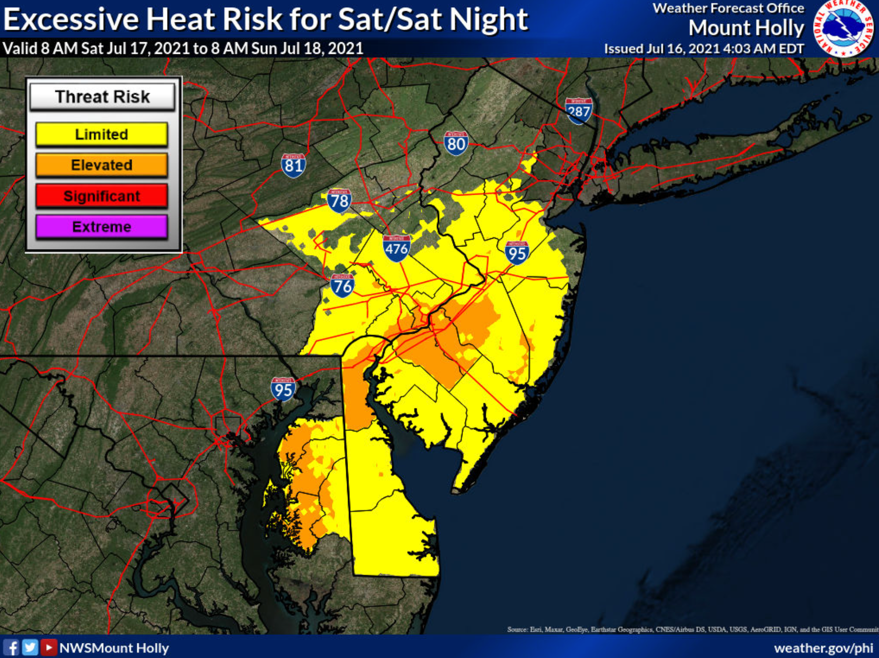
There's a chance the first round of thunder and rain could hit southeastern Pennsylvania on Friday afternoon, as forecasters predict a possibility of severe weather after 3 p.m. Intermittent thunder is possible until midnight.
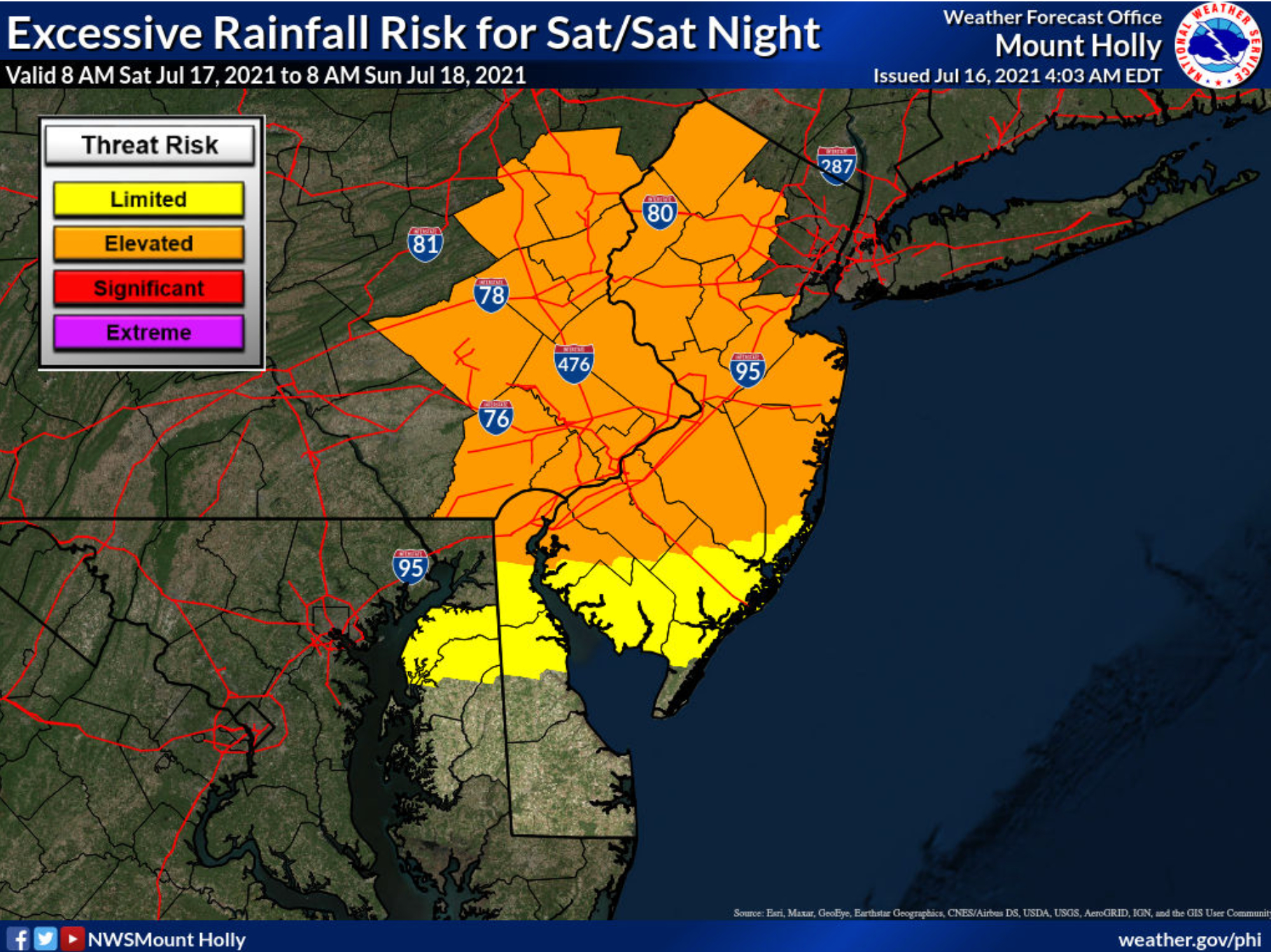
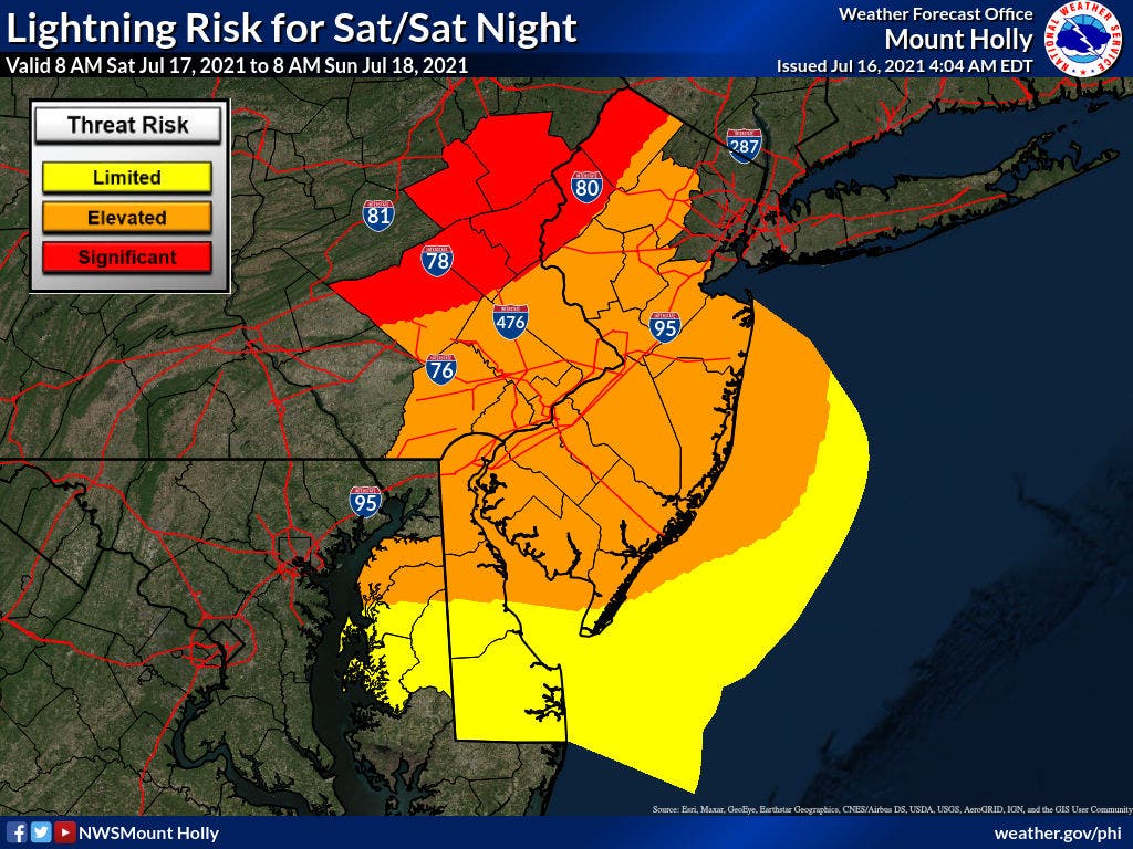
The greater threat will come Saturday, with a likelihood of severe weather, and storms that could produce heavy rainfall, according to the National Weather Service.
Most of the five-county suburban region is at an "elevated" risk for heavy rainfall Saturday night, with the lightning risk rising to "significant" slightly to the west:
Heavy rain could hit the area again on Sunday, although temperatures will likely drop into the 80s.
Here's a glance at the full forecast through next week:
Friday
A slight chance of showers and thunderstorms after 3 p.m. Sunny, with a high near 94. Southwest wind 5 to 10 mph. Chance of precipitation is 20 percent.
Friday night
A slight chance of showers and thunderstorms before midnight. Partly cloudy, with a low around 76. Southwest wind around 5 mph. Chance of precipitation is 20 percent.
Saturday
Showers and thunderstorms likely, mainly after 2 p.m. Some of the storms could produce heavy rainfall. Mostly sunny, with a high near 93. Heat index values as high as 101. South wind 5 to 10 mph. Chance of precipitation is 60 percent. New rainfall amounts between a tenth and quarter of an inch, except higher amounts possible in thunderstorms.
Saturday night
Showers and thunderstorms likely, mainly before 2 a.m. Some of the storms could produce gusty winds and heavy rain. Mostly cloudy, with a low around 73. South wind 5 to 10 mph. Chance of precipitation is 60 percent. New rainfall amounts between a quarter and half of an inch possible.
Sunday
Showers and thunderstorms likely, mainly after 2 p.m. Some of the storms could produce heavy rainfall. Mostly cloudy, with a high near 86. Southwest wind around 5 mph. Chance of precipitation is 70 percent. New rainfall amounts between a tenth and quarter of an inch, except higher amounts possible in thunderstorms.
Sunday night
Showers and thunderstorms likely, mainly before 8 p.m. Some of the storms could produce heavy rainfall. Mostly cloudy, with a low around 70. Chance of precipitation is 60 percent. New rainfall amounts between a tenth and quarter of an inch, except higher amounts possible in thunderstorms.
Monday
A chance of showers, with thunderstorms also possible after 2 p.m. Partly sunny, with a high near 84. Chance of precipitation is 40 percent.
Monday night
A chance of thunderstorms before 8 p.m. Partly cloudy, with a low around 69. Chance of precipitation is 30 percent.
Get more local news delivered straight to your inbox. Sign up for free Patch newsletters and alerts.


