Weather
Severe Thunderstorm Watch Issued In Southeastern PA
Watch for damaging winds, possible hail and other bad weather that's expected to hit the greater Philadelphia area. Here's where and when.



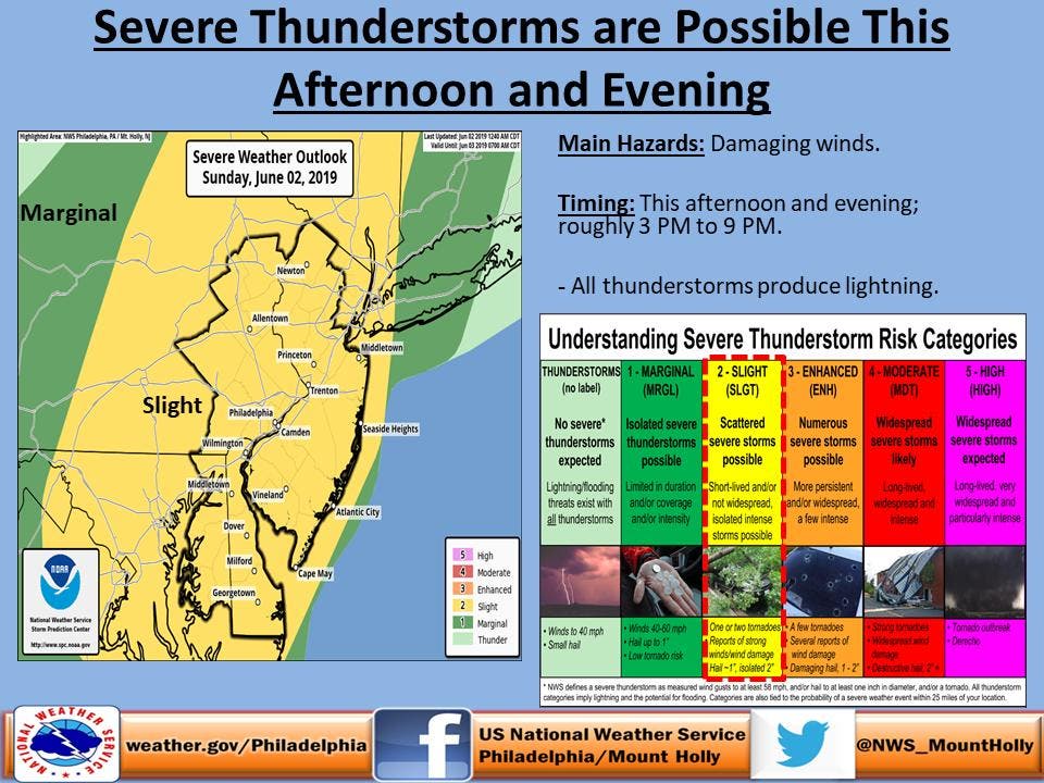
A severe thunderstorm watch was issued for southeastern Pennsylvania on Sunday as more bad weather was expected to hit the area.
In this storm, 60-mph wind gusts and quarter-size hail are possible. Minor damage to vehicles is possible, according to the National Weather Service. Wind damage to roofs, siding, trees and power lines is possible.

A hazardous weather outlook was also issued, saying some thunderstorms during the afternoon and evening could be severe with locally damaging winds, according to the NWS.
Find out what's happening in Norristownfor free with the latest updates from Patch.
The severe thunderstorm watch was in effect until 10 p.m. The storms could start after 3 p.m., but the worst may not hit until the early-to-late evening hours.
A batch of drenching showers and locally severe thunderstorms will continue to swing through the northeastern United States to end this weekend before unseasonably cool air settles in to start the new week, according to AccuWeather.
Find out what's happening in Norristownfor free with the latest updates from Patch.
Severe thunderstorms first ignited across Maryland and West Virginia on Sunday afternoon, dropping quarter-sized hail on a few communities, according to AccuWeather.
Hail, damaging winds and downpours will remain concerns as violent thunderstorms continue to erupt across the mid-Atlantic into Sunday evening. Locally severe thunderstorms will also fire across parts of eastern New York and western New England, according to AccuWeather.
Storms can pack a punch all the way to the Interstate-95 corridor from New York City to Philadelphia, Washington, D.C., and Richmond, Virginia, according to AccuWeather.
.jpeg)
- Sunday afternoon: Showers and thunderstorms likely. Some storms could be severe, with large hail, damaging winds, heavy rain, and frequent lightning. Cloudy, with a high near 86. West wind around 11 mph. Chance of precipitation is 60%. New rainfall amounts of less than a tenth of an inch, except higher amounts possible in thunderstorms.
- Sunday night: Showers and thunderstorms likely before 1am, then a slight chance of showers between 1am and 2am. Some storms could be severe, with large hail, damaging winds, heavy rain, and frequent lightning. Cloudy, then gradually becoming partly cloudy, with a low around 58. West wind 7 to 10 mph becoming north after midnight. Chance of precipitation is 70%. New rainfall amounts of less than a tenth of an inch, except higher amounts possible in thunderstorms.
- Monday: Sunny, with a high near 70. Breezy, with a northwest wind 7 to 12 mph increasing to 16 to 21 mph in the afternoon.
- Monday night: Mostly clear, with a low around 51. Northwest wind 5 to 8 mph.
With reporting from Patch correspondent Tom Davis
Get more local news delivered straight to your inbox. Sign up for free Patch newsletters and alerts.


