Weather
Wednesday Storm Could Bring Snow To Eastern PA: Latest Forecast
Downpours and wind gusts will be accompanied by snow in some areas, possibly ending one of the longest snow droughts in regional history.


EASTERN PA — Snow chances have increased in the Delaware Valley for the incoming storm, with torrential rainfall, heavy winds, and some slight snow accumulation possible, according to the latest forecast.
The storm will reach the region on Wednesday morning, with a chance of snow before 10 a.m. before some snow becomes "likely," the National Weather Service said. Snow could be mixed with rain through 1 p.m. before fading into rain by 1 p.m.
Up to half an inch of snow is possible, according to the National Weather Service, although it could be less than that. And AccuWeather maps have measurable snow (more than a tenth of an inch) missing most of the greater Philadelphia area. So we may have to wait until Wednesday to know for sure if the near-historic snow drought will come to an end.
Find out what's happening in Norristownfor free with the latest updates from Patch.
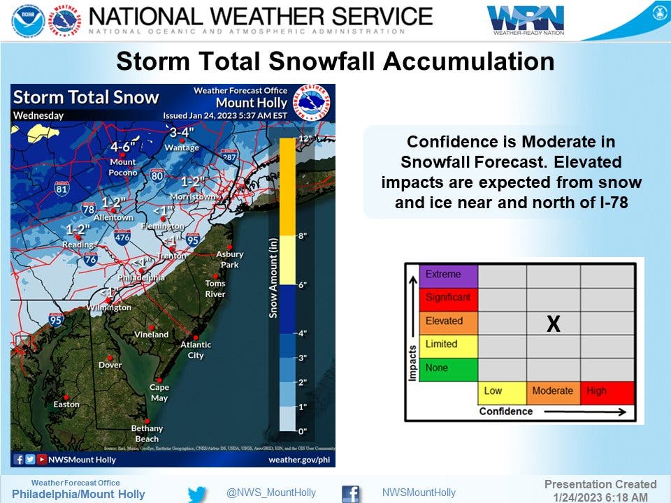
What is more certain is that there will be heavy precipitation. Rain will continue, along with wind gusts up to 20 miles per hour, forecasters said. Thunderstorms will hit overnight into Thurdsay. Up to another three quarters of an inch of rain could fall. Travel impacts are likely.
"The potential for this storm to have a negative impact on travel is significant and from a flight standpoint alone is likely to be the most disruptive since the Christmastime Arctic cold and snow outbreak," AccuWeather Senior Meteorologist Alex Sosnowski said.
Find out what's happening in Norristownfor free with the latest updates from Patch.
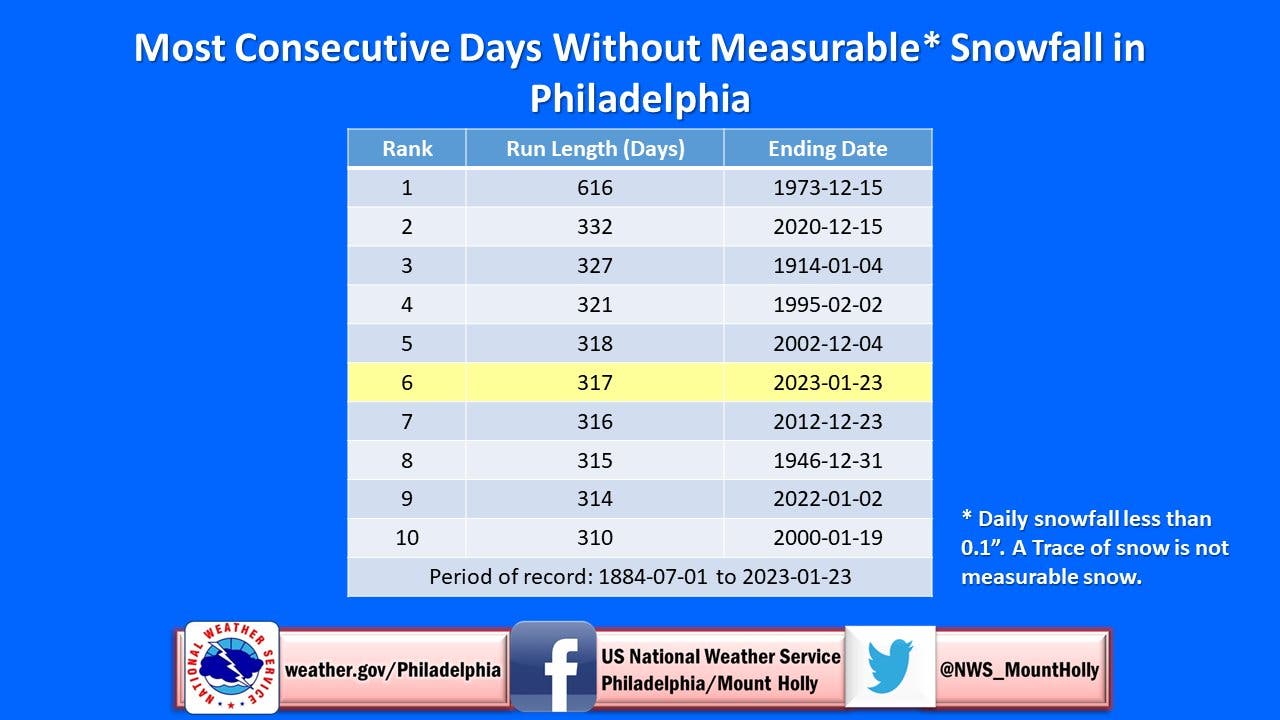
If there does turn out to be measurable snowfall during this storm, it would end the sixth longest snow drought in recorded history.
Here's the full forecast:
Tuesday
Sunny, with a high near 45. West wind around 15 mph.
Tuesday night
Partly cloudy, with a low around 30. West wind 5 to 10 mph becoming light and variable after midnight.
Wednesday
A chance of snow before 10am, then snow likely, possibly mixed with rain between 10 a.m. and 1 p.m., then rain after 1 p.m. High near 44. Light east wind increasing to 10 to 15 mph in the morning. Chance of precipitation is 100 percent. New snow accumulation of less than a half inch possible.
Wednesday night
Rain and possibly a thunderstorm before 1 a.m., then a chance of rain and thunderstorms between 1am and 4a.m. Some of the storms could produce heavy rainfall. Low around 42. Breezy, with an east wind 15 to 20 mph becoming west after midnight. Chance of precipitation is 100 percent. New rainfall amounts between a half and three quarters of an inch possible.
Thursday
Mostly cloudy, with a high near 46. Breezy, with a west wind 20 to 25 mph, with gusts as high as 40 mph.
Thursday night
Mostly cloudy, with a low around 29. Breezy.
Get more local news delivered straight to your inbox. Sign up for free Patch newsletters and alerts.


