Weather
Snow Squalls, Below Zero Wind Chills: Philly-Area Forecast
The Arctic blast could bring near-record low temperatures to the region, forecasters said.


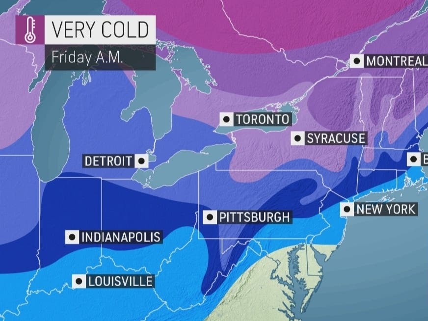
EASTERN PA — The Arctic blast that will hit the greater Philadelphia region overnight Friday could bring with it snow squalls, subzero wind chills, and near record low temperatures, according to forecasters.
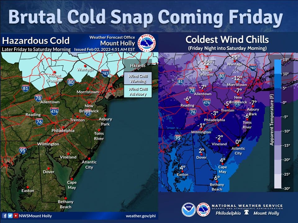
The spur off the polar vortex will cause temperatures to plummet from in the 40s Thursday to single digits in some parts of the region overnight Friday, the National Weather Service said. Philadelphia's wind chill could be as low as negative 1, with an AccuWeather "real feel" as low as negative 10 for parts of the region.
Wind gusts of up to 20 miles an hour in the city and 30 miles an hour in the outlying suburbs will make things even more dicey.
Find out what's happening in Norristownfor free with the latest updates from Patch.
"Dress warmly & limit exposed skin," the National Weather Service's Mt. Holly, New Jersey station warned.
It's also possible that snow squalls could hit the region.
Find out what's happening in Norristownfor free with the latest updates from Patch.
"Dry air in place will try to combat the extent of the snow squall band and may reduce it to harmless flurries or perhaps snow that does not reach the ground," AccuWeather meteorologist Brian Wimer said.
Current predictions from AccuWeather call for squalls in parts of eastern Pennsylvania, and perhaps on the edge of the greater Philadelphia area. However, the outlet warns that this could shift, and impact more of the region.
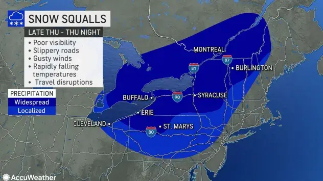
"Forecasters say there is a chance of a snow squall farther to the south and east, possibly reaching parts of the mid-Atlantic and New England coasts on Friday," AccuWeather added.
Snow squalls can cause treacherous conditions on roads, and have led to deadly pile ups and accidents on Pennsylvania highways in the past several winters. Motorists are urged to exercise caution.
Here's the full forecast:
Thursday
Mostly sunny, with a high near 39. Southwest wind 5 to 15 mph.
Thursday night
Partly cloudy, with a low around 28. Southwest wind around 10 mph, with gusts as high as 20 mph.
Friday
Mostly sunny, with a temperature falling to around 21 by 5pm. Blustery, with a northwest wind 15 to 20 mph, with gusts as high as 35 mph.
Friday night
Mostly clear, with a low around 12. Wind chill values as low as -1. Blustery, with a northwest wind 10 to 20 mph.
Saturday
Mostly sunny, with a high near 28. West wind around 10 mph becoming southwest in the afternoon.
Saturday night
Partly cloudy, with a low around 22.
Sunday
Partly sunny, with a high near 46.
Sunday night
Mostly cloudy, with a low around 33.
Get more local news delivered straight to your inbox. Sign up for free Patch newsletters and alerts.


