Weather
Thunder, Heavy Winds Loom In Southeastern PA Weekend Forecast
Here's the latest forecast and timing for the storm that will hit the Philadelphia area this weekend:


SOUTHEASTERN PA — A storm front will hit the greater Philadelphia area this weekend, bringing with it powerful winds, rain, and the potential for more severe weather with thunderstorms.
A fast moving storm front could deliver some showers late Friday night into early Saturday morning, but the greater likelihood of severe weather is on Saturday. While rain could hit early, showers are "likely" after 2 p.m., according to the National Weather Service, and a thunderstorm is possible into the evening before 11 p.m.
A wind advisory will go into effect for the entire southeastern portion of the state starting at 1 p.m. Sustained south winds are predicted from 15 to 25 miles per hour, and gusts up to 45 miles per hour could hit the area.
Find out what's happening in Norristownfor free with the latest updates from Patch.
"Gusty winds could blow around unsecured objects," the National Weather Service said in their advisory. "Tree limbs could be blown down and a few power outages may result. Secure any outdoor holiday decorations from blowing away in the wind."
The advisory will expire at 1 a.m. Sunday.
Find out what's happening in Norristownfor free with the latest updates from Patch.
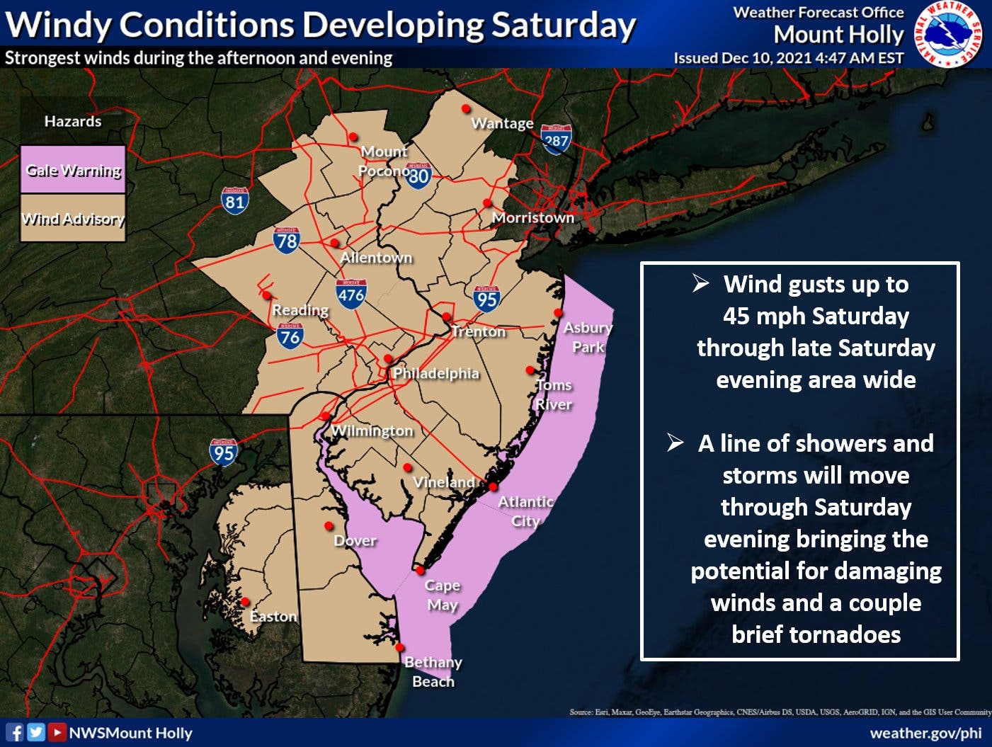
"Storms should move quickly enough to limit flooding concerns, but some areas may be on the receiving end of multiple lines of thunderstorms, which would raise the risk of flash flooding," Accuweather notes.
The complete forecast is included below:
Friday
Partly sunny, with a high near 50. Southwest wind around 5 mph.
Friday night
A chance of showers, mainly after 11pm. Patchy fog after 2am. Otherwise, increasing clouds, with a low around 43. Calm wind becoming east around 5 mph. Chance of precipitation is 40%. New precipitation amounts of less than a tenth of an inch possible.
Saturday
A chance of showers before 11am, then showers likely after 2pm. Patchy fog before 8am. Otherwise, cloudy, with a high near 69. South wind 5 to 10 mph increasing to 10 to 15 mph in the afternoon. Winds could gust as high as 45 mph. Chance of precipitation is 60%. New precipitation amounts of less than a tenth of an inch possible.
Saturday night
Showers and possibly a thunderstorm before 11pm, then a chance of showers. Some of the storms could produce gusty winds. Low around 42. Breezy, with a south wind 15 to 20 mph becoming northwest after midnight. Winds could gust as high as 45 mph. Chance of precipitation is 80%. New precipitation amounts between a tenth and quarter of an inch, except higher amounts possible in thunderstorms.
Sunday
Sunny, with a high near 48. Northwest wind around 10 mph, with gusts as high as 20 mph.
Sunday night
Clear, with a low around 33.
Get more local news delivered straight to your inbox. Sign up for free Patch newsletters and alerts.


