Crime & Safety
WEATHER ALERT: Snow, Wintry Mix Expected For Pennsylvania Thursday Night
A storm forecast to travel slowly could turn up in the Northeast. The National Weather Service has issued a Hazardous Weather Outlook.

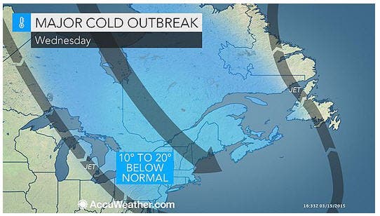
One more time, for snow?
A storm forecast to travel slowly across the South could turn up in the Northeast on Thursday, Friday and Saturday, raising the risk of wet snow or a wintry mix, forecasters say.
The track and strength of that storm will determine which areas receive snow versus rain, according to Accuweather, in a release.
Find out what's happening in Radnorfor free with the latest updates from Patch.
The pattern will make it uncomfortable for outdoor sports that typically ramp up early in the spring, AccuWeather noted.
The National Weather Service has issued a Hazardous Weather Outlook for much of eastern Pennsylvania, noting that temperatures are expected to warm up during the day, raising the flood risk because of snow melting.
Find out what's happening in Radnorfor free with the latest updates from Patch.
The upcoming pattern will limit the risk of flooding in the Northeast in the absence of heavy rain. The chilly weather will slow the rate of melting snow and the runoff by bringing nights below freezing and days above freezing, according to AccuWeather.
Melting snow and rounds of heavy rain have caused flooding on the Ohio River Basin and were causing water levels to rise on the lower Mississippi River, according to AccuWeather.
While the pattern is going back to what occurred during much of the winter, longer daylight hours and strengthening sunshine will negate some of the chill, according to AccuWeather.
Get more local news delivered straight to your inbox. Sign up for free Patch newsletters and alerts.