Politics & Government
FEMA Releases New Upper Dublin Floodplain Maps
Plus, updates on the township's quest to receive state funding to build dams near the office park.
The Federal Emergency Management Agency (FEMA) and Upper Dublin township have each recently formed new solutions to prevent flooding in high-risk parts of the area.
The FEMA plan, which focuses on improving already existing policies, is to update floodplain maps to provide accurate data for those with properties potentially at risk for flooding.
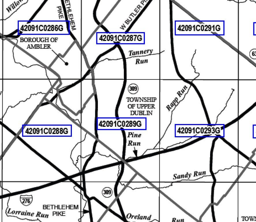
These maps, which can be referenced at either the township building or online, are being updated tentatively in September 2012. You may view the maps by following the instructions at the bottom of this article.
Find out what's happening in Upper Dublinfor free with the latest updates from Patch.
One of the fundamental changes to the floodplain maps involves the Office Park, a key revenue generator for the township. Township Code Enforcement Director Rick Barton explained that these changes are the result of new data concerning flood levels in the immediate area.
“Some of the ‘base flood elevations’ are increased in the office park,” Barton said. “There is some decrease [and increase] of flood areas in isolated areas outside of the office park. [The updates] will take into account more accurate recording data. You have to locate your property as best you can on the floodplain map and see how you might be affected.”
Find out what's happening in Upper Dublinfor free with the latest updates from Patch.
These updated maps are expected to be adopted with no resistance.
Locally, Upper Dublin Township has submitted a request to the state government for a grant to build dams to control water flow. These dams would be situated upstream from Upper Dublin and would provide the township the capacity to control water flows in key locations for flood prevention.
However, the grant is far from a done deal.
“We’re not sure if we will get funding for both [dams] or just for one, if at all,” said Barton. “That is still up in the air.”
The township’s application still sits with the Commonwealth Finance Authority, which holds power to award such funds in the form of an H20 grant.
Despite a from the Pennsylvania Environmental Council, the quest for approval is still a three-way conversation between the authority, Upper Dublin Township and URS, which is contracted to complete the designs on the dams.
The key obstacle is how complete the designs must be. To date, the township has spent just over $1.2 million on the designs, bringing them to 85 percent completion. However, URS has twice returned to the board of commissioners to request more money—$30,000 in January and $50,000 in March—to strengthen the proposal's chance of receiving grant money.
Although ultimately released, the commissioners were relecutant to continue to channel funds into the project when the chance of approval is unclear. The grant money could award as much as $20 million.
***
Floodplain instructions:
In the event that one needs to currently determine flood risk in their property, there are several methods to check.
The quickest way to check is through the Internet at www.rampp-team.com/pa.htm.
Navigate to the Montgomery County section of the page, where you will see links to a wealth of information. Click on the first link, Preliminary Interactive Flood Map Index (Sheet 1), to view an interactive PDF file.
“If you have some difficulty with that, certainly they can give me a call here at Upper Dublin,” said Barton. “Together we’ll make our best estimate as where their property lies on these maps.”
A third method for checking is an independent review of the property. “If there’s any question about [your property], and you’re concerned, your next step would be to hire an engineer to actually go out and take the raw data that the map is based on.” said Barton. “They come to your property and locate the flood elevation to see if it affects your house.”
For more information, call the Upper Dublin Township Building, or visit www.rampp-team.com/pa.htm for current floodplain maps and data.