Weather
After hot weather Wednesday, autumn like weather comes in for Thursday and Friday. Temperatures warm up by the weekend.
We hit 90 degrees in Providence on Wednesday. A cold front and some passing showers will help cool us off tonight, with sunshine Thursday.

Weather Forecast Discussion for Rhode Island on September 15, 2016
Just when we think we are almost to autumn, summer quickly returns. It is quite hot outside right now, as T.F. Green Airport is reporting 90 degrees at the moment. However, temperatures will quickly drop, as we await a cold front passing through southern Vermont. This front is only forming widely isolated showers and thunderstorms. The line is only far south as Worcester, MA and Hartford, CT as of 3:59 p.m. Wednesday. We will see skies become cloudy over the next 3-4 hours, as we may see a widely isolated shower or thunderstorm. Any showers and thunderstorms will end by 11 p.m., as the cold front passes to our east. High pressure over eastern Canada will bring much drier air, lowering our dewpoint temperatures into the upper 40’s. Despite the hot temperatures, low temperatures tonight will fall into the upper 50’s after skies clear after midnight.
That strong high will remain over New England for Thursday, giving us northeast winds. This will help make the day feel like autumn, as high temperatures only reach the lower 70’s, despite bright sunshine. The high’s center will be right over Rhode Island tomorrow night, giving us calm winds. With clear skies, this will make for excellent radiational cooling, and low temperatures will fall into the lower 50’s in Providence. North of Providence, I would not be surprised if lows fall into the middle to upper 40’s. The high moves offshore on Friday, but we will keep sunny skies and high temperatures in the lower 70’s. We will keep clear skies Friday night, with lows in the city in the lower 50’s.
Find out what's happening in East Providencefor free with the latest updates from Patch.
By Saturday, the high will move further into the Atlantic, and the ridge will begin to weaken. We will keep mostly sunny skies for the day, and with south winds, this will help raise our high temperatures into the upper 70’s. A low pressure system centered over Quebec Saturday night will bring overcast skies. Low temperatures will be warmer, thanks to cloud cover bouncing back the radiation our ground absorbed during the day. Look for low temperatures in the lower 60’s. We may see some showers ahead of the front by 6 a.m. Sunday morning. We will see scattered showers through the day, with daytime highs in the upper 70’s. The cold front will pass through Sunday night, keeping us with scattered showers and lows only falling into the middle 60’s.
We will see a passing showers through the day, as the front becomes stalled just to our east. Also, with dewpoints rising again, there will be patchy fog, especially during the morning commute. High temperatures will reach the upper 70’s. Eventually, high pressure over West Virginia will clear our skies late Monday night. So, we will see mostly cloudy skies with lows in the middle 60’s. This high pressure system will give us mostly sunny to sunny skies for Tuesday and next Wednesday. Expect high temperatures on both days to be near 80, with lows in the lower to middle 60’s.
Find out what's happening in East Providencefor free with the latest updates from Patch.
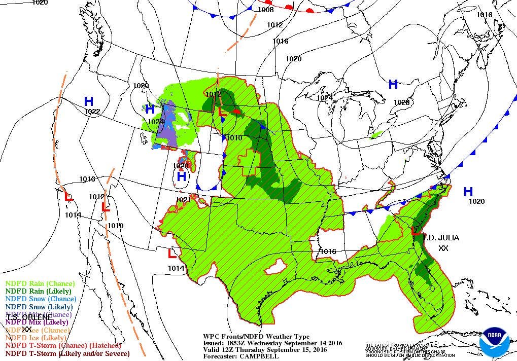
Tropical Update: Since my last discussion, the Atlantic Ocean now has two names tropical storms, and one tropical depression. At 11 p.m. Tuesday night, the National Hurricane Center started Tropical Storm Julia. This low was just stalled off the coast of Florida, and bringing heavy rain. It had winds of 40 mph, but the center was already over land. As of 2 p.m. Wednesday, Julia was centered 25 miles southeast of Savannah, GA. The system remains inland, and will slowly weaken. It is forecast to become a remnant low Friday morning, before dissipating by Friday night.
Meanwhile, Tropical Storm Ian is centered about 695 miles east of Bermuda. It has maximum sustained winds of 50 mph, and is moving north-northwest at 20 mph. The system will eventually merge with the cold front that is moving over Northern New England by Thursday afternoon. It will then move north-northeast to northeast and eventually become a post-tropical by Friday morning.
The final tropical with advisories is Tropical Depression Twelve. Its first advisory came out at 11 a.m. this morning. Twelve is centered 95 miles northwest of the Cabo Verde Islands. Maximum sustained winds are at 35 mph, and moving west-northwest of 14 mph. At this time, the forecast is for the system to move west-southwest to west-northwest over the next 5 days. However, the circulation will move into some strong westerly wind shear, helping to weaken the system within 36 hours. From there, it will move into a more favorable environment, and strengthen slightly between 96 and 120 hours. There is the chance this system weakens considerably, and simply becomes a tropical wave, as forecast by the American computer model.
Jim Laurie is a local meteorologist who earned a B.S. in Meteorology at Lyndon State College in Lyndonville, VT. Jim has fifteen years of professional experience, with eight years in the field of marine meteorology.


