Weather
After some decent rainfall Saturday evening, we return to warm, sunny conditions; hotter weather returns on Tuesday
The humidity will decrease after tonight, and we return to above normal temperatures after the holiday weekend. Showers possible on Friday.

Weather Forecast Discussion for Rhode Island on August 7, 2016
I apologize for the lack of weather discussions, as my schedule changed rather quickly after Tuesday. But, except for the heavy rain that passed through northern Rhode Island early Saturday evening, it has been sunny. We had some cooler temperatures in the middle of the week, but we returned to hot and humid weather on Saturday. Parts of northern Rhode Island has seen between 0.30 and 0.50 inches of rainfall. In fact, a car got stuck on Mineral Spring Avenue due to street flooding.
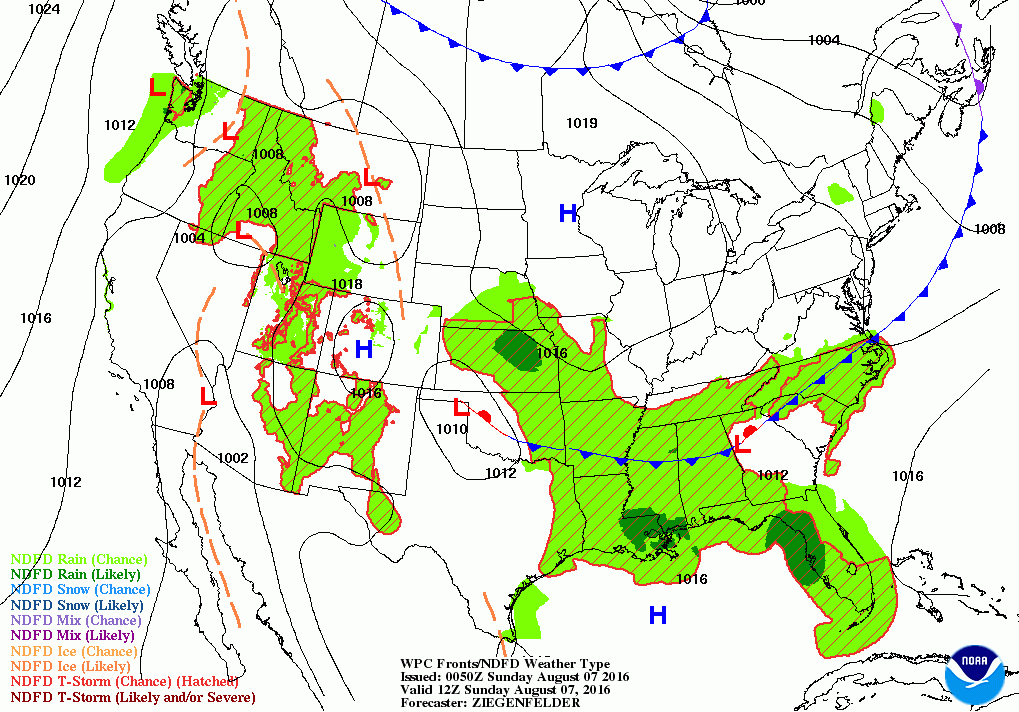
Right now, the cold front that helped trigger that rainfall is still making its way into western Massachusetts. It should pass through the Ocean State before 11 p.m. So, we may see a passing shower, then skies begin to clear after midnight. The humidity will begin to drop, but low temperatures tonight will only fall into the upper 60’s. Also, look out for patchy fog, especially in northern Rhode Island, where the heaviest rainfall was received. We will keep sunny skies for Sunday, as high pressure ridging builds over us from the west. Expect high temperatures in the middle 80’s. We will keep clear skies for Sunday night, with lows in the middle 60’s. We will enter Victory Day on Monday with more of the same, with sunny skies and highs in the middle 80’s. Low temperatures will fall into the lower 60’s Monday night, under clear skies.
Find out what's happening in East Providencefor free with the latest updates from Patch.
The high pressure center will be squarely over Southern New England on Tuesday, giving us sunny skies. But, with lighter winds, the high temperatures are forecast to reach the upper 80’s. I would not be surprised if Providence reached 90. However, a cold front moving through Quebec, Canada may pass over eastern Massachusetts Wednesday evening. We will see increasing clouds by the late afternoon, with the risk for some showers during the overnight hours. The best chance for precipitation will be between 7 p.m. and 6 a.m. Thursday morning. Look for highs Wednesday in the middle 80’s, with overnight lows in the lower 70’s.
We will return to mostly sunny skies Thursday, but with some warmer air moving north, high temperatures will reach the upper 80’s to lower 90’s. We will see partly cloudy skies until the early evening, before increasing clouds take over the skies. This is due to a frontal boundary passing over the Ocean State late Thursday night. It will also become more humid, with lows in the lower 70’s. By early Friday morning, that frontal boundary may help trigger some showers and light rain through the day. Expect high temperatures in the middle 80’s. The low pressure center connected to the now warm front will move further north and east through Friday night. Look for overnight lows in the upper 60’s.
Find out what's happening in East Providencefor free with the latest updates from Patch.
We will keep the risk for scattered showers right into next Saturday. I would not call it a washout, but there will be off and on activity through the day. There may be times we see some partial sunshine. Overall, expect highs in the lower 80’s. Looking ahead to next Sunday, the early prognosis is that the low pressure remains stalled over eastern Massachusetts, and we could see a greater chance at precipitation through the day.
Finally, it’s been a while since I updated you on Tropical Storm Earl. Earl did become a hurricane before moving into Belize City, Belize around 12:30 a.m. Thursday morning. As expected, the system stayed intact, albeit weaker, and moved across into the southern Gulf of Mexico. Friday morning. Earl then moved inland over southeastern Mexico after 1 a.m. Saturday morning. The last advisory for Earl was sent at 10 a.m. Saturday morning.
First Pitch Forecast (for McCoy Stadium, home of the Pawtucket Red Sox):
August 7th vs. Buffalo (1:05 p.m.): Sunny, 86.
August 8th is the Jeffrey Osbourne Celebrity All-Star Softball Game (7:05 p.m.): Partly cloudy, 79.
Jim Laurie is a local meteorologist who earned a B.S. in Meteorology at Lyndon State College in Lyndonville, VT. Jim has fifteen years of professional experience, with eight years in the field of marine meteorology.


