Weather
Despite cooler, less humid weather, the warmer temperatures and humidity will return, starting on Wednesday.
This enjoyable weather will begin to change, as the dewpoints increase once again. The most humid and warmest temperatures come on Friday.

Weather Forecast Discussion for Rhode Island on August 24, 2016
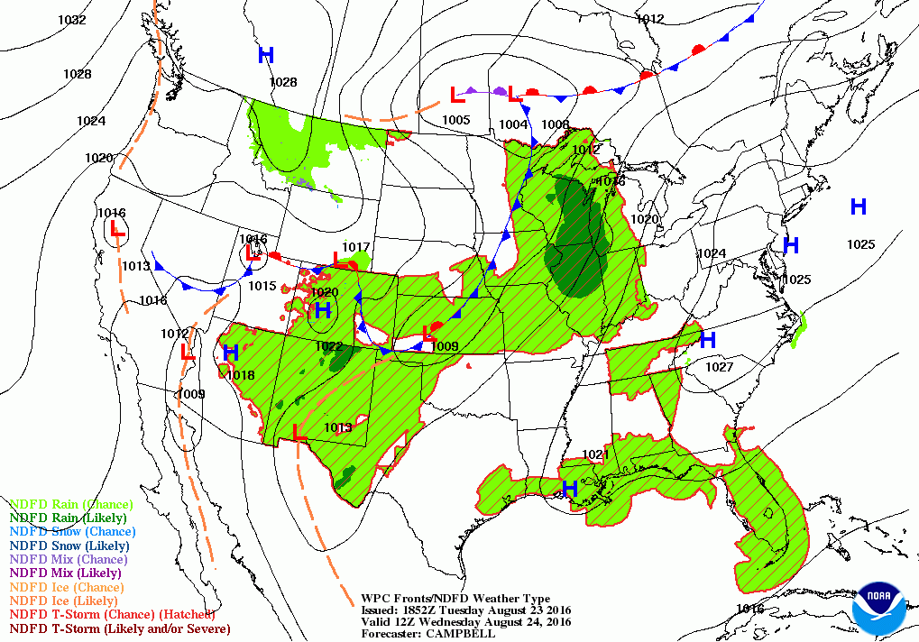
A high pressure system centered over the Mid-Atlantic States is giving the Ocean State, and the rest of Southern New England, some of the best weather in the country. Thanks to cooler air, temperatures have been in the upper 70’s to lower 80’s. Also, we received some much needed rainfall early Monday morning, with T.F. Green Airport receiving almost three quarters of an inch. However, we will return to a dry spell this week, with the next chance at showers and thunderstorms on Friday.
Right now, the high is being dominate, keeping any storm systems in the Central Plains. We will see clear skies tonight, and temperatures will remain cool. Lows will fall into the lower 60’s, so we can once again give the fans and air conditioners a break. But, the humidity will slowly begin to creep back over the next few days. Winds will turn more to the southwest, allowing our dewpoint temperatures to creep back into the lower 60’s. Also, southwest will also help raise our temperatures into the middle 80’s, since the breeze will not be coming off the waters. We will keep clear skies for Wednesday night, but low temperatures will rise into the middle 60’s. By Thursday, the strong high pressure ridge will begin to break down, as a low pressure system moves eastward over eastern Canada. We will start Thursday with bright sunshine, with high and mid-level clouds moving in through the afternoon. With the humidity increasing, it will become slightly uncomfortable, with daytime highs reaching the middle to upper 80’s. It will become mostly cloudy by Thursday night, with the risk for a passing shower or thunderstorm by 3 a.m. Friday morning. With the extra cloud cover and high humidity, low temperatures will only fall into the lower 70’s.
Find out what's happening in East Providencefor free with the latest updates from Patch.
The cold front will move through Southern New England before noon on Friday. We will see the highest dewpoint temperatures during this time. So, expect very humid conditions with the risk for showers and thunderstorms through the day. I am expecting mostly cloudy skies with highs in the upper 80’s. High pressure from the west will build over the Ohio River Valley, helping to clear our skies. By Friday night, we will return to partly cloudy skies, but lows will only fall into the upper 60’s.
We enter the final weekend for our school kids before heading back on Monday or Tuesday. Saturday looks to be beautiful, as high pressure builds itself over Vermont. We will remain warm, with highs reaching the middle 80’s. But, with northerly winds, the dewpoint temperatures will slowly come down. The high will move slowly off to the east Saturday night, keeping us under partly cloudy skies and lows in the middle 60’s. The high will stay off the coast of Cape Cod on Sunday, giving us partly cloudy skies. However, with falling heights in the upper levels of the atmosphere, temperatures will be slightly cooler. Expect daytime highs to be in the lower 80’s with lowering humidity. By Sunday night, a low pressure system over northern Vermont will bring mostly cloudy skies, with lows in the middle 60’s.
Find out what's happening in East Providencefor free with the latest updates from Patch.
As the low passes through, there is the risk for some passing showers for Monday. The best chance to see some showers will be between 2 and 5 p.m. Otherwise, it will be mostly cloudy with highs in the lower 80’s. We will see the risk for showers continue into midnight, before the moisture moves off to the east. Skies will slowly clear into Tuesday morning. Look for lows to fall into the middle 60’s. We return to bright sunshine next Tuesday, as high pressure near Illinois influences the weather. Look for high temperatures to reach the lower 80’s.
Finally, let’s take a look at the Atlantic, as there is some activity right now for tropical systems. At 11 a.m. Tuesday, the National Hurricane Center put out the last advisory on Post-Tropical System Fiona. The system ran into wind shear, not allowing the system to intensify, but rather break apart. It will be a remnant low for the next 48 hours before dissipating on Saturday.
On Monday night, the first advisory was put out for Tropical Storm Gaston. Gaston is currently located 685 miles west of the southernmost Cabo Verde Islands. Maximum sustained winds are at 65 mph, and is forecast to become a hurricane by 8 a.m. Wednesday. The system is forecast to turn west-northwest and then northwest. It will be well east-southeast of Bermuda as of 8 a.m. Sunday. However, Bermuda will see high swells and seas coming on their east side from this system.
Finally, a hurricane hunter will be going in to look at Invest 99L, located a few hundred miles east of the Lesser Antilles. It has a 40% chance of becoming a tropical system within 48 hours, and 60% within 5 days. This area will be continued to be monitored, as it remains disorganized and has a poorly defined circulation.
First Pitch Forecast (for McCoy Stadium, home of the Pawtucket Red Sox):
August 23rd vs. Syracuse (7:05 p.m.): Partly cloudy, 80.
August 24th vs. Lehigh Valley (7:05 p.m.): Partly cloudy, 79.
Jim Laurie is a local meteorologist who earned a B.S. in Meteorology at Lyndon State College in Lyndonville, VT. Jim has fifteen years of professional experience, with eight years in the field of marine meteorology.


