Weather
Dry, But Cold Weather On Tap Next Few Days
We will have dry weather over the next several days. Meanwhile, the Southeast U.S. tries to return to normal after Hurricane Matthew.

Weather Forecast Discussion for Rhode Island on October 11, 2016
Well, we received some much needed rainfall throughout Saturday afternoon and Sunday. At T.F. Green Airport, 1.66 inches of rainfall was received. Although that helps out, we are still several inches below normal, so a moderate to severe drought continues. However, we will not be seeing any summer like temperatures any time soon.
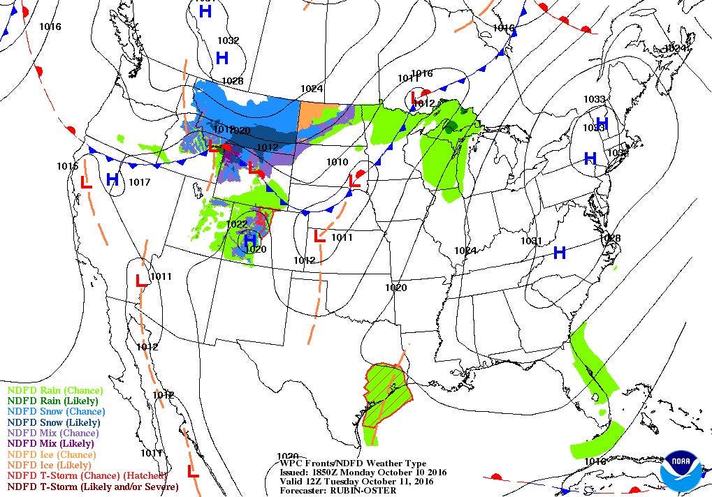
In fact, a Frost Advisory is in effect from 2 a.m. to 9 a.m. Tuesday as temperatures will be falling into the upper 30’s tonight under clear skies. The interior parts of Rhode Island are under this advisory, like northwest Providence County, western Kent County, and Washington County. The light winds and clear skies will be due to a very strong high pressure center, which will move over Northern New England Tuesday morning. Look for highs to reach the lower 60’s. With winds shifting to the southeast Tuesday night, we will have partly cloudy skies, with low temperatures being milder, ranging in the middle 40’s.
Find out what's happening in East Providencefor free with the latest updates from Patch.
The high’s center will move off the Gulf of Maine and into the Atlantic on Wednesday. We will continue to see mostly sunny skies and highs in the middle 60’s. By Wednesday night, dewpoint temperatures will be rising, thanks in part to southwest winds bringing moisture into Southern New England. In fact, we may see local areas of patchy to dense fog Wednesday night. Low temperatures will only fall to near 50 degrees. We will keep more clouds than sun on Thursday, as a cold front moves through Rhode Island by around 9 p.m. There may be a passing shower until 1 a.m. in northern Rhode Island. Otherwise, look for high temperatures near 70, with lows falling into the upper 40’s once skies begin to clear by 4 a.m.
With a new high pressure system taking over on Friday, we will return to mostly sunny skies, and cooler temperatures, with highs in the lower 60’s. The high will bring clear skies Friday night, with lows in the lower 40’s. With light winds Saturday, we will only see high temperatures in the upper 50’s despite sunny skies. We will have partly cloudy skies Saturday night, with lows falling to near 40 degrees. We return to sunshine on Sunday, as high pressure ridging remains over Southern New England. Highs on Sunday rise into the lower 60’s, with some high clouds Sunday night and lows near 50. A weak cold front will move through the Ocean State on Monday, giving us mostly cloudy skies with highs in the middle to upper 60’s. A passing shower by 4 p.m. is possible, but there may not be a lot of moisture with the front to create a shower.
Find out what's happening in East Providencefor free with the latest updates from Patch.
Tropical Update and Matthew’s Wrath: Matthew is no longer getting advisories from the National Hurricane Center. Tropical Storm Nicole, however, may move over Bermuda by noon Thursday morning. The forecast is for Nicole to strengthen back into a hurricane by 8 p.m. Tuesday evening. Then, the system turns more north and north-northeast towards Bermuda. The system will then quickly move off to the northeast, staying away from the U.S. eastern coastline.
Meanwhile, Matthew killed at least 1,023 people, with 1,000 people dead in Haiti, and 23 people across the southeast U.S. In North Carolina, 1,500 have become stranded in the town of Lumberton as the river rose to dangerous levels. Some people are actually stranded on their roofs. More than a foot of rain fell in this part of the state. Around 447,000 residents are still without power in the state.
In Virginia, a large sinkhole opened up along Route 58 in Pittsylvania County on Saturday. It may take up to a week to re-open the road. About 91,000 people are still without power. In Florida, just 75,000 are still without power as of Monday morning. During the height of Matthew on the state, over 1 million people were without power. The biggest destruction came along St. Johns County. A new inlet was formed from Matthew between Marineland and Mantanzas Inlet. Part of the Jacksonville Pier was torn off, thanks to the combination of storm surge and rough waters.
In Georgia, 150,000 are still without power in the southeastern part of the state. On Tybee Island, a new storm surge record of 12.5 feet was reached. The previous record was 12.2 feet, caused by Hurricane David back in 1979. Finally, in South Carolina, 500,000 people are still without power as of Monday afternoon. Meanwhile, crews were trying to rescue about 150 people out of the third floor of a town hall due to high flood waters in the town of Nichols. Finally, 400,000 people are without power on Hilton Head Island, with a foot of water still covering roads.
Jim Laurie is a local meteorologist who earned a B.S. in Meteorology at Lyndon State College in Lyndonville, VT. Jim has fifteen years of professional experience, with eight years in the field of marine meteorology.


