Weather
Dry Weather Thursday Night Into The Weekend; Showers Possible Sunday?
After a cold front moves offshore tonight, we will see nice but cooler weather into the weekend. Dry weather continues into Election Day.

Weather Forecast Discussion for Rhode Island on November 4, 2016
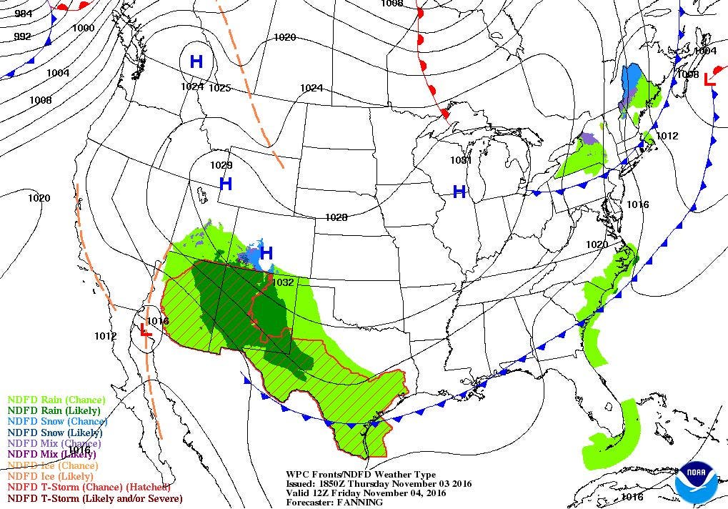
At the moment, a low pressure system is centered right over eastern Connecticut. This low brought some early afternoon showers to the northwest part of Rhode Island. But, the latest radar imagery shows the shower activity stayed well north of the state. So, there may be a widely isolated shower over our area for the next 3-5 hours. After 8 p.m., we will keep mostly cloudy skies through most of the night, as the low’s center moves further offshore. Low temperatures tonight will be in the middle 40’s.
As high pressure ridging from the north and west builds over New England, we will see mostly sunny skies for Friday. However, with north winds and slightly high wind gusts, temperatures will only reach the middle 50’s for highs. As the ridge axis moves over the state Friday night, temperatures will fall to near freezing under clear skies. This may hurt any plants or gardens in the southeastern part of the state, as the growing season continues. So, please bring in any potted plants, or try to cover any plants still in the ground.
Find out what's happening in East Providencefor free with the latest updates from Patch.
We will still have nice weather entering the weekend, as high pressure dominates most of the Eastern U.S. We will see mostly sunny skies Saturday, with highs in the lower 50’s. With winds shifting to the west, Saturday night will not be as cold, as the mercury only falls into the lower 40’s. Also, we will see partly cloudy skies, as the clouds act like a blanket, and keep the energy absorbed by the ground not to escape into the atmosphere. Also, remember to set your clocks back one hour at 2 a.m. Sunday morning, as we return to Eastern Standard Time. A low pressure system developing near Nova Scotia Sunday may help give us more clouds than sunshine. There may even be a passing shower, especially for the Cape. For the moment, we will stay optimistic, and call for partly to mostly sunny skies. High temperatures will reach the upper 40’s to lower 50’s. The high pressure center moves right below Rhode Island Sunday night, giving us partly cloudy skies and lows falling into the middle 30’s.
The weather will continue to remain dry as we move into Monday. With the high settling over the Southeast U.S., we will see mostly sunny skies with highs near 50 degrees. We will keep clear skies for Monday night, but some warmer air from the south will boost our low temperatures into the upper 30’s. We will see mostly sunny skies as we head to the polls on Tuesday, with highs reaching the upper 50’s. We will see partly cloudy skies Tuesday night, with lows in the lower 40’s.
Find out what's happening in East Providencefor free with the latest updates from Patch.
The computer models begin to disagree with each other as we approach Wednesday morning. The European model brings a low past northern Maine by 7 a.m. The result is showers before 5 a.m. with showers and light rain into the mid-afternoon. However, the American model has the low’s center further north, all the way into the end of Quebec, Canada. This keeps the precipitation shield further north as well. So, the American model believes we continue with dry weather. Looking at other models, the strong high keeps any cold front further north. Although my confidence level is not very high at the moment, I will keep us under partly sunny skies for Wednesday. Look for daytime highs to be in the middle 50’s. The high pressure ridge will build back over us Wednesday night, giving us partly cloudy skies with lows in the lower 40’s. The high will continue to give us nice weather for Thursday, with highs in the upper 50’s. At the moment, the models do indicate the high will provide us with dry weather for Veteran’s Day, although we will see increasing clouds through the afternoon. We may begin to see some rain for Saturday.
Jim Laurie is a local meteorologist who earned a B.S. in Meteorology at Lyndon State College in Lyndonville, VT. Jim has fifteen years of professional experience, with eight years in the field of marine meteorology.


