Weather
Heat and humidity return on Friday, along with possible showers/thunderstorms; lower humidity, good weather for weekend
The humidity will be at its worst on Friday, along with scattered showers and thunderstorms from a cold front. Skies clear for the weekend.

Weather Forecast Discussion for Rhode Island on August 26, 2016
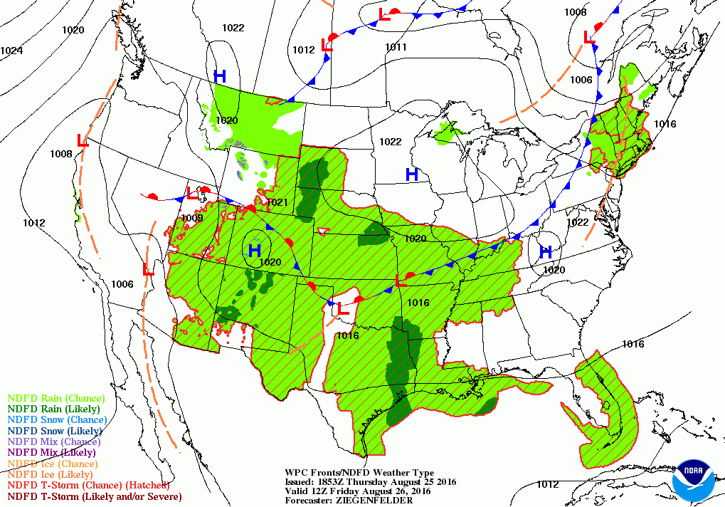
We have had some delightful weather the last few days across the Ocean State. Cooler air helped to keep temperatures in the lower 80’s Monday and Tuesday, but southwest winds helped to increase temperatures into the middle 80’s on Wednesday. Now, the southwest winds will help bring more moisture up towards New England, increasing the dewpoint temperatures. So, the air will become muggy again, and more uncomfortable for sleeping tonight. However, as we move into the weekend, a cold front passing will help lower the humidity once again.
At the moment, that cold front is just now passing Michigan, and moving east. A few pop-up showers are over western New England. For Rhode Island, thickening clouds will push in within the next 2-3 hours. We will see mostly cloudy skies by tonight, with the chance for scattered showers and thunderstorms through the evening. Expect overnight low temperatures to only fall into the lower 70’s. The cold front will move slowly across the state on Friday, so we will keep a slight chance for showers and thunderstorms. Expect high temperatures to reach the middle 80’s. However, if the precipitation moves out to sea a little faster, highs will reach the upper 80’s thanks to partial sunshine by the evening commute. It will also be quite muggy, so this will be the most uncomfortable day of the week. Any shower or thunderstorm activity should come to an end between 8 and 10 p.m., as the front moves offshore. Skies will begin to clear Friday night, but with the humidity remaining, low temperatures will only fall into the upper 60’s.
Find out what's happening in East Providencefor free with the latest updates from Patch.
School kids will enjoy this final weekend, as high pressure brings dry weather for most of the Northeast U.S. The humidity will lower as well, as winds turn to the northeast. But, temperatures will remain quite warm for this time of the month, as the mercury reaches the middle 80’s. The high’s center moves quickly over northern Maine Saturday night, giving us clear skies and lows in the middle 60’s. High pressure riding will give us partly to mostly sunny weather on Sunday, with highs in the lower to middle 80’s. The computer models agree that a low pressure system staying over eastern Canada could provide us with a few scattered showers Sunday night into Monday morning. However, the models conclude any precipitation stays north of Rhode Island. So, I will call for overcast Sunday night with lows in the upper 60’s.
The models diverge on Monday, as the American model continues to produce showers over eastern New England. But, the European and United Kingdom models already have any precipitation offshore. So, I will call for partly sunny skies for Monday, with highs in the middle 80’s. High pressure builds in from the Ohio River Valley Monday night, returning us to partly cloudy skies. Low temperatures will fall into the upper 60’s.
Find out what's happening in East Providencefor free with the latest updates from Patch.
As we look into the rest of the forecast, the models are unsure what do with Invest 99L, an area of disorganized showers and thunderstorms. The spaghetti models agree the system will track towards western Florida and quite possibly the Florida Keys. From there, the models are unsure what to do with the system as it reaches the southeast Gulf of Mexico. The models do agree that high pressure will continue to keep us dry into next Thursday. High temperatures will remain in the middle 80’s, with lows Monday night into Wednesday night in the upper 60’s under partly cloudy skies.
Meanwhile, the entire Gulf Coast is watching Invest 99L, which is giving Hispaniola heavy rain. Based on the latest Hurricane Hunter report, it still lacks a defined center, and the strongest winds have decreased below tropical storm strength. Also, wind shear in the upper levels of the atmosphere is hindering any intensification. A lot of the models feel the system will stay north of Cuba, and slowly move west-northwest into the eastern Gulf of Mexico by Monday afternoon. We will have to continue watching this system, due to the forecast track and how it may effect flooded regions in the coming days. Is has a 40% chance of becoming a tropical system within 48 hours, and a 70% chance within 5 days.
Also, Tropical Storm Gaston remains a high-end system, but not quite a hurricane. Maximum sustained winds around the center are at 70 mph, and you need 74 mph or more to call it a hurricane. It is about 1160 miles east-northeast of the Leeward Islands. The current forecast has Gaston becoming a hurricane by 8 a.m. Saturday, and tracking towards Bermuda. Once the system leaves wind shear and enters warmer waters, Gaston will intensify after 48 hours, and could have maximum winds of 105 mph within 96 hours. But, the track will change, causing Gaston to slow down and move more to the north and northeast after 8 p.m. Sunday. This sudden change in the track is due to an atmospheric weakness around 60W longitude. At this time, it pauses no threat to Bermuda or the east coast. However, it will being increasing swells to the Northeast U.S. by late Sunday.
First Pitch Forecast (for McCoy Stadium, home of the Pawtucket Red Sox):
August 25th vs. Lehigh Valley (7:05 p.m.): Mostly cloudy, 79.
Jim Laurie is a local meteorologist who earned a B.S. in Meteorology at Lyndon State College in Lyndonville, VT. Jim has fifteen years of professional experience, with eight years in the field of marine meteorology.


