Weather
Much needed rainfall arrives Sunday night; cooler weather occurs early start of week; back to summer on Wednesday
Despite coming to the end of August, we are not seeing any autumn like weather. Refreshing temperatures, cool air come Monday and Tuesday,


Weather Forecast Discussion for Rhode Island on August 21, 2016
Over the last several days, the summer weather has continued, although temperatures have remained in the middle to upper 80’s. The humidity has creeped back into Southern New England, thanks mostly to southerly winds. Also, the state has gone into a Drought Advisory, due to the lack of rainfall the last several months. However, we will get a chance at some rainfall Sunday night into Monday.
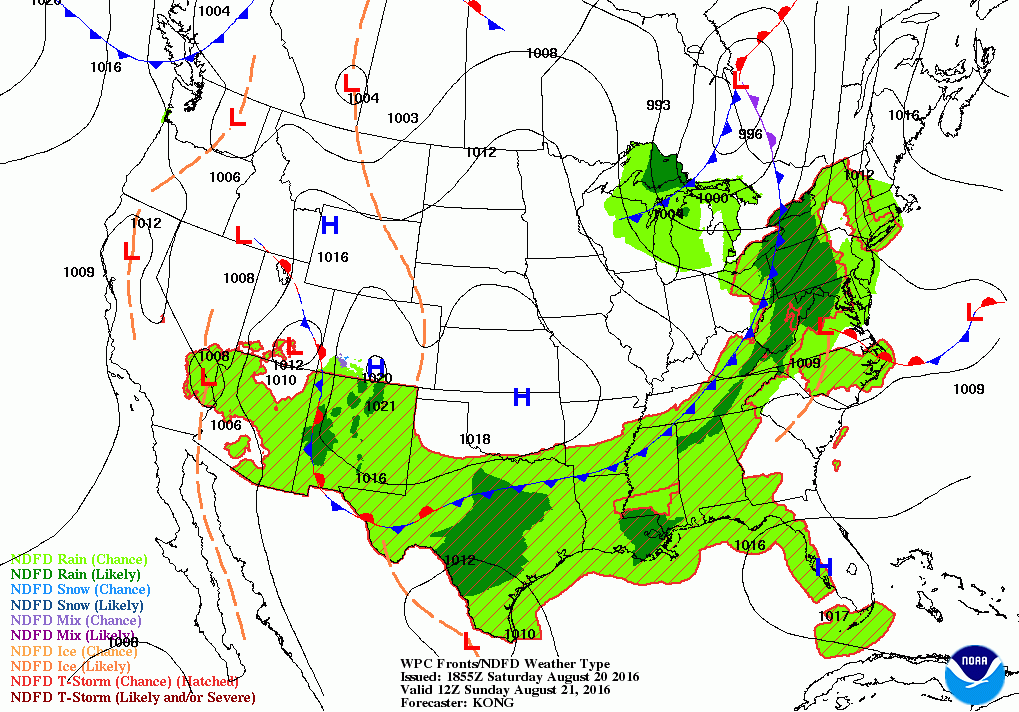
At the moment, we are experiencing some cooler temperatures, thanks to winds coming from the southeast. High temperatures across the state range from the upper 70’s to lower 80’s. This is actually normal weather for this time in August. A few spot showers have actually shown up on radar, but mostly over western Massachusetts and northern Connecticut. As we move through Saturday night, the weather remains dry, so any outdoor events will go off without a hitch. However, we will see increasing clouds through the night, as a low pressure system near the U.S.-Canadian border moves east. Look for lows in the middle to upper 60’s. By Sunday afternoon, the cold front will be over eastern New York. It may help create widely isolated showers after 1 p.m. Otherwise, expect mostly cloudy skies with highs around 80. We may see scattered showers before midnight, with heavier rainfall by 2 a.m. We will see isolated thunderstorms as well, and some may be strong, but not severe. With high humidity and high dewpoints in the upper 60’s, low temperatures will only fall into the lower 70’s. Any steady rain will end by 7 a.m., and we may see an isolated shower until 10 a.m. Otherwise, skies will begin to slowly clear, with partly sunny skies by the afternoon. Look for highs to reach the lower 80’s. However, the most significant change in the weather will be the lower humidity.
Find out what's happening in East Providencefor free with the latest updates from Patch.
After the cold front moves offshore, high pressure will help bring west to northwest winds. Also, the upper levels of the atmosphere will have a trough instead of a ridge, meaning cooler air coming down from Canada. It will feel refreshing Monday night, as skies clear as high pressure centers itself over the Mid-Atlantic. With dewpoints falling into the lower 50’s, low temperatures will fall as well, into the middle 50’s. This will give our fans and air-conditioners a much needed break. We will keep the drier, cooler air into Tuesday, as we have sunny skies and highs in the upper 70’s to near 80. Winds will slowly change back to the south Tuesday night. We will keep clear skies, but temperatures will slowly increase, as overnight lows fall into the lower 60’s. By Wednesday, the humidity will begin to return, and high temperatures will rise into the middle 80’s under sunny skies. Skies remain clear Wednesday night, with lows back in the middle 60’s.
Despite the high pressure center being in the eastern Atlantic, the ridge will remain right over New England. Look for daytime highs to reach the middle to upper 80’s under mostly sunny skies. We will see partly cloudy skies Thursday night, with lows only in the upper 60’s. We will keep mostly sunny skies for Friday morning, but clouds will be increasing by the afternoon. A cold front will begin to trek its way towards the east coast, with the risk for scattered showers Friday night into Saturday. Daytime highs Friday will reach the upper 80’s, with lows Friday night in the upper 60’s to lower 70’s inland. High pressure over the Mid-Atlantic will return us to mostly sunny skies next Saturday, with highs forecast to reach the upper 80’s. I hope everyone enjoys the last full week of school vacation. Sadly, the students of Portsmouth and Little Compton return on August 25th.
Find out what's happening in East Providencefor free with the latest updates from Patch.
Finally, let’s take a look at the tropics. Tropical Storm Fiona formed as Tropical Depression Six at 11 p.m. Tuesday night. It took until 5 p.m. Wednesday to give it her name. Right now, Fiona is about 875 miles east-northeast of the Leeward Islands. Maximum sustained winds are at 40 mph, and is moving northwest at 15 mph. The system is forecast to slightly weaken, as it enters dry air aloft along with wind shear at the upper levels. Due to this, it will likely weaken back to a Depression tonight, then become a remnant low within 48 hours. At the moment, the National Hurricane Center is watching two other areas for possible development, but will need at least 5 days to enter an environment for possible intensification into a tropical storm. The percentages increase to 60 and 70% after 5 days.
Jim Laurie is a local meteorologist who earned a B.S. in Meteorology at Lyndon State College in Lyndonville, VT. Jim has fifteen years of professional experience, with eight years in the field of marine meteorology.


