Weather
RI Weather: Sunny Sunday, Light Rain/Snow Showers Late Sunday Night
We will see a very unsettled weather pattern this week. We may see a mix of rain and snow early Monday, along with Wednesday and Thursday.

Weather Forecast & Discussion for Rhode Island on December 4, 2016
“The First Forty-Eight”
- Sunday: Sunny in the morning, with partly cloudy skies by the late afternoon. Highs in the upper 30’s to near 40, with NNW winds at 8-11 mph. Overcast skies with possible snow and rain showers after 4 a.m. Lows in the upper 20’s.
- Monday: Light rain and snow showers until 11 a.m., before changing back to rain showers. Highs in the lower 40’s. Winds turn to the west at 5-8 mph. Partly cloudy skies after midnight, with lows in the upper 20’s to lower 30’s.
Forecast Discussion:
Find out what's happening in East Providencefor free with the latest updates from Patch.
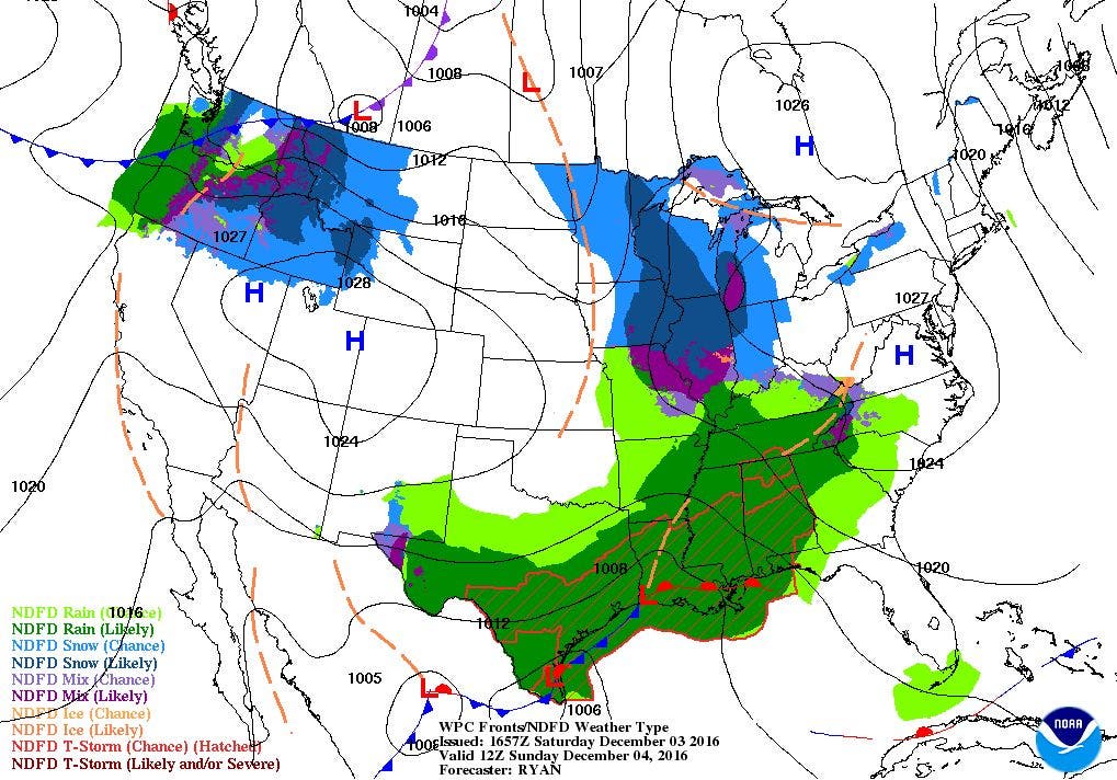
At the moment, a strong high pressure system centered over Illinois is giving us the dry weather over the Ocean State. However, a low pressure system leaving Nova Scotia is helping to create a decent pressure gradient, creating the strong northwest winds at the moment. As we head into tonight, the low will move further away, and high pressure moves into Ohio. This will help diminish the winds, and create clear skies Saturday night. Look for lows in the upper 20’s. For Sunday, we will keep sunny skies through the day, but low level moisture will begin to slide below the high’s center during the afternoon. Despite the sunshine, highs will only reach near 40 degrees. By Sunday night, a couple of weak disturbances from the Great Lakes and over North Carolina will bring some precipitation towards Southern New England. With temperatures in the upper 20’s, we will see a mix of showers mixed with some snowflakes. However, no accumulation is expected, as the precipitation will not arrive until after 4 a.m.
By Monday morning, the disturbance past the Great Lakes will affect us more than the low off of North Carolina. We will still see scattered snow and rain showers mixing until 11 a.m. By then, temperatures will be warm enough to make it just plain rain showers. Showers become more isolated by the evening commute, and should end by 8 p.m. Look for highs to reach the lower 40’s, with partly cloudy skies by Monday night, thanks to an area of high pressure ridging moving over the Northeast U.S. Low temperatures will reach the upper 20’s to lower 30’s. We will remain under the influence of the high during the day hours Tuesday. So, we can expect sunny skies, with highs in the lower 40’s.
Find out what's happening in East Providencefor free with the latest updates from Patch.
Another complex low pressure system from the Southeast U.S. sets us up for more wet weather late Tuesday night. Two lows will begin to affect our weather. The first one is a low currently over Mexico. This low will slowly work east, then into the Ohio River Valley by Tuesday night. A second low from the same system will form just off the coast of Georgia Tuesday morning. We will see a mix of rain and snow showers after 2 a.m. Look for low temperatures to be near freezing. Temperatures warm up enough to make plain rain showers after 8 a.m., and remain this way through Wednesday. High temperatures will reach the lower 40’s. We may see some isolated snow/rain showers Wednesday night, if the Carolina low stays quasi-stationary, and does not move. The American model at the moment believes in this scenario. I looked at the Canadian model, and it also believes in this scenario. Lows will fall into the lower 30’s.
After looking over the models, it now makes forecasting Thursday’s weather even more difficult. If that low remains, a strong polar front is expected to move towards New England later Thursday night. Along with it is an upper level low with a lot of upper level dynamics. The cold blast of air, along with the dynamics, would help intensify the system at the surface, and create a secondary low right over the Ocean State. We would see rain at first Thursday morning, but once the cold front pushes through, that precipitation would change over to possibly all snow. Snow would taper off by the evening, as the low’s center moves towards Nova Scotia. Highs would start in the lower 40’s in the morning, then quickly lower as the cold front pushed through the area. Thursday night’s lows would fall into the upper 20’s to lower 30’s.
We would see limited sunshine by Friday afternoon, as a weak disturbance would move through the area by the mid-afternoon. Skies would become overcast, with the chance for more rain showers. Highs would reach the upper 30’s. High pressure moving over the Southeast U.S. will bring partly cloudy skies Friday night. Low temperatures will reach the upper 20’s. Highs temperatures next Saturday will only be in the upper 30’s.
Jim Laurie is a local meteorologist who earned a B.S. in Meteorology at Lyndon State College in Lyndonville, VT. Jim has fifteen years of professional experience, with eight years in the field of marine meteorology.


