Weather
Showers, Rain Expected Into Saturday; Sunny And Colder Next Week
An approaching low will bring some much needed showers and rain into Saturday. Then, we will see cooler temperatures starting on Monday.

Weather Forecast Discussion for Rhode Island on October 21, 2016
After breaking a 71-year high temperature record on Wednesday (83 degrees), Rhode Island has returned to more normal temperatures on Thursday. Although we are still nine degrees above normal, with a high of 71, cooler air and much needed rainfall will be expected this weekend. From there, we will begin to really feel the autumn chill across the state.
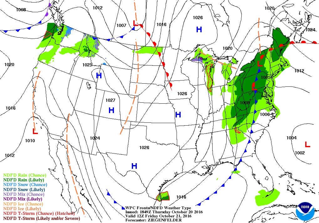
At this time, a low pressure system over southern Ohio is helping to bring more moisture over the Ocean State. Skies are becoming filled with mid-level clouds. The low will slowly move east by early Saturday morning. With showers already reaching western Massachusetts and New Hampshire, this shield of precipitation will eventually move over the state by the evening. The rainfall may become heavier at times, especially after midnight. Patchy fog is expected as well. Look for low temperatures to fall into the middle 50’s. It will take a while for the cold front to actually move into Southern New England, so we may see a brief lull in the shower activity Friday morning. By 10 a.m., the showers will become more widespread, with rain by the afternoon. Patchy fog will continue, due to the high dewpoint temperatures. Highs on Friday will reach the lower 70’s. The low’s center will move over Rhode Island Friday night. Rain will continue, along with patchy fog. Some areas may see a half-inch to an inch of rain before sunrise Saturday morning. Look for lows to fall into the lower 50’s.
Find out what's happening in East Providencefor free with the latest updates from Patch.
By Saturday morning, we will still see steady rain, thanks in part to moisture from a tropical disturbance feeding into the low over Southern New England. The low’s center will slowly move into Maine by the afternoon, giving us scattered showers through the afternoon. With a tight pressure gradient developing, strong northwest winds will rip through the region by the mid-afternoon. We could see wind gusts of 30-40 mph at times. Showers will come to an end before sunset, with mostly cloudy skies and breezy conditions during the evening. Look for highs Saturday in the middle 50’s, with lows in the lower 40’s.
Although high pressure ridging takes over as the new weather feature on Sunday, low-level moisture will keep the skies mostly sunny, with winds diminishing through the day. High temperatures on Sunday will be in the upper 50’s. We will keep partly cloudy skies into midnight, before a quick moving and weak low pressure system develops over central New York. We will see increasing clouds into sunrise, but only some drizzle. Lows will fall into the lower 40’s. As the low quickly passes through, we may see widely isolated showers Monday morning. Any precipitation ends by Monday afternoon, as the low is centered over the Atlantic. We should see some partial sunshine before dusk. Highs will reach the upper 50’s. Skies become clear Monday night, with cold temperatures, as lows are forecast to be in the upper 30’s.
Find out what's happening in East Providencefor free with the latest updates from Patch.
By Tuesday, high pressure coming down from central Canada into the western Great Lakes will bring mostly sunny to sunny skies until Wednesday. But, temperatures will be below-normal, as highs on both days only reach the lower to middle 50’s. Low temperatures will be cold, as the mercury falls into the middle 30’s. Some ocean effect showers may creep back towards the mainland Wednesday night, before we return to sunny skies next Thursday. Highs on Thursday will only be in the middle 50’s.
Finally, the NOAA has issued its forecast for the upcoming 2016-2017 winter season. Read that here.
Jim Laurie is a local meteorologist who earned a B.S. in Meteorology at Lyndon State College in Lyndonville, VT. Jim has fifteen years of professional experience, with eight years in the field of marine meteorology.


