Weather
RI Weather Forecast: Record Heat Details, Storm Timeline Revealed
Some of Rhode Island could see new highs today, but it's far from a beach day.



It'll be almost 100 degrees and some of us won't even be able to think about going to the beach. A hazardous weather outlook has been issued for the northern half of Rhode Island for a combination of extreme heat and potential storms. There's a lot to cover, so we'll try to keep it neat and quick:
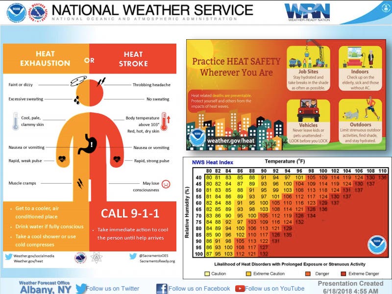
The Heat: As the National Weather Service keeps saying this morning, it's "gonna be a scorcha!" The excessive heat and humidity will make for temperatures in the 90s and push heat indices as high as 94 in much of Rhode Island this afternoon. The southern part of the state could see much more mild temperatures, with highs forecast in the 70s.
>>>Do you have a photo of your favorite beach? Today's the day to share it! Send it to patchyphotos@gmail.com, and remember to include the name of the beach and identify your friends and family in the photo.
Find out what's happening in Newportfor free with the latest updates from Patch.


So that means we should have some new record-high temperatures before the day is done. Here are some to keep an eye on.
- Providence - 92 degrees (1994). Today's forecast: 88. Normal high: 78.
- Boston - 92 degrees (1993). Today's forecast: 94. Normal high: 77.
- Worcester - 91 degrees (1994). Today's forecast: 91. Normal high: 75.
- Westfield, MA - 94 degrees (2006). Today's forecast: 96. Normal high: 79.
What's it going to look like the rest of the week? Tuesday, Wednesday, and Thursday have highs in the 80s with some clouds.
Find out what's happening in Newportfor free with the latest updates from Patch.
The Storms: The reason it's not such an obvious beach day is because of the the potential for thunderstorms this afternoon into evening. Lightening, gusty winds, and excessive rain are all eyed today. The worst of it is expected to coincide with the evening commute. See the simulated radar below.
A rough timeline of potential strong to severe thunderstorms forecast later today; looking at storm development beginning shortly after noon and continuing through early evening; w/ any storms, the threat of strong to damaging winds, frequent lightning, and/or excessive rainfall pic.twitter.com/nlaNnncQmj
— NWS Boston (@NWSBoston) June 18, 2018

"There is the potential for a few strong to severe storms this afternoon into evening. Frequent lightning, strong to damaging winds, as well as brief heavy rainfall along with possible flooding are the expected potential threats with strongest storms," the National Weather Service said.
Get more local news delivered straight to your inbox. Sign up for free Patch newsletters and alerts.