Community Corner
Update: Rip Current Threat Grows as Katia Strengthens to Cat 2
Forecasters expects some potentially dangerous conditions along the coast for the next few days.

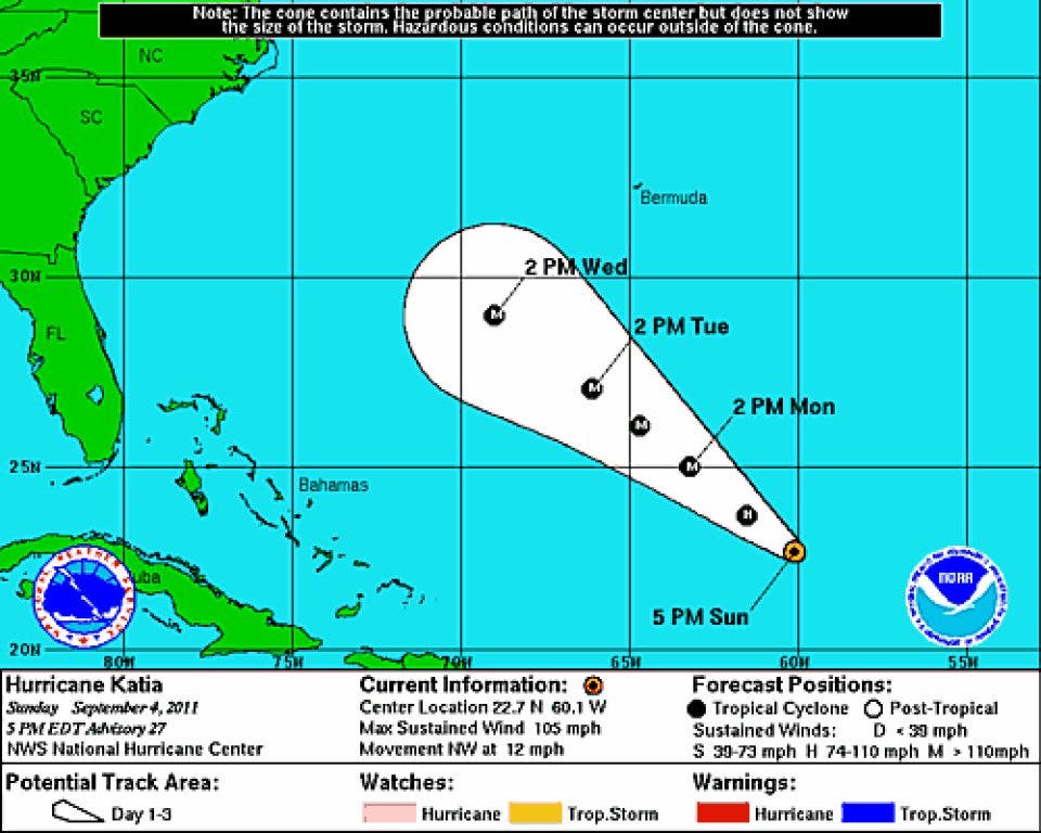

Update (8 p.m., Sept. 4, 2011): Hurricane Katia has strengthened throughout the day and is now a Category 2 story with winds around 105 mph, according to the National Hurricane Center.
Forecasters say some dangerous rip currents could appear along the East Coast in the coming days, and conditions should be monitored.
The projected path (at right) still shows just a slight chance of a major impact on the Carolinas.
Find out what's happening in Charlestonfor free with the latest updates from Patch.
Original story (9 a.m. Sept 4, 2011): Hurricane Katia, wavering on the border of tropical storm and hurricane strength for the past few days, was upgraded to a hurricane once again at 6 a.m. Sunday.
At 5 a.m., the storm was moving to the northwest near 12 mph, and the general motion "is expected to continue for the next couple of days," according to the National Hurricane Center at NOAA.
Find out what's happening in Charlestonfor free with the latest updates from Patch.
Winds are expected to remain near 70 mph, with some strengthening forecasted in the next 48 hours.
Forecasters at the Weather Channel believe the storm will remain out at sea, but there is a possibility it will come closer to the coast.
Get more local news delivered straight to your inbox. Sign up for free Patch newsletters and alerts.