Community Corner
Beryl Bringing Strong Winds, Heavy Rain to Lowcountry
Storm expected to move through S.C. early Wednesday.

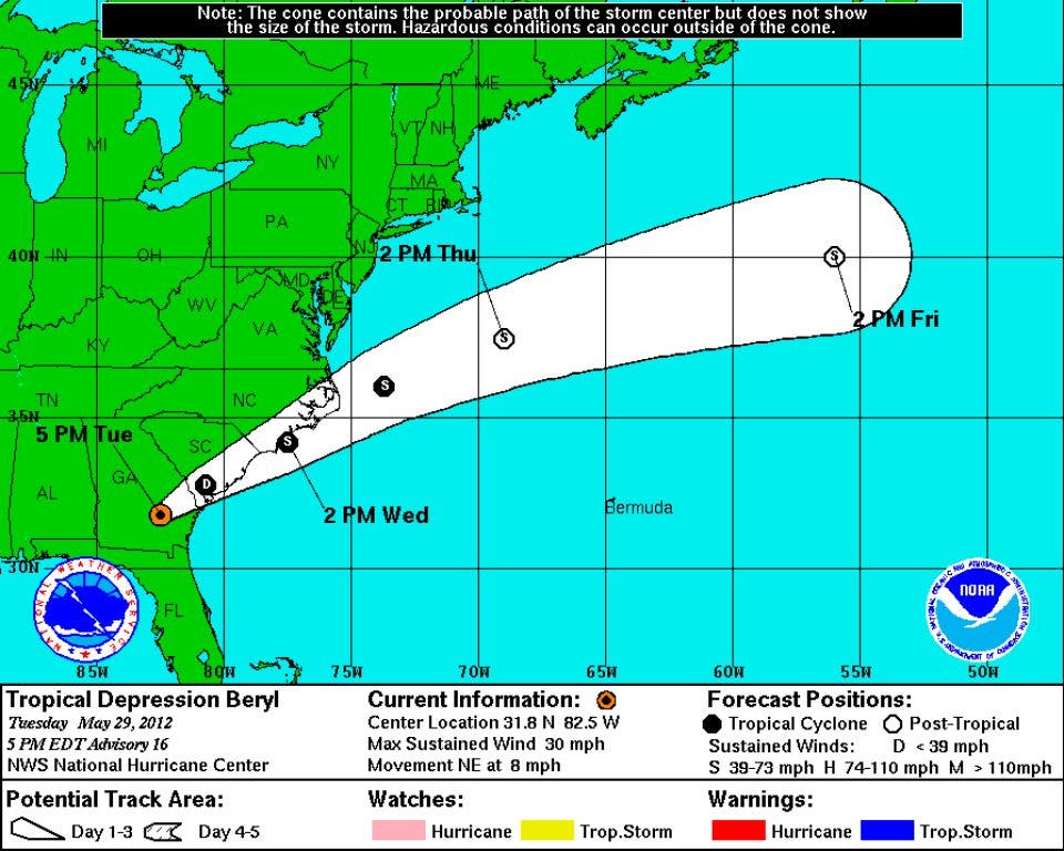

Update, 6 a.m.: After moving through the area overnight, Tropical Depression Beryl was 25 miles north-northeast of Charleston at 5 a.m., carrying sustained winds up to 35 mph.
The storm is expected to move off the South Carolina coast today and run up the North Carolina shore into this evening. The storm could regain tropical storm strength later today, according to the National Hurricane Center.
Showers and possible thunderstorms are expected to continue through the morning.
Find out what's happening in Goose Creekfor free with the latest updates from Patch.
Update, 11:15 p.m.: Tropical Depression Beryl was 85 miles west-southwest of Charleston at 11 p.m.
Find out what's happening in Goose Creekfor free with the latest updates from Patch.
By 8 a.m. Wednesday, the center of Beryl is expected to be just north of Charleston, with sustained winds at 35 mph as it head out for the open waters of the Atlantic.
The has been extended to 6 a.m. A flood advisory regarding minor flooding in Berkeley and Dorchester counties has been extended until 2:30 a.m., adding central Charleston County.
First Report: Tropical Depression Beryl continued its march to the Lowcountry on Tuesday, but the former tropical storm that has poured heavy rain on Florida and Georgia is taking its time.
As of 5 p.m., the storm was 85 miles west-southwest of Savannah with sustained winds up to 30 mph, according to the National Hurricane Center.
The storm is expected move to the South Carolina coast early Wednesday before moving out into the Atlantic. The winds aren't expected to pick up tonight, but the NHC warns that Beryl could regain tropical storm status Wednesday as it moves along the S.C. coastline, but the strongest winds should stay offshore.
Specific threats from Beryl, according to the NHC:
- Isolated tropical storm wind gusts, particularly in rainbands.
- Dangerous surf conditions tonight.
- Total rain accumulations from 3 to 6 inches and up to 8 inches in some areas of eastern South Carolina.
- Isolated tornadoes are possible in the area tonight.
A early Tuesday for the Charleston area.
Get more local news delivered straight to your inbox. Sign up for free Patch newsletters and alerts.