Community Corner
Hurricane Irene Drives Toward Carolinas
Charleston still expecting some impact, but greater risk up the coast.


Aug. 24, 8 a.m.: Further updates are .
Aug. 24, 5 a.m.: As we get closer to Saturday morning, the path for Hurricane Irene is becoming clearer. The storm is expected to stay off of the Charleston coast, but could still impact the Lowcountry with tropical storm or hurricane force winds and heavy rain.
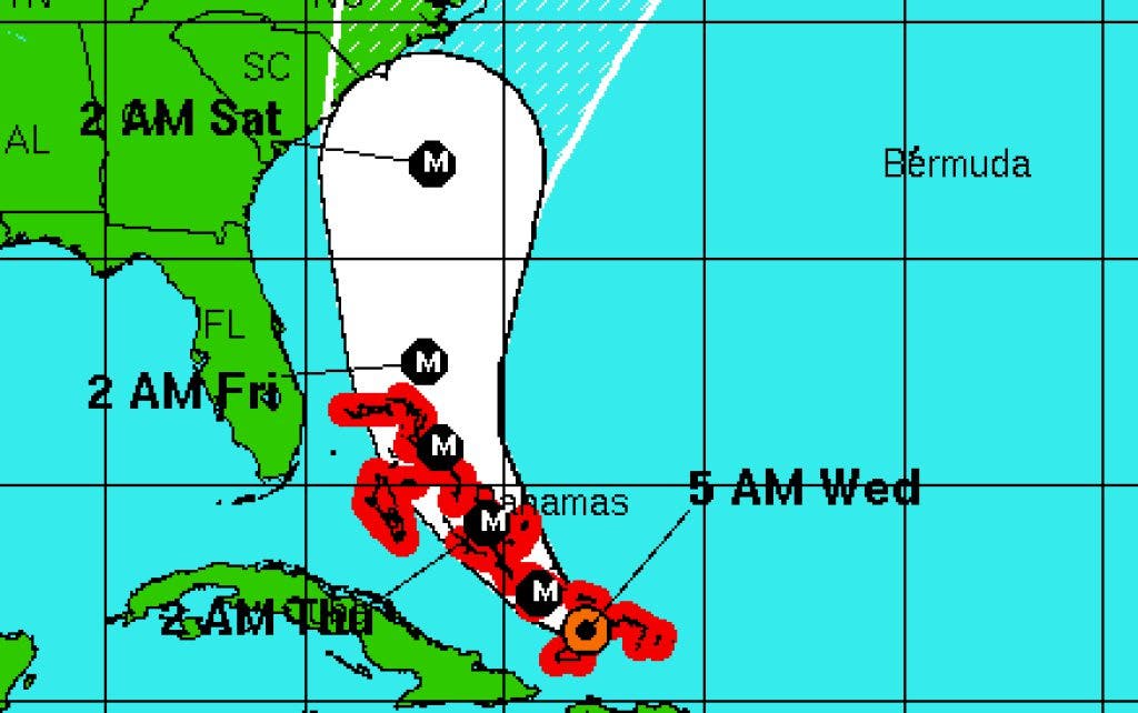
The latest forecast from the National Hurricane Center puts the storm roughly 190 miles off the Charleston coast on Saturday morning with wind speeds up to 120 mph.
Find out what's happening in Goose Creekfor free with the latest updates from Patch.
The threat for a U.S. landfall appears greatest along North Carolina's sea islands, but Horry County is also in the range of possibilities.
Aug. 23, 5 p.m.: The latest forecast for Hurricane Irene moves the landfall threat farther up the coat. Charleston is now on the far western edge of the potential path. But the storm could still impact the Lowcountry.
Find out what's happening in Goose Creekfor free with the latest updates from Patch.
Winds are expected to reach 125 mph by Thursday and the hurricane is expected to maintain that strength through Friday. Irene is currently a Category 1 with 90 mph winds.
Aug. 23, 11 a.m.: A strengthening Hurricane Irene continued to churn toward the Carolinas on Tuesday, as the unpredictability of the storm keeps Charleston under the threat of hurricane or tropical storm winds.
The latest track estimates from the National Hurricane Center suggest the storm will run along the South Carolina coast Friday afternoon and into Saturday morning before potentially making landfall in North Carolina.
The storm is expected to carry winds between 115 and 125 mph as it passes the Palmetto State.
According to the Weather Channel, the storm was packing 100 mph winds as of 11 a.m., and moving at 12 mph. There are 80 million people who could be impacted, according to the weather network.
The immenent threat is the Bahamas, where the storm is expected to drag slowly for much of the week, reaching up to 125 mph winds before heading into open waters Thursday and Friday.
Currently, the storm is at a Category 2 with 100 mph winds.
on local preparations for the potential impacts from Irene.
Get more local news delivered straight to your inbox. Sign up for free Patch newsletters and alerts.