Community Corner
Fort Worth: Help Plan For The Future And Share Your Transportation Experience
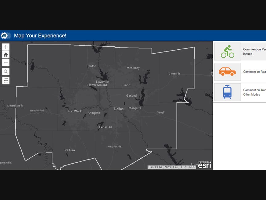
The North Central Texas Council of Governments is accepting public input through a new online mapping tool.
May 14, 2020
The interactive map allows users to comment on vehicle, bicycle, pedestrian and public transit issues.
Find out what's happening in Dallasfor free with the latest updates from Patch.
The North Central Texas Council of Governments is accepting public input through a new online mapping tool. Map Your Experience is intuitive and designed to help the agency use public input to collaborate with partners and develop innovative solutions for regional transportation issues.
Residents can provide as many comments as they wish as well as browse and comment on pins placed by others on the map. Providing personal information is optional and will not be visible to others in the tool. However, users will be asked to provide their ZIP code.
Find out what's happening in Dallasfor free with the latest updates from Patch.
The tool is in beta test mode and is open to the public. Staff will reassess the tool in the fall to ensure it is fully functional and meeting users’ needs. Comments from the test period will be used to guide upcoming planning efforts, including an update to Mobility 2045, the region’s long-range metropolitan transportation plan.
This press release was produced by the City of Fort Worth. The views expressed here are the author’s own.