Community Corner
Williamson County Shares Pics Of Underground Cave That Ate Street
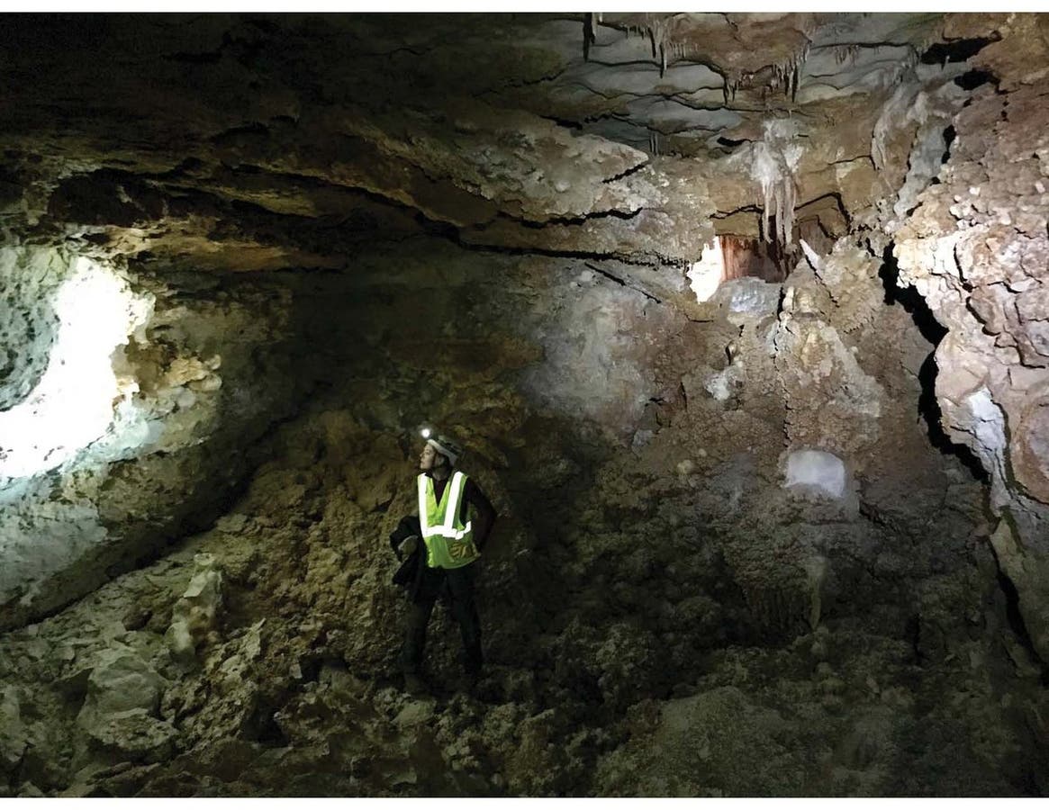
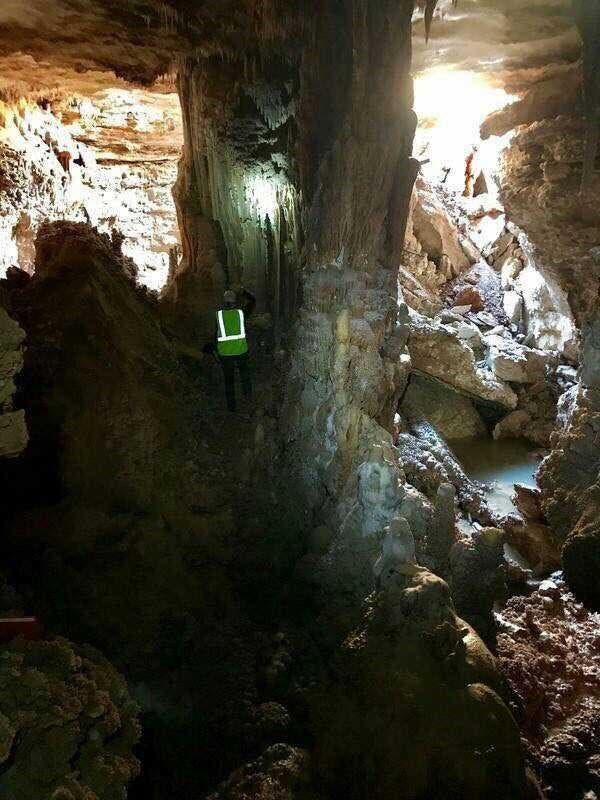
Officials release stunning photos of cave that gave way under street, saying it's 170 feet long and from 10 feet to 22 feet in height.

WILLIAMSON COUNTY, TX — Environmental consultants on Friday released more details on the cause of a 20-foot sinkhole that emerged on a county street Thursday morning — including stunning photos of the underground cave that partially collapsed to create the fissure.
The previously unexplored cave system underneath the road's surface was discovered by virtue of the road collapse after its roof crumbled by continual dripping water from a pipe leak. Officials said the cave starts at around the middle of Cambria Drive some 20 feet west of the curb and heads east about 170 feet. The height of the cave varies reaching a height of approximately 22 feet near the entrance with an average of 10 feet to 15 feet, officials added.
Brushy Creek Municipal Utility District officials previously said the roof of the cave collapsed Thursday morning, creating the gaping hole in the roadway.
Find out what's happening in Round Rockfor free with the latest updates from Patch.
Structural engineers now are scheduled to evaluate the site along the 8400 block of Cambria Drive on Monday to determine the cave's stability and plot out possible repairs. For the time being, the roadway will remain closed for several weeks as county officials work with Texas Commission on Environmental Quality (TCEQ) representatives to determine what the next steps should be.
Related story: Engineers To Assess 20-Foot Williamson County Sinkhole
Find out what's happening in Round Rockfor free with the latest updates from Patch.
About a dozen residents near the collapse lost water service in the wake of the collapse cave that crushed a pipe, but service has since been restored. County officials publicly thanked residents in keeping the area safe by staying behind fencing that has since been installed around the perimeter of the site.
The street collapsed Thursday at around 3 a.m. near the Woods of Brushy Creek neighborhood situated between Highway 183 and Cedar Park on the west and Interstate 35 and Round Rock to the east. Residents say they heard what they believed was thunder amid the collapse before learning of the sinkhole.
Hydrogeologists mapped the cave using a laser range finder. @BrushyCreekMUD #brushycreekcave pic.twitter.com/H7wSGORt5Q
— bcmud (@BrushyCreekMUD) February 9, 2018
Cave mapping found the length to be 170 feet. Structural engineers on site Monday. https://t.co/zYnDPRxe0k
— bcmud (@BrushyCreekMUD) February 9, 2018
>>> Photo provided by Cambrian Environmental via Williamson County
Get more local news delivered straight to your inbox. Sign up for free Patch newsletters and alerts.