Weather
Flood Watch Issued As 'Pineapple Express' Arrives In Puget Sound
A flood watch will be in effect from 4 p.m. Thursday until Saturday afternoon. The Seattle area could see two inches of rain by tomorrow.

SEATTLE — Many Puget Sound rivers are likely to see moderate flooding over the next two days, as another marathon of heavy rain socks Western Washington. The latest storms are courtesy of a "pineapple express" — a warmer variety of atmospheric river with a knack for soaking the West Coast.
As the National Oceanic and Atmospheric Administration explains:
"A well-known example of a strong atmospheric river is called the 'Pineapple Express' because moisture builds up in the tropical Pacific around Hawaii and can wallop the U.S. and Canada's West Coasts with heavy rainfall and snow. Prevailing winds cross over warm bands of tropical water vapor to form this 'river,' which travels across the Pacific as part of the global conveyor belt. When it reaches the west coast, the Pineapple Express can dump as much as five inches of rain on California in one day."
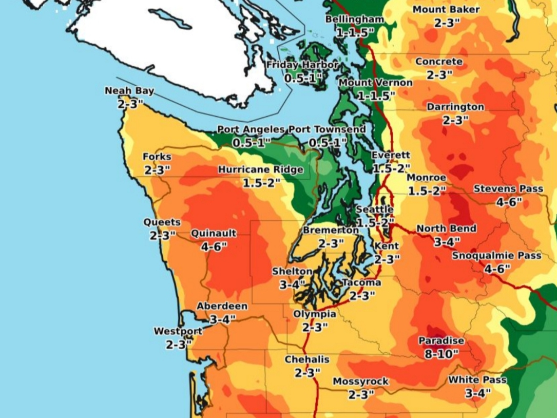
Forecasters expect the latest front will live up to its reputation, dumping up to two inches of rain around Seattle and three inches in Tacoma by Friday night — and about twice that amount in the mountains.
Find out what's happening in Puyallupfor free with the latest updates from Patch.
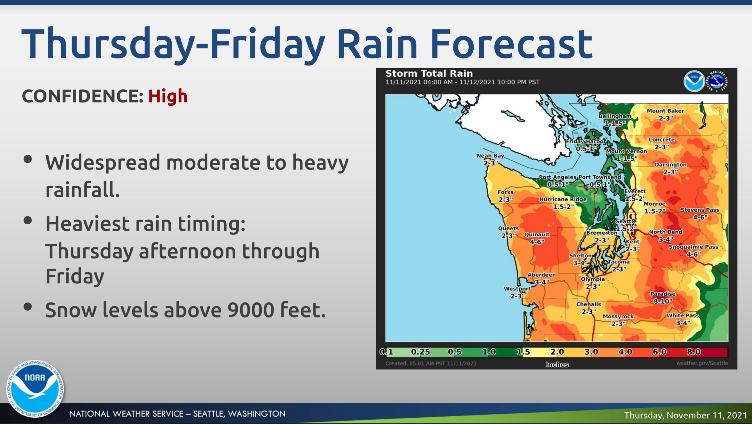
Periods of widespread, heavy rain are forecast to pick up by Thursday afternoon, likely making for a messy evening commute. Conditions are unlikely to let up much through Friday, and a flood watch will be in place from 4 p.m. Thursday until 2 p.m. Saturday.
Flood Watch Issued For These Counties (Thursday - Saturday):
Find out what's happening in Puyallupfor free with the latest updates from Patch.
- Clallam
- Grays Harbor
- Jefferson
- Mason
- Skagit
- Whatcom
- King
- Lewis
- Pierce
- Snohomish
- Thurston
Forecasters said the latest models show 48-hour rain totals landing between three and five inches across much of Western Washington. Periods of excessive rainfall are possible throughout the region, adding to the risk of flooding and landslides.
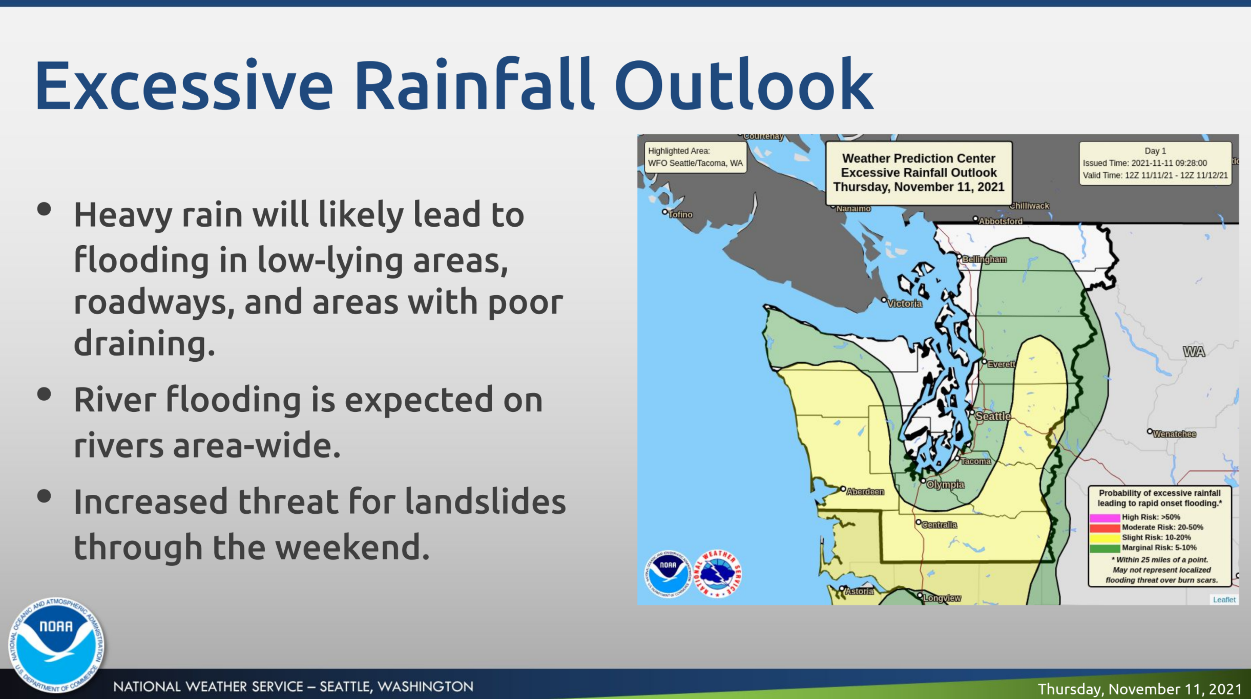
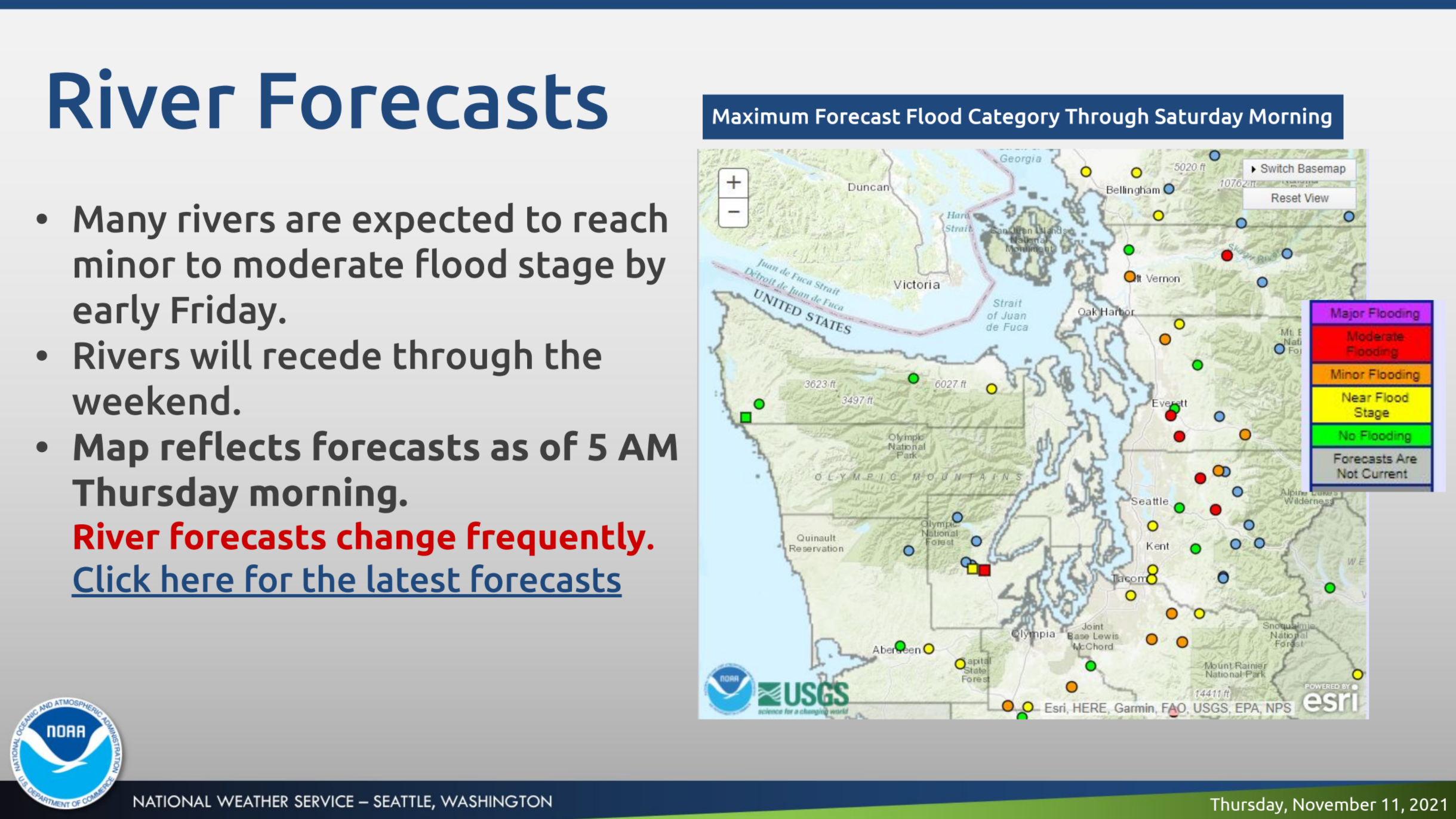
Many rivers are expected to reach at least minor flood stages, and some may get close to the moderate range, including portions of the Snoqualmie, Snohomish and Puyallup rivers. The Tolt River near Carnation and the Snoqualmie River at Snoqualmie Falls could reach the major flood stage by late Friday morning.
Review live river conditions and the latest flood forecasts via the National Weather Service.
Sign up to receive local flood alerts in King, Pierce, or Snohomish counties.
Unlike the last big storm, forecasters are not expecting significant winds this time around, though it will be breezy. Snow levels will also be much higher, around 10,000 feet, and afternoon temperatures in the lowlands are forecast around 60 degrees through Friday.
The heaviest rain should pass by Saturday, but forecasters expect a few showers will linger and rivers will continue to run high. The National Weather Service forecasts drier weather by next Tuesday, but temperatures will run much cooler — roughly 10 degrees below normal — with overnight lows expected to dip into the 30s.
We're keeping a close eye on the atmospheric river — and rivers closer to the ground. 📲If you live in a flood-prone area, sign up for flood alerts: https://t.co/o2uwFCaVYT 📲Stay in the know and sign up for emergency alerts: https://t.co/zXiIt4APzL#KingCountyReady #WAwx https://t.co/y6Q8JynoFr
— King County, WA (@KingCountyWA) November 11, 2021
Get more local news delivered straight to your inbox. Sign up for free Patch newsletters and alerts.