Weather
Historic October Heat, Smoke & Fire Dangers: Puget Sound Forecast
October could steamroll through another slate of records this weekend with more heat, fire concerns and smoke in the forecast.

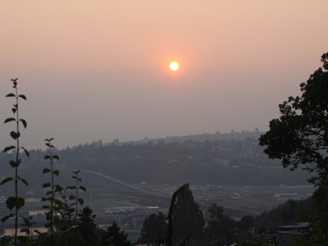
SEATTLE — The latest forecasts show a good chance that this weekend will be another one for the record books. If temperatures in Seattle reach their projected high Sunday, the Emerald City will break through 80 degrees later in the year than ever before and hit the threshold twice in October for the first time. Saturday will get close, too, and more daily records look likely to fall.
Seattle already broke its October record for most 75-degree days, logging its sixth Thursday, more than any other year since records began in the 1890s. According to the National Weather Service, the last 100 days have seen 77 with above-normal temperatures, including 25 straight through Wednesday. With just 0.4 inches of rain since July 5, it has also been the second-driest 100-day stretch ever recorded in Seattle.
After October 15th, records highs across Western Washington fall considerably....so much so that 80° is unheard of that late in the year. Here's where some of the records stand and where we could be on Sunday. #wawx pic.twitter.com/klBIQcYF45
— NWS Seattle (@NWSSeattle) October 13, 2022
Unfortunately, the latest twist in a strange year of weather will coincide with more wildfire smoke. An air quality alert will be in place across Western Washington from 5 p.m. Friday to 11 a.m. Monday.
Find out what's happening in Redmondfor free with the latest updates from Patch.
“Starting tonight through [Sunday] night, easterly winds will pick up and King and Snohomish counties are likely to see steady smoke from the Bolt Creek and White River fires, and [unhealthy for sensitive groups] or unhealthy air quality,” the Puget Sound Clean Air Agency warned Friday. “The smoke could easily push further west and south to Kitsap and Pierce counties, and beyond.”
Any near term improvement in low level smoke around Puget Sound is likely to be short-lived. Offshore winds increase late tonight & Sat. & this will push more wildfire smoke into the region. Be sure to check your local air quality agency website for the latest air quality values. pic.twitter.com/lUTRwAv4FE
— NWS Seattle (@NWSSeattle) October 14, 2022
The easterly winds will lend to hot, dry and breezy conditions along the west slopes of the Cascades, bringing critical fire dangers through the weekend. A red flag warning will be in place for the area between Saturday morning and Sunday afternoon, with relative humidity as low as 25 percent.
Find out what's happening in Redmondfor free with the latest updates from Patch.
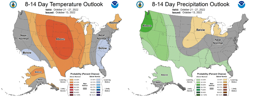
Finally, there is some good news on the horizon: Temperatures are on track to tumble about 10 degrees by Monday, and there are some early signals in the extended forecast that fall weather may finally take hold by next weekend. Odds from the Climate Prediction Center also favor a shift to wetter weather arriving over the last full week of October.
Here is the five-day weather outlook for the Seattle area:
- Saturday: 79°/54° (Haze)
- Sunday: 81°/51° (Haze)
- Monday: 70°/51° (Mostly sunny)
- Tuesday: 69°/50° (Partly sunny)
- Wednesday: 71°/50° (Mostly sunny)
Get more local news delivered straight to your inbox. Sign up for free Patch newsletters and alerts.