Weather
Another Heat Wave Incoming: Puget Sound Temps Soar By Late Week
Forecasters are tracking another stretch of dry heat expected in the latter half of the week, along with the potential for wildfire smoke.


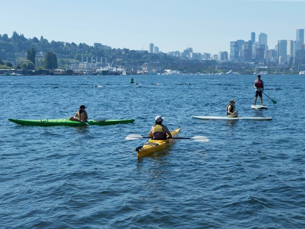
SEATTLE — An excessive heat watch will be in place for most of Washington, beginning Wednesday and lasting through at least Saturday evening, with forecasters expecting a stretch of some of the warmest weather in weeks.
"Extreme heat and humidity will significantly increase the potential for heat related illnesses, particularly for those working or participating in outdoor activities," the National Weather Service wrote Sunday. "Nighttime relief Thursday, Friday and Saturday morning will be poor across Eastern Puget Sound and the adjacent Cascade foothills."
While not expected to be as hot as the historic highs of late June, the Seattle area could reach the mid-90s both Friday and Saturday, with parts of the Sound Sound drawing nearer to triple digits.
As you can see on the map at https://t.co/JZtP9Jx5mJ excessive heat watches are now up for later this week. Here in Western WA it will be hot Thursday through Saturday (but not as hot as it was at the end of June). Here in Seattle we should see three days in the lower to mid 90s. pic.twitter.com/h95rMGi8KE
— NWS Seattle (@NWSSeattle) August 8, 2021
Monday and Tuesday are on track to stay relatively mild, with plenty of sunshine and temperatures in the mid-to-high 70s, before breaking into the 80s on Wednesday. The latest forecasts show favorable odds for three consecutive days in the 90s, from Thursday through Saturday.
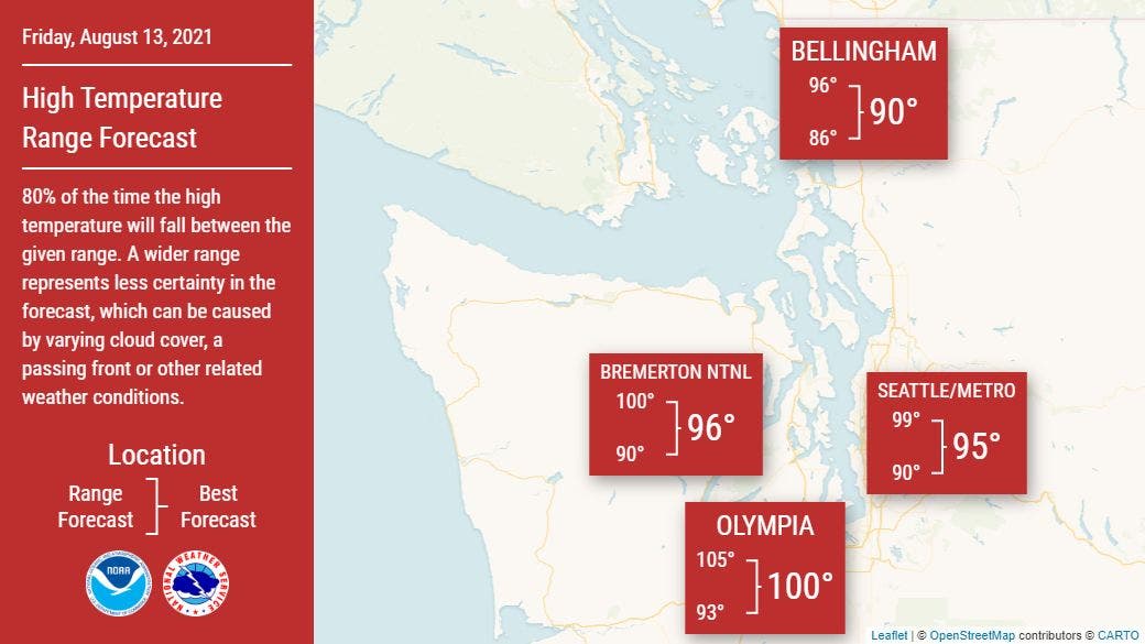
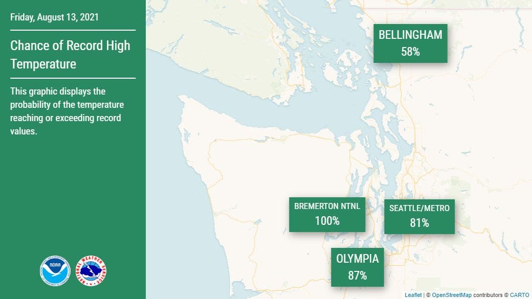
Right now, Friday looks to be the hottest of the group and brings the highest chances for daily records to be shattered around Seattle, Bremerton and Olympia.
Overnight conditions are expected to offer little respite from the heat streak, with temperatures likely to bottom out in the 60s.
"Early Thursday morning, the forecast calls for light offshore flow in the hours leading up to daybreak, which has increased the overnight low temperatures into the mid to upper 60s," wrote Maddie Kristell, a meteorologist with NWS Seattle. "Given the warm afternoon expected the day before, and with Thursday's highs looking to be in the mid to upper 90s across Puget Sound, this offers little overnight relief from the heat. The same scenario sets up Friday and Saturday morning, and highs once again well in the 90s on both days."
Air quality forecasters still monitoring the potential for mid-week wildfire smoke
One unwelcome factor that could mitigate some of the heat is the potential for wildfire smoke returning to Western Washington in the week ahead. In an update Monday morning, the Puget Sound Clean Air Agency flagged the potential for easterly winds developing by Thursday, which could filter in smoke from wildfires burning in Canada and east of the Cascades.
In a post Friday on the Washington Smoke Blog, forecasters said there was still some uncertainty in the models and expected a more firm outlook early this week. Long-range air quality forecasts show air degrading to the "moderate" range Thursday and Friday.
Smoke and air quality resources:
- Washington Smoke Blog
- Daily air quality forecasts
- Wildfire smoke preparedness tips
- AirNow's live smoke and air quality maps
Though the weekend brought a small dose of much-needed rain, the next stretch of dry heat will further elevate wildfire concerns, as more than two dozen blazes burn across Washington and Oregon.
There are now 28 fires spread across 795,622 acres -- 13 fires in Oregon and 15 in Washington. This BRAND NEW Sunday morning shows the large uncontained fires and complexes in the Pacific Northwest as of August 8!NWCC Blog: https://t.co/5gEciPMiTV pic.twitter.com/edfmUJsPs9
— Northwest Interagency Coordination Center (@NWCCInfo) August 8, 2021
Get more local news delivered straight to your inbox. Sign up for free Patch newsletters and alerts.