Weather
Puget Sound Rain Forecast: Atmospheric River Prompts Flood Watch
A round of widespread, heavy rain is forecast through Friday, which could push many rivers near their flood stage. Here's what to know.


SEATTLE — At atmospheric remains on target to soak Western Washington, bringing up to two inches of rain to the Seattle area by Friday morning. The National Weather Service expects heavier precipitation will arrive in Puget Sound by Wednesday night and carry into Friday, prompting new flood concerns as area rivers experience a rapid rise.

"Generally 1 to 2 inches expected across the interior lowlands, with pockets of 2 to 3 inches totals possible along the north coast of the Olympic Peninsula," NWS Seattle wrote Wednesday. "As a result, expect widespread rises in rivers across the region, with the greatest threat for river flooding outside of the Skokomish basin likely in northern and central Cascade basins."
A flood watch will be in effect between Thursday afternoon and Friday morning in King, Snohomish, Jefferson, Skagit, Whatcom, Clallam and Grays Habor counties. While most rivers should see just mild flooding, if any, a handful could reach moderate flood stage by Thursday afternoon. The rivers most likely to experience flooding include the Snoqualmie, Nooksack, Skagit, Stillaguamish and Skykomish.
Find out what's happening in Seattlefor free with the latest updates from Patch.

Residents can check live river conditions and monitor evolving flood forecasts via the National Weather Service.
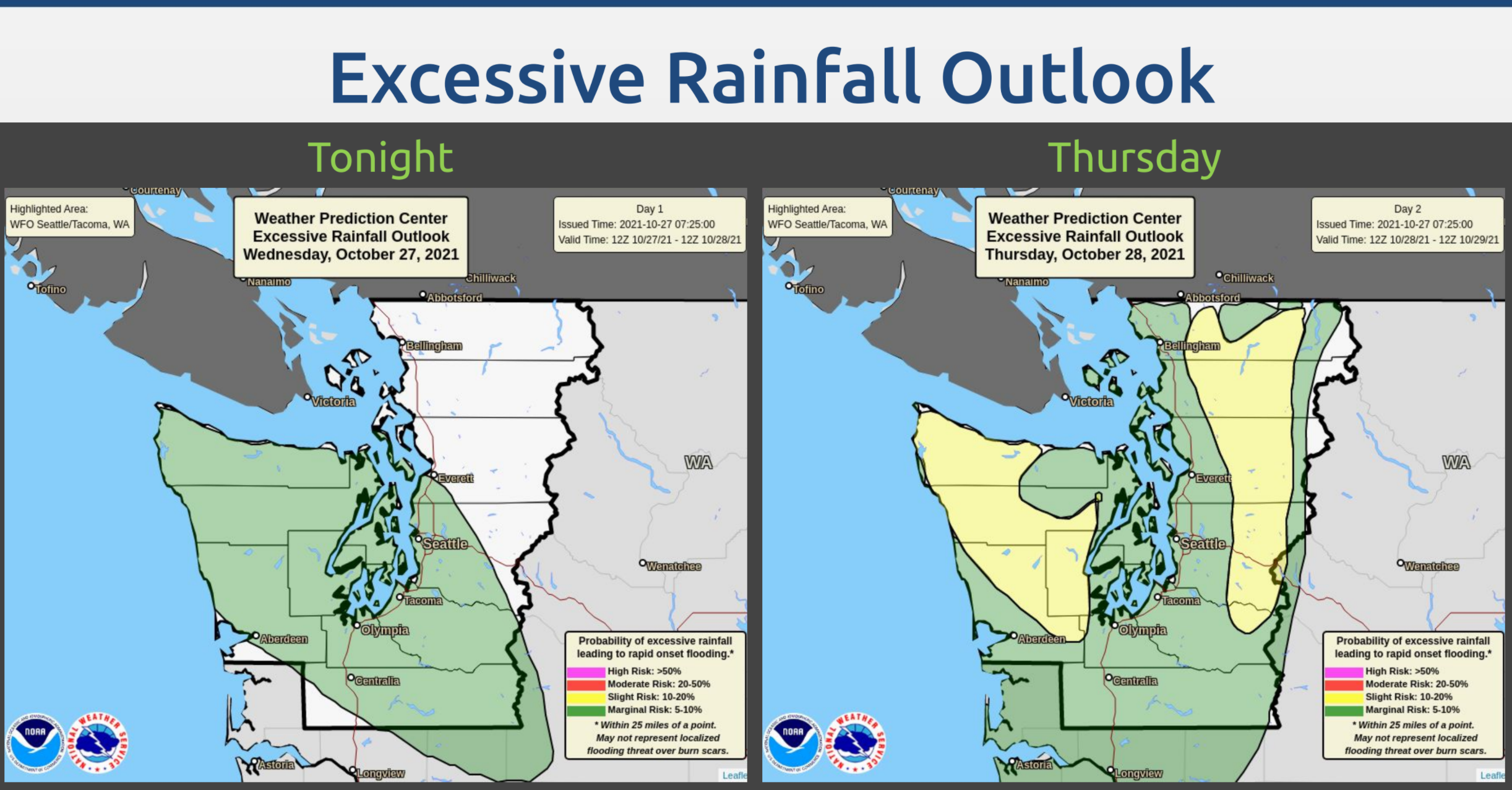
Forecasters expect a marginal risk of excessive rainfall, which can lead to "rapid-onset flooding" for most of the region Thursday, with a slightly higher risk on the Olympic Peninsula and the Cascades. Some urban flooding will be possible, especially in areas with poor drainage, forecasters said.
Find out what's happening in Seattlefor free with the latest updates from Patch.
This round of wet weather looks unlikely to bring snowfall to the mountain passes, with snow levels rising to about 10,000 feet through Friday morning.
The forecast brightens up after Friday, allowing for a dry and sunny Halloween weekend as area rivers begin to crest, then recede. With clearer skies, overnight temperatures will also be lower, and may dip into the 30s Saturday night. Rain is back in the forecast by next Monday, as another system approaches.
Here's the 5-day weather outlook for the Seattle area:
- Thursday: 57°/46° (Rain/Flood Watch)
- Friday: 46°/51° (Rain, then mostly sunny)
- Saturday: 53°/39° (Sunny)
- Sunday: 55°/42° (Mostly sunny)
- Monday: 54°/44° (Chance of rain)
Get more local news delivered straight to your inbox. Sign up for free Patch newsletters and alerts.