Weather
A Cold April Ends, But May Might Be Similar: Puget Sound Forecast
As Puget Sound closes the books on one of its chilliest Aprils, forecasters say the trend could continue through May. Here's what to expect.

SEATTLE — One of Seattle's coldest Aprils in decades comes to a close this weekend, but the chillier trend may linger through May — if history is any indicator. According to the National Weather Service, the Emerald City had recorded 24 days of below-average temperatures by Thursday, logging just three days that were warmer than normal. As the Seattle Weather Blog notes, that helped make for the second-coldest April since the 1970s.
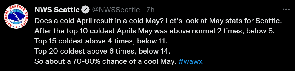
Analyzing data from previous years, the National Weather Service found the top 10 coolest Aprils were most often followed by below-average temperatures continuing in May.
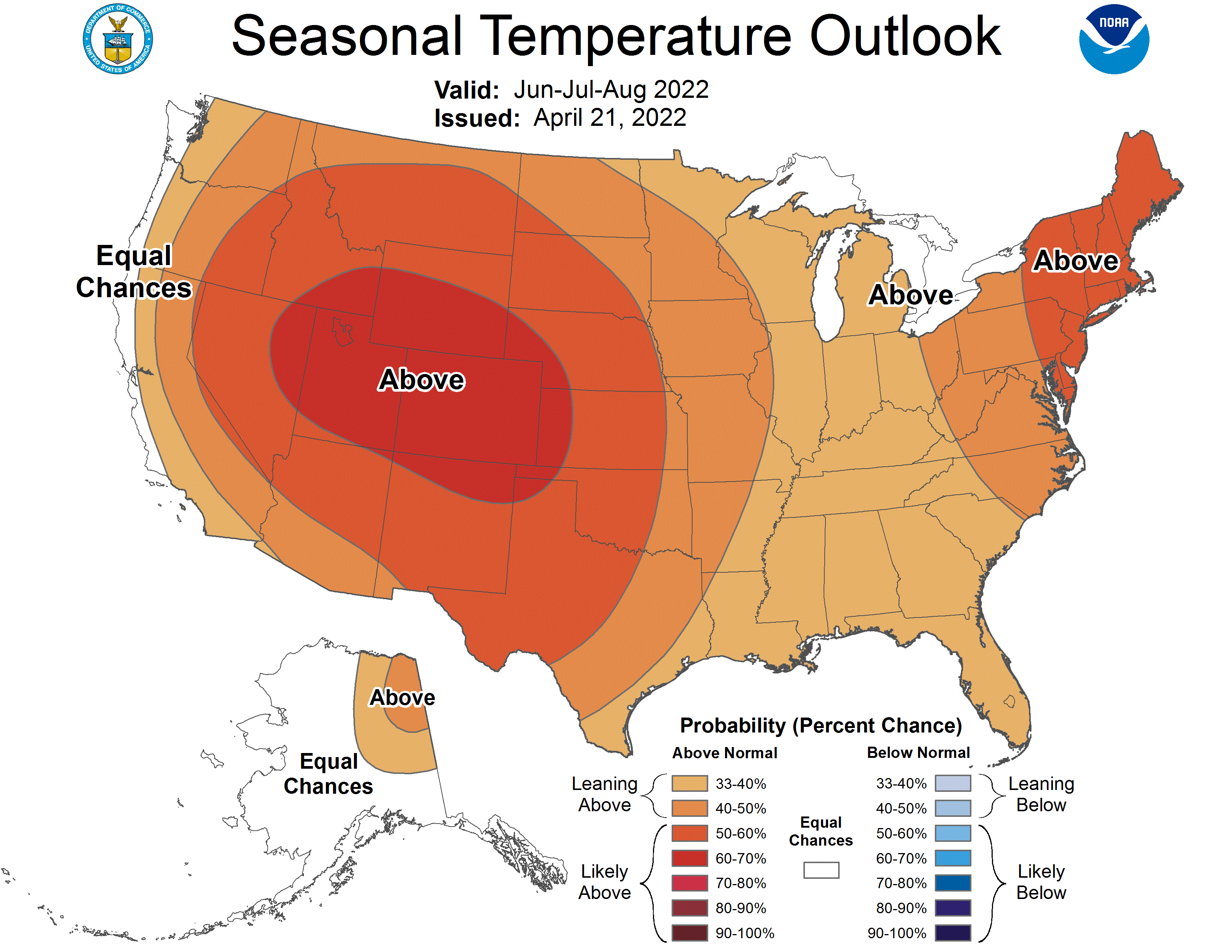
The trends are in line with what climatologists had predicted this spring in the Pacific Northwest, and Washingtonians may look back fondly on these cooler months if expectations for another hot summer come to pass. The Climate Prediction Center's latest seasonal outlooks show growing odds for above-average temperatures across nearly the entire United States between June and August, including both sides of the Cascades.
Find out what's happening in Seattlefor free with the latest updates from Patch.
Forecasters also see a drier summer ahead, which could complicate Washington's drought outlook and increase wildfire risks. Last year, during a record-breaking and deadly run of summer heat, Western Washington saw three days of triple-digit temperatures. The National Oceanic and Atmospheric Administration said the odds also favor La Niña continuing through the summer.
A sunny start to May
Find out what's happening in Seattlefor free with the latest updates from Patch.
Looking back at the near term, forecasters expect a rainy finale to the month, thanks to another wet weather system moving through in the evening, with rain expected through Saturday morning and some afternoon showers likely.
The first day of may looks to trend on the warmer side, with partly sunny skies and afternoon highs making a triumphant return to the 60s. However, the rain will be back in the cards for Monday as temperatures tumble back into the 50s. A bright spot next week could arrive Wednesday when forecasters expect more sunshine and afternoon temperatures soaring through the mid-60s.
Here is the five-day weather outlook for the Seattle area:
- Saturday: 58°/44° (AM rain/PM showers)
- Sunday: 62°/47° (Partly sunny)
- Monday: 55°/46° (Rain)
- Tuesday: 58°/45° (Mostly cloudy)
- Wednesday: 66°/49° (Partly sunny)
Get more local news delivered straight to your inbox. Sign up for free Patch newsletters and alerts.
