Weather
Cold Start To The Week, Then More Rain For Puget Sound: Forecast
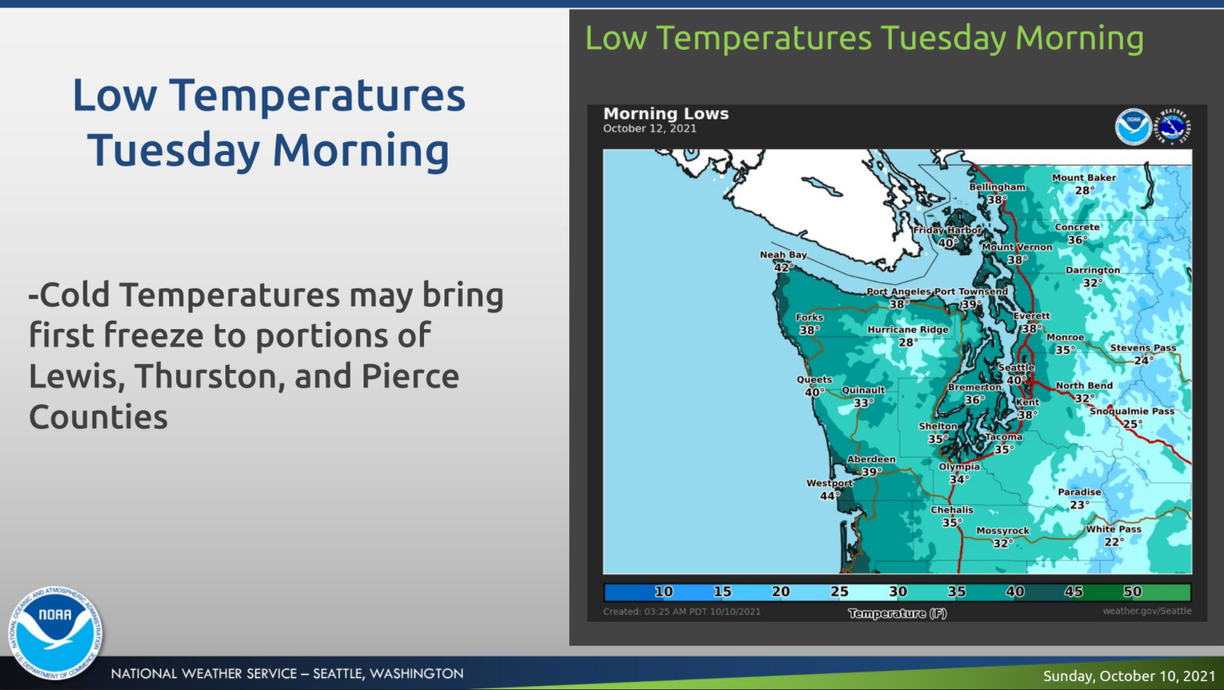
Monday is forecast to be mostly sunny, but the lack of cloud cover will lay the groundwork for some frigid temperatures early Tuesday.


SEATTLE — Some sunshine is back in the forecast Monday after an active weekend of wet weather, but colder temperatures are here to stay for at least another few days. As promised, Saturday and Sunday provided a few bouts of heavy rain, hail and even a scattering of thunderstorms across Western Washington, and predictions for a bit of snow in the mountains came to pass, too.
A Puget Sound Convergence Zone currently bringing❄️flakes to Snoqualmie Pass this morning. Have pass travel on your agenda? Make sure to check road conditions at: https://t.co/C7Kb5jOtXK #wawx pic.twitter.com/91WYAJ4UvR
— NWS Seattle (@NWSSeattle) October 10, 2021
Snow levels remained relatively low Sunday evening, and the National Weather Service said another inch or two would be possible in portions of the Cascades, especially at Stevens Pass.
As cloud cover dissipates Monday, temperatures in the lowlands will tumble a few more degrees, making for another chilly afternoon, followed by what's likely to be the coldest morning in months — and even a frost for some.
Find out what's happening in Seattlefor free with the latest updates from Patch.
"[W]ith clearing skies expected, Monday night/Tuesday morning appears to be the coldest of the week with widespread low temperatures in the 30s and possible freezing temperatures across areas of south Puget Sound, and perhaps even in a few of the outlying areas in the far east portions of the Seattle metro area," NWS Seattle wrote Sunday.
After the Tuesday morning chill, the rest of the week looks like it will fall into another wet groove. The early week break in the rain will be short-lived, with a good shot for showers returning Tuesday night and chances for rain continuing every day through next weekend. Afternoon highs are forecast in the low-to-mid 50s through at least Thursday, with overnight temperatures in the mid-40s.
Find out what's happening in Seattlefor free with the latest updates from Patch.
At least a chance of showers through the work week. Could be cool enough on Tuesday morning where frost is possible for some interior locations. Highs mainly in the 50s, with lows in the 30s to mid 40s. #wawx pic.twitter.com/MQytZkQCmj
— NWS Seattle (@NWSSeattle) October 11, 2021
"Another front approaches later Tuesday and pushes onshore into Wednesday with another round of widespread precipitation," forecasters wrote "Overall, the ensemble guidance supports a mean trough across the western U.S. late in the week, which will generally maintain a cooler pattern with at least the potential for a few weak disturbances to clip the region and bring some rain/higher Cascades snow chances at times."
Here's the 5-day weather outlook for the Seattle area:
- Monday: 54°/38° (Mostly sunny)
- Tuesday: 54°/45° (PM showers)
- Wednesday: 54°/44° (Chance of rain)
- Thursday: 55°/47° (Chance of rain)
- Friday: 58/47° (Chance of rain)
Get more local news delivered straight to your inbox. Sign up for free Patch newsletters and alerts.
