Weather
Heat Advisory Begins Wednesday In Puget Sound: What To Know
A heat advisory will begin Wednesday in the lowlands, with an excessive heat warning in place for the west slopes of the Cascades.


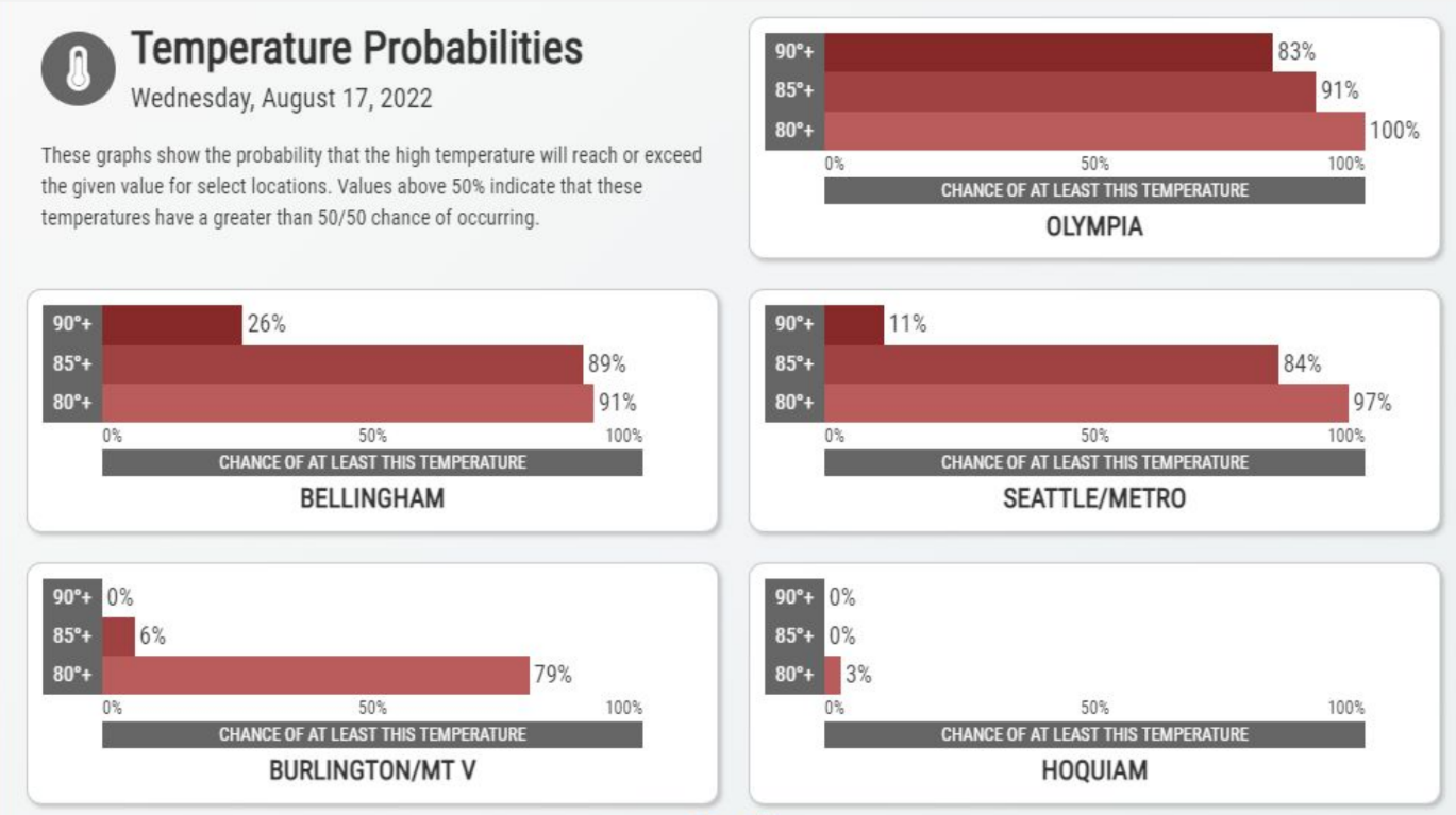
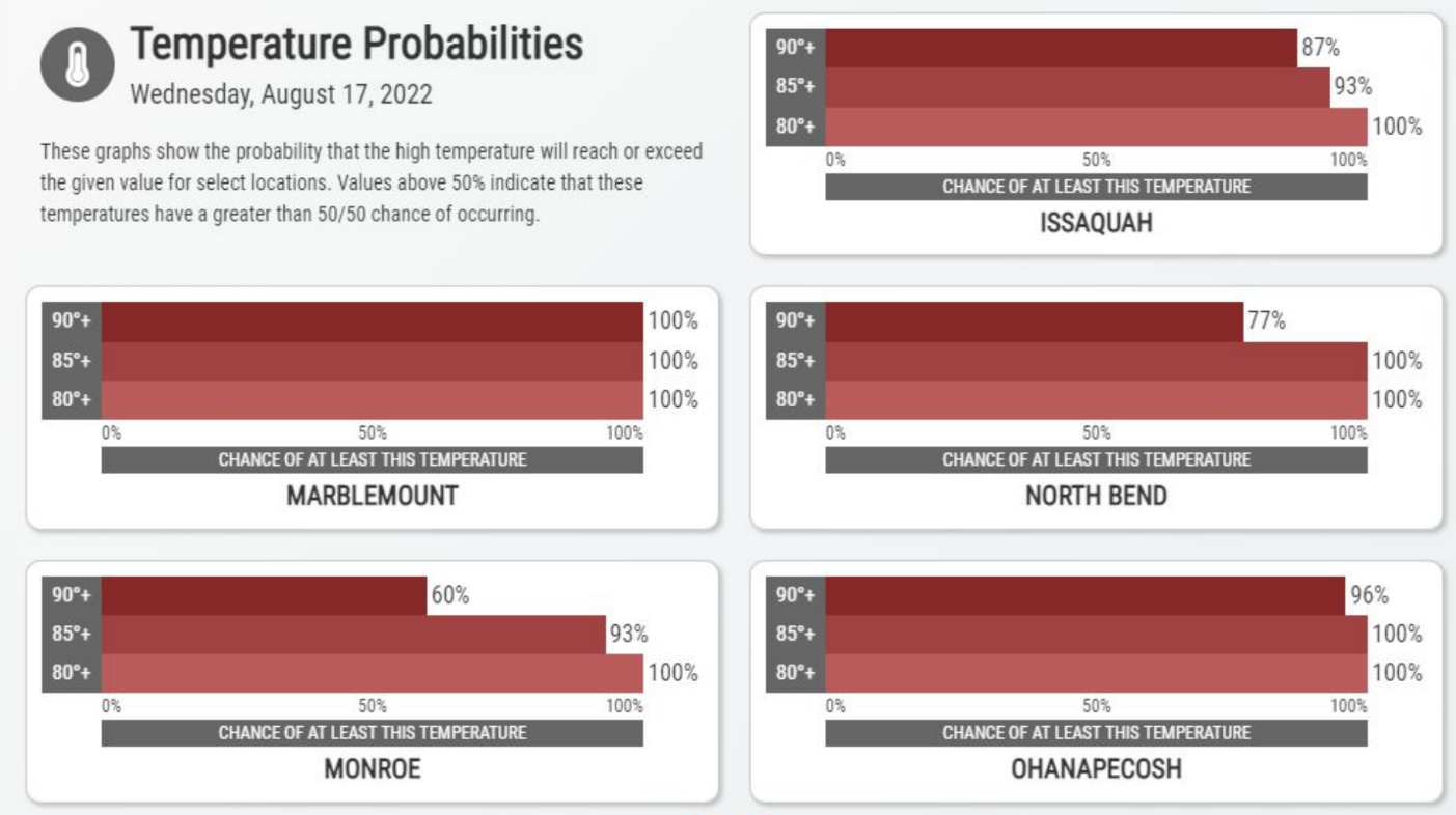
SEATTLE — Another blast of heat is set to descend on Western Washington, and a heat advisory will be in effect through Thursday night across the region as afternoon highs climb into the mid-80s and low-90s. According to the latest forecasts, the Seattle area is less likely to hit the 90s Wednesday, but could break the threshold Thursday for the 11th time this summer.
Olympia, Issaquah and North Bend are among the communities that may hit the 90s on both days. Forecasters with the National Weather Service said the incoming heat would lend to moderate heat risks Wednesday and Thursday for most of the interior, with higher risks for communities in the Cascade valleys and foothills, where highs could get close to triple digits.
"Drink plenty of fluids, stay in an air-conditioned room, stay out of the sun, and check up on relatives and neighbors," NWS Seattle wrote Tuesday. "Young children and pets should never be left unattended in vehicles under any circumstances. Take extra precautions if you work or spend time outside. When possible reschedule strenuous activities to early morning or evening."
Find out what's happening in Seattlefor free with the latest updates from Patch.
An excessive heat warning will be in place along the west slopes of the Cascades, including for the cities of Concrete, Lyman, Hamilton, Darrington and Morton.
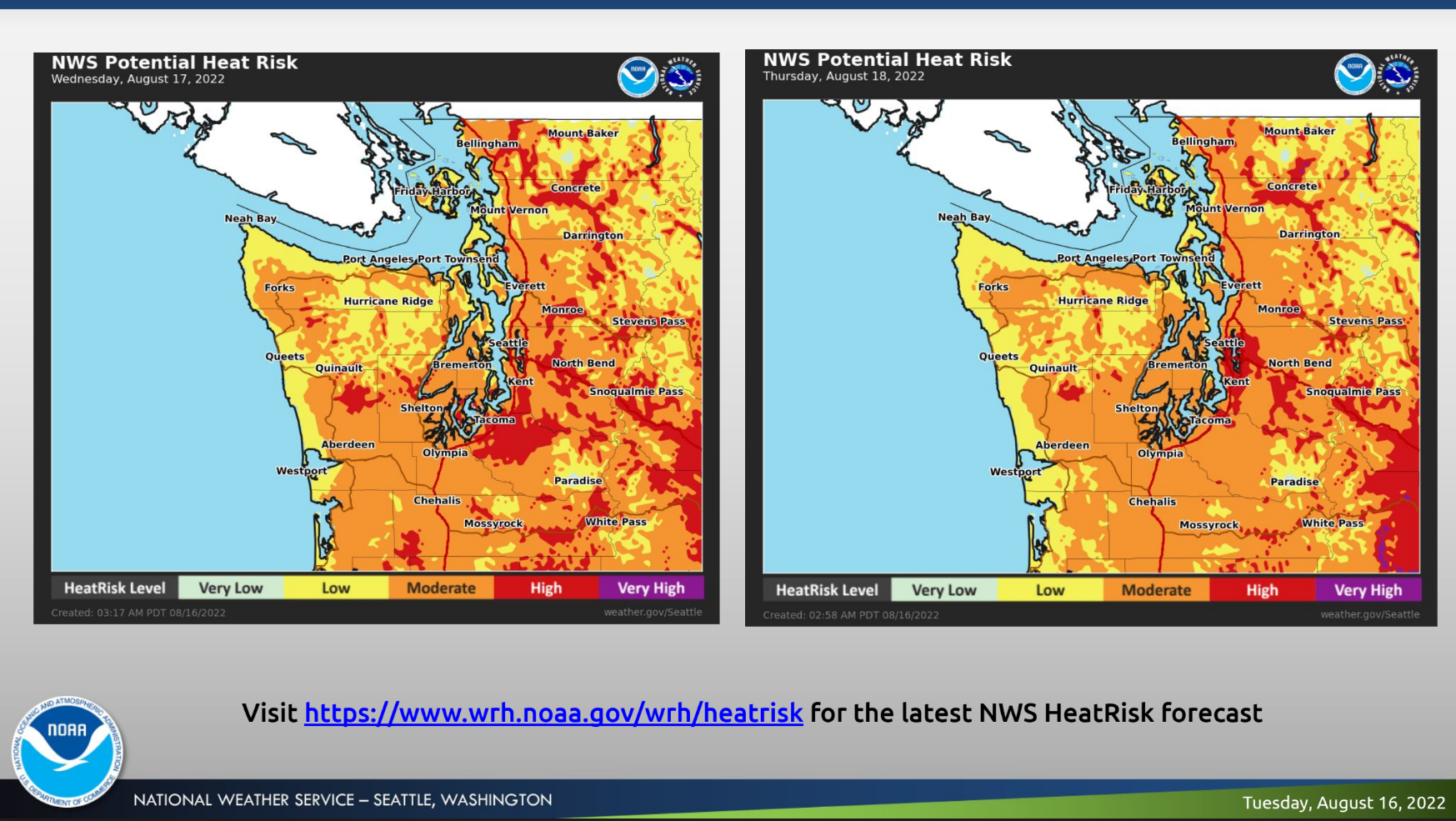
Overnight temperatures in the mid-60s may limit relief from the heat for the foothills and urban lowland areas, while lows should run a little cooler for communities south of Puget Sound and west of the I-5 corridor.
Find out what's happening in Seattlefor free with the latest updates from Patch.
The latest run of summer heat should make its exit Friday, returning temperatures close to their seasonal normals. Forecasters expect Friday, Saturday and Sunday will post afternoon highs right around 80 degrees. The current seven-day forecast shows no signs of rain.
Here's what to expect for temperatures Wednesday:
Get more local news delivered straight to your inbox. Sign up for free Patch newsletters and alerts.
