Weather
Heat Risks Ahead For Puget Sound, But Not As Hot As June
Western Washington is looking at another heat-up to end July, but forecasters do not expect conditions will be as extreme as last month.


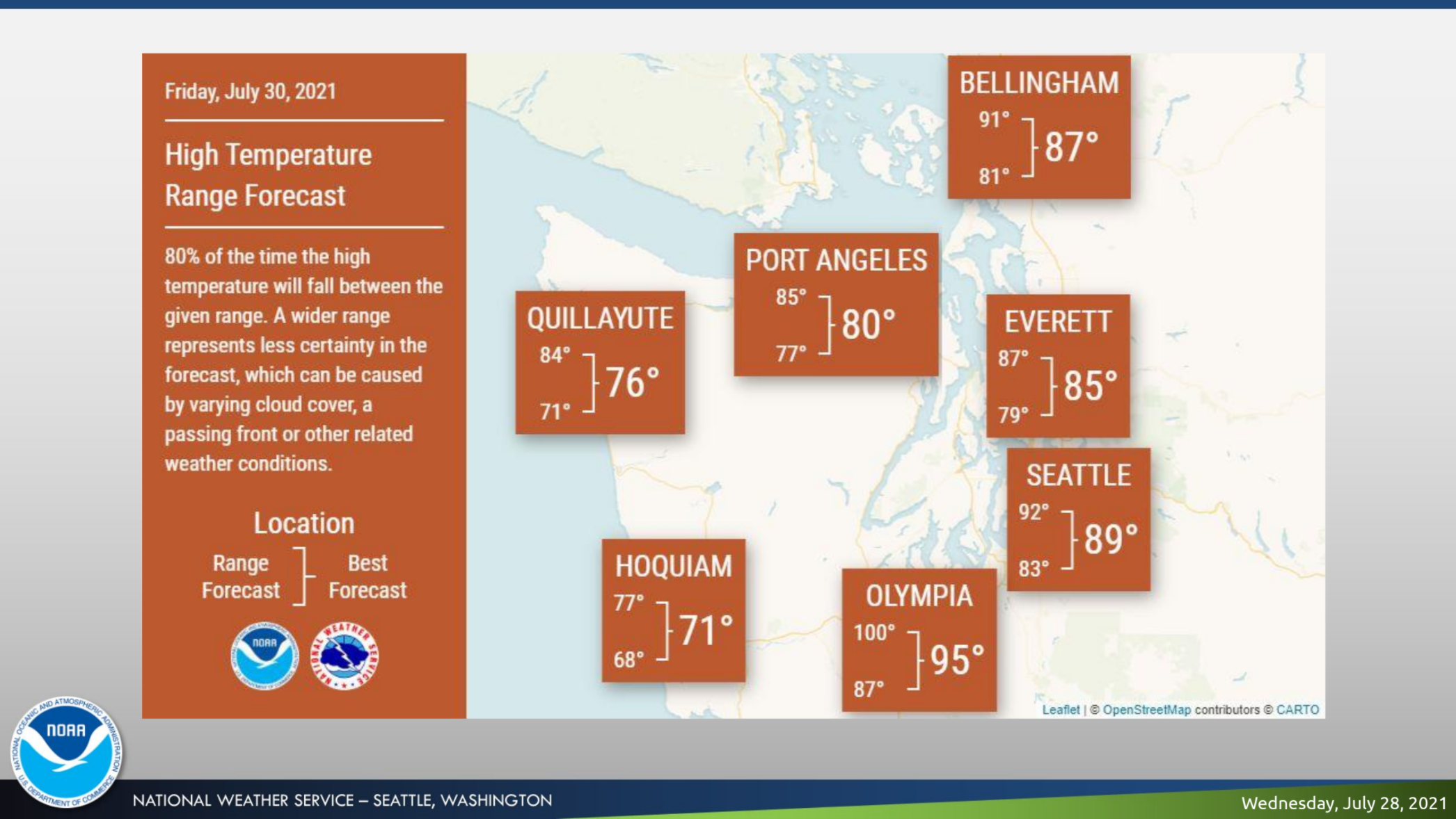
SEATTLE — Puget Sound is poised to end another month on a hot note, with forecasters flagging moderate heat risks building Thursday, peaking Friday and lingering into Saturday. Fortunately, the latest warm-up is not expected to compare with the extreme and historic heat wave that capped off June, but temperatures Friday and Saturday afternoon will still pose some risks for people sensitive to heat or without air conditioning.
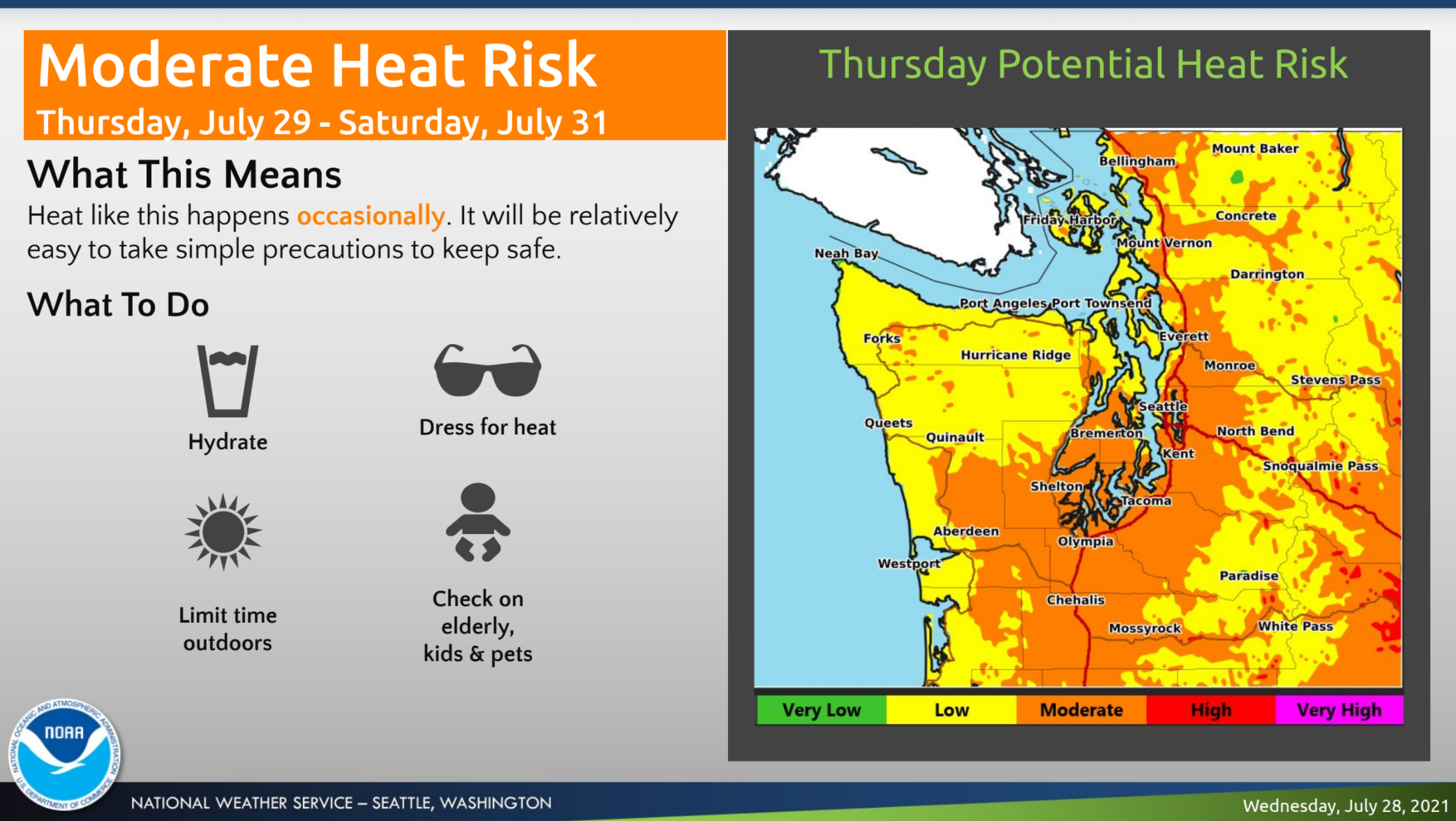
According to the National Weather Service, temperatures will nudge a few degrees higher by Thursday, landing in the high 80s for most communities in the lowlands. Friday is likely to be the warmest in the bunch, coming close to 90 degrees in Seattle and a few degrees higher on the Eastside and parts of Pierce County. Olympia is likely to see the mid-90s, with a small chance that temperatures could make it to triple digits.
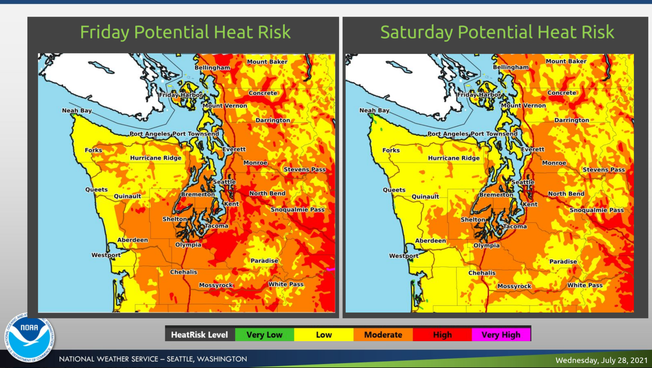
Most of Western Washington will see heat risks in the moderate range Thursday, according to the latest projections. By Friday, more areas are likely to see high risk, reflected in the red on the map, affecting a greater portion of the population. Forecasters said an inversion could make for similar heat at high elevations and unusually warm overnight temperatures in the mountains. The heat should begin to taper off again Saturday, and fall a few degrees further by Sunday, before returning to the normal range by next week.
Precipitation remains largely out of the equation for Puget Sound, with the best chance for some rain arriving near the Cascades late Saturday into Sunday, and a very slim chance for a "stray shower or two" in the lowlands, forecasters said. The conditions will continue to elevate fire risks, while 15 active wildfires are already burning in Washington and Oregon.
Here's where things stand as of Wed. morning, July 28! There are 701,205 acres of active fires in the PNW. There are 6,983 in the region. There are 382 and there are 64 out fighting fires. These resources are spread across 15 active fires -- 4 in OR and 11 in WA. pic.twitter.com/2ZvV9GvCWh
— Northwest Interagency Coordination Center (@NWCCInfo) July 28, 2021
While smoke from Western wildfires continues to impact much of the country, air quality west of the Cascades should stay in the good range through at least Friday, forecasters said. However, a shift in conditions could soon bring a change of fortune.
The Puget Sound Clean Air Agency writes:
"The table westerly winds that have been keeping wildfire smoke out of our region are beginning to change. This will bring some upper level smoke, however it doesn't look like much will mix down to ground level by the end of the week. Smoke predictions for this weekend are less certain and we will keep you updated."
The latest air quality forecasts are posted on the agency's website and the Washington Smoke Blog. A map of live air quality and wildfire smoke conditions is available via AirNow.
Get more local news delivered straight to your inbox. Sign up for free Patch newsletters and alerts.
