Weather
Heat Streak And Critical Fire Conditions Forecast In Washington
Hot, dry, and windy weather will heighten wildfire concerns over the next few days. Wednesday and Thursday are on track to be the hottest.


SEATTLE, WA — A prolonged stretch of hot, dry days, mixed with breezy conditions, will set the table for critical fire dangers through at least mid-week, according to the National Weather Service.
The peasant weekend weather will give way to a warming trend starting Monday, with afternoon temperatures ranging from the low to mid-80s across the lowlands and along the coast, forecasters said. Wednesday and Thursday are likely to be the hottest days in the group, as temperatures near or surpass 90 degrees across the region.
The heat is on next week! It's a good time to think about how to stay cool in these warmer temperatures! Never leave pets or children in the car, stay hydrated, & use caution with any activity that could spark a wildfire. #wawx pic.twitter.com/MxVLOViViD
— NWS Seattle (@NWSSeattle) September 5, 2020
East winds are expected to arrive Monday afternoon, bringing gusts ranging from 25 to 40 mph in the Cascades, foothills and western Whatcom County. The windy conditions are likely to last through at least Tuesday, compounding the fire danger, forecasters said.
Find out what's happening in Seattlefor free with the latest updates from Patch.
Hot, dry, and windy conditions will create critical fire weather concerns Monday-Wednesday across much of W WA. Do your part to prevent wildfires by avoiding any activity that could create a spark! #wawx pic.twitter.com/uRbVns7vr1
— NWS Seattle (@NWSSeattle) September 6, 2020
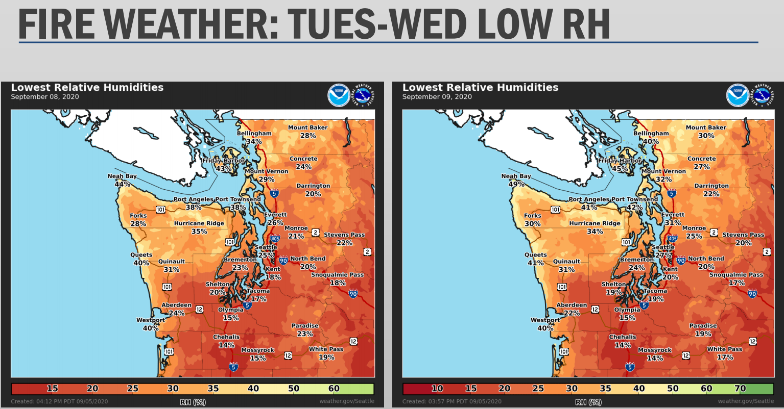
According to the National Weather Service, the humidity will be well below normal throughout the region, especially on Tuesday and Wednesday. In the South Sound, relative humidity levels could drop below 20 percent around Tacoma and Olympia.
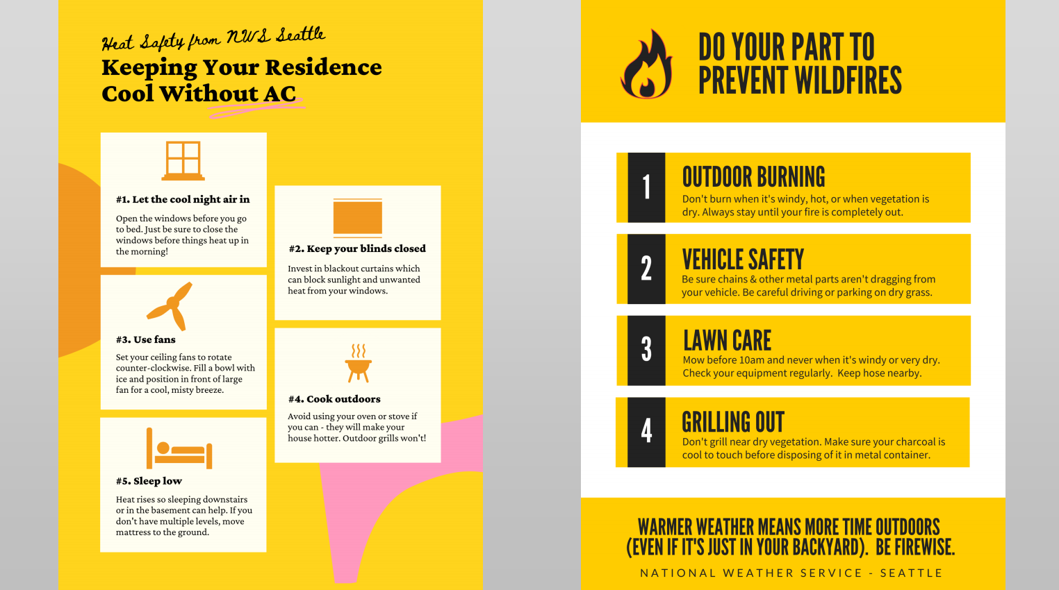
Here are a few tips on how to stay cool at home and prevent wildfires:
Find out what's happening in Seattlefor free with the latest updates from Patch.
Get more local news delivered straight to your inbox. Sign up for free Patch newsletters and alerts.
