Weather
Expect Light Snow In Puget Sound For Rest Of Week
Watch for snow through Friday, but nothing at all like we saw earlier in February.

SEATTLE, WA - If you see snow start to fall Wednesday evening, know that it probably won't amount to much.
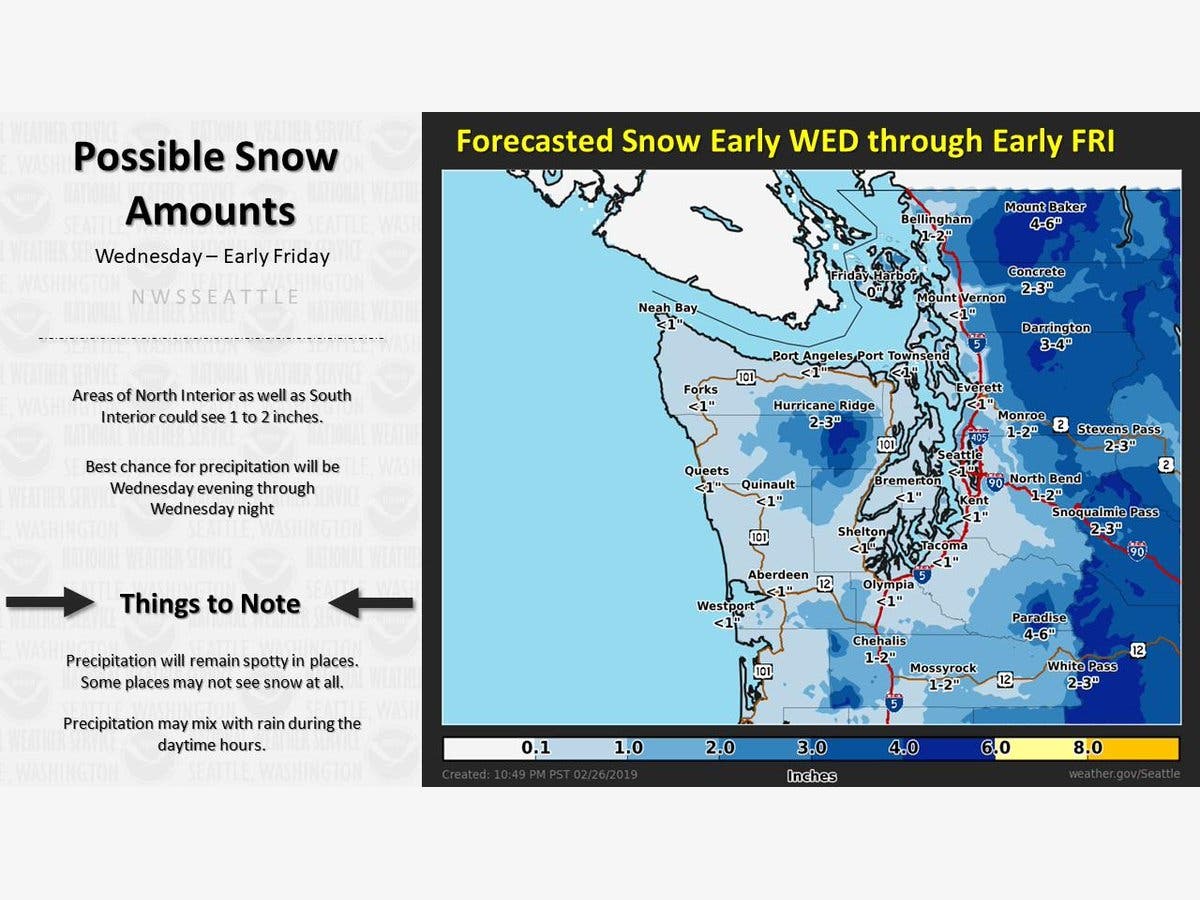
Forecasts Wednesday morning show the possibility for light accumulations through Friday, and the National Weather Service says the best chance for snow is Wednesday night.
Snow totals, if you can call them that, will be less than an inch in Seattle and on the Eastside. Parts of the I-90 corridor, from Issaquah to North Bend, could see up to 2 inches, however. At some points on Wednesday, precipitation will fall as rain.
Find out what's happening in Seattlefor free with the latest updates from Patch.
With just a little more than a day left in February 2019, Puget Sound area has accumulated between 18 inches (Kent, Maple Valley) to up to 2 feet in parts of Seattle, Renton, and Bellevue.
Interested to know how much snow has fallen across western Washington this winter? Here's a graphic showing the latest season-to-date snowfall totals across the area! Additional light snow in some locations through early Friday will add to these totals! #WAwx pic.twitter.com/m6ntuC0WEX
— NWS Seattle (@NWSSeattle) February 27, 2019
Find out what's happening in Seattlefor free with the latest updates from Patch.
Get more local news delivered straight to your inbox. Sign up for free Patch newsletters and alerts.
