Weather
More Lowland Snow Chances Forecast In Washington This Week
Four of the next five days have a chance at lowland flurries, with the best shot for all expected Tuesday night or Wednesday morning.

SEATTLE — Below-normal temperatures will stick around for the last full week of January, allowing for a few more brushes with lowland snow, according to the latest forecasts.
Two weather systems expected this week should provide the conditions for some flurries, particularly Tuesday night through Wednesday morning and Friday night through Saturday morning, the National Weather Service said.
Right now, forecasters believe the best chance for everyone to see at least a dusting will arrive Tuesday into Wednesday, as snow levels drop below 500 feet.
Find out what's happening in Seattlefor free with the latest updates from Patch.
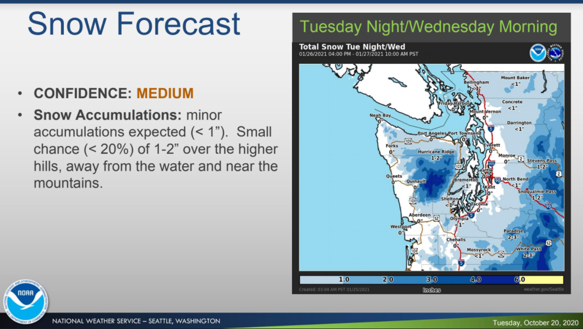
"Currently, the most likely scenario is for minor accumulations (less than an inch) for most lowland areas below 500 feet," forecasters wrote Monday morning. "There is a small chance (less than 20%) of 1-2 inches in some areas. The best chance for 1+ inches of snow is over the higher hills, away from the water and areas near the mountains."
Here's a look at the high temperature forecast over the next two days. Colder air will filter in Monday evening, but will be drier. Additional chances for showers return by Tuesday, but may be fairly limited. Stay tuned! #wawx pic.twitter.com/pI5vfusksu
— NWS Seattle (@NWSSeattle) January 25, 2021
With more precipitation on tap, this month could prove to be one of the wettest Januaries on record, according to NWS Seattle. Monday and Thursday look to provide a break between weather patterns, with only scattered showers expect both days.
Find out what's happening in Seattlefor free with the latest updates from Patch.
With 0.18 inches so far today Seattle jumps up 2 spots on the wettest January list to number 16 ( out of 77 years ) with 7.95" for the month. Another inch of rain the rest of the month will put January 2021 in 7th place right behind 6th place 2020 which had 9.23" of rain. #wawx
— NWS Seattle (@NWSSeattle) January 25, 2021
Forecasters are keeping tabs on the potentially wetter second system, moving into the region Friday, which could bring heavier snow, especially to areas along the Hood Canal and the Kitsap Peninsula. The National Weather Service will share more details on that outlook as the weekend nears.
Get more local news delivered straight to your inbox. Sign up for free Patch newsletters and alerts.
