Weather
Mountain Snow, Rainy Days Ahead For Washington: Puget Sound Forecast
Forecasters expect the first of two stronger weather systems will arrive Sunday, kicking off a wet and windy stretch in Western Washington.


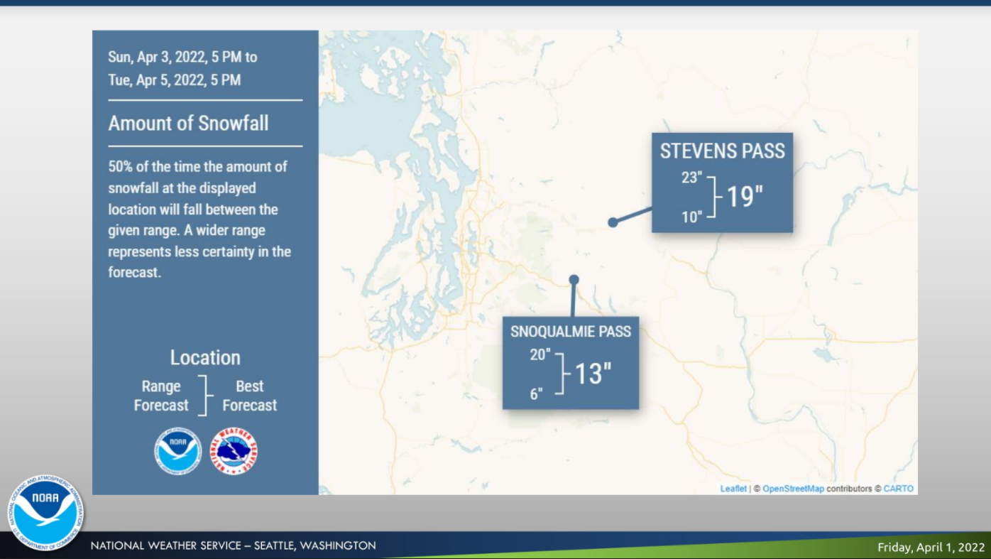
SEATTLE — It may be spring, but the Cascades have not seen the last of the snow just yet. Forecasters are tracking a pair of incoming storm systems that could drop close to two feet of snow over Stevens and Snoqualmie passes between Sunday night and Tuesday.
First, the National Weather Service expects a weaker front will move across the region late Friday into Saturday morning, bringing rain showers back to Puget Sound after a brief reprieve. The first of two stronger systems is forecast to arrive Sunday afternoon, bringing widespread rain, breezy conditions, mountain snow and large coastal swells through Tuesday.
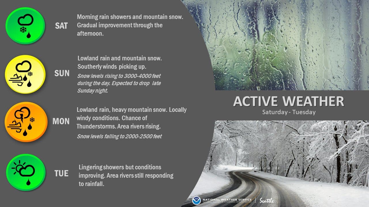
"Precipitation spreads back into the area during the day Sunday as the first of a pair of systems arrives associated with a broad upper trough over the northeast Pacific," NWS Seattle wrote Friday. "The initial shot of precipitation on Sunday won't be particularly heavy, but the arrival of a cold front early in the extended period and subsequent strong westerly flow aloft will be impactful."
Find out what's happening in Seattlefor free with the latest updates from Patch.
In the mountains, forecasters expect Snoqualmie Pass will pick up at least a foot of fresh snow, while Stevens could get closer to two feet.
In the lowlands, forecasters are also tracking the potential for river flooding between Monday and Wednesday in King and Mason counties. Residents with trips planned to the coast will also want to be especially cautious Monday, as the National Weather Service expects dangerous surf conditions.
Find out what's happening in Seattlefor free with the latest updates from Patch.
"Combined seas over the coastal waters will likely build significantly on Monday to 18 to 23 feet, with a large west swell component," forecasters wrote in a Friday briefing. "This could lead to both dangerous conditions for beachgoers due to high surf, as well as the potential for minor erosion along the coastline."
Things should gradually calm down through Tuesday, setting up for drier and warmer days around mid-week. Temperatures could hit 60 degrees by next Thursday. More details on next week's forecast will be shared in the coming days.
Here is the 5-day weather outlook for the Seattle area:
- Saturday: 54°/43° (Chance of showers)
- Sunday: 53°/45° (Rain)
- Monday: 51°/41° (Rain & breezy)
- Tuesday: 52°/38° (AM showers likely)
- Wednesday: 55°/42° (Partly sunny)
Get more local news delivered straight to your inbox. Sign up for free Patch newsletters and alerts.
