Weather
NOAA Winter Outlook: What The 3rd La Niña Could Mean For Washington
Things are looking up for another active winter in Washington, according to NOAA's annual predictions. Here's what could be headed our way.

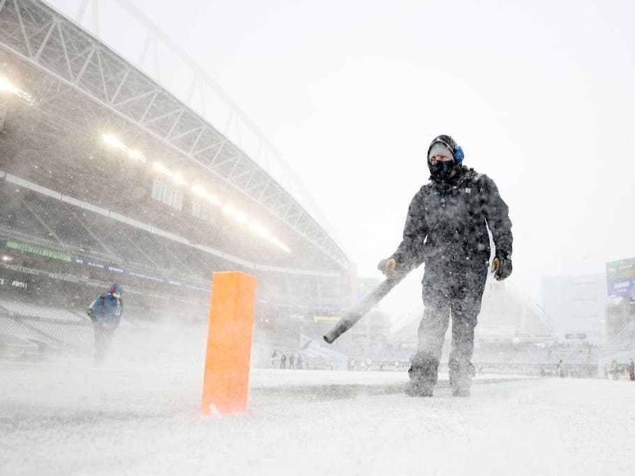
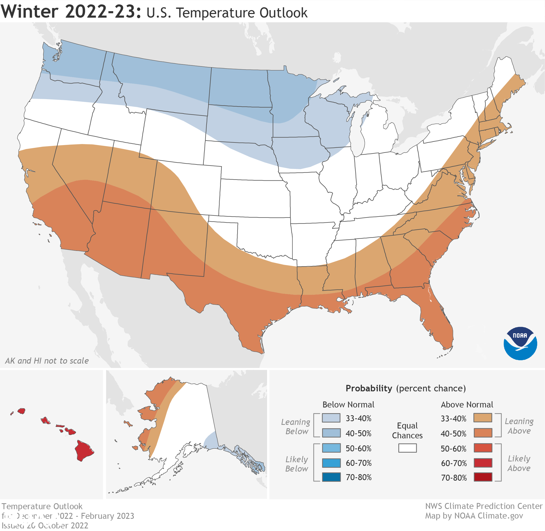
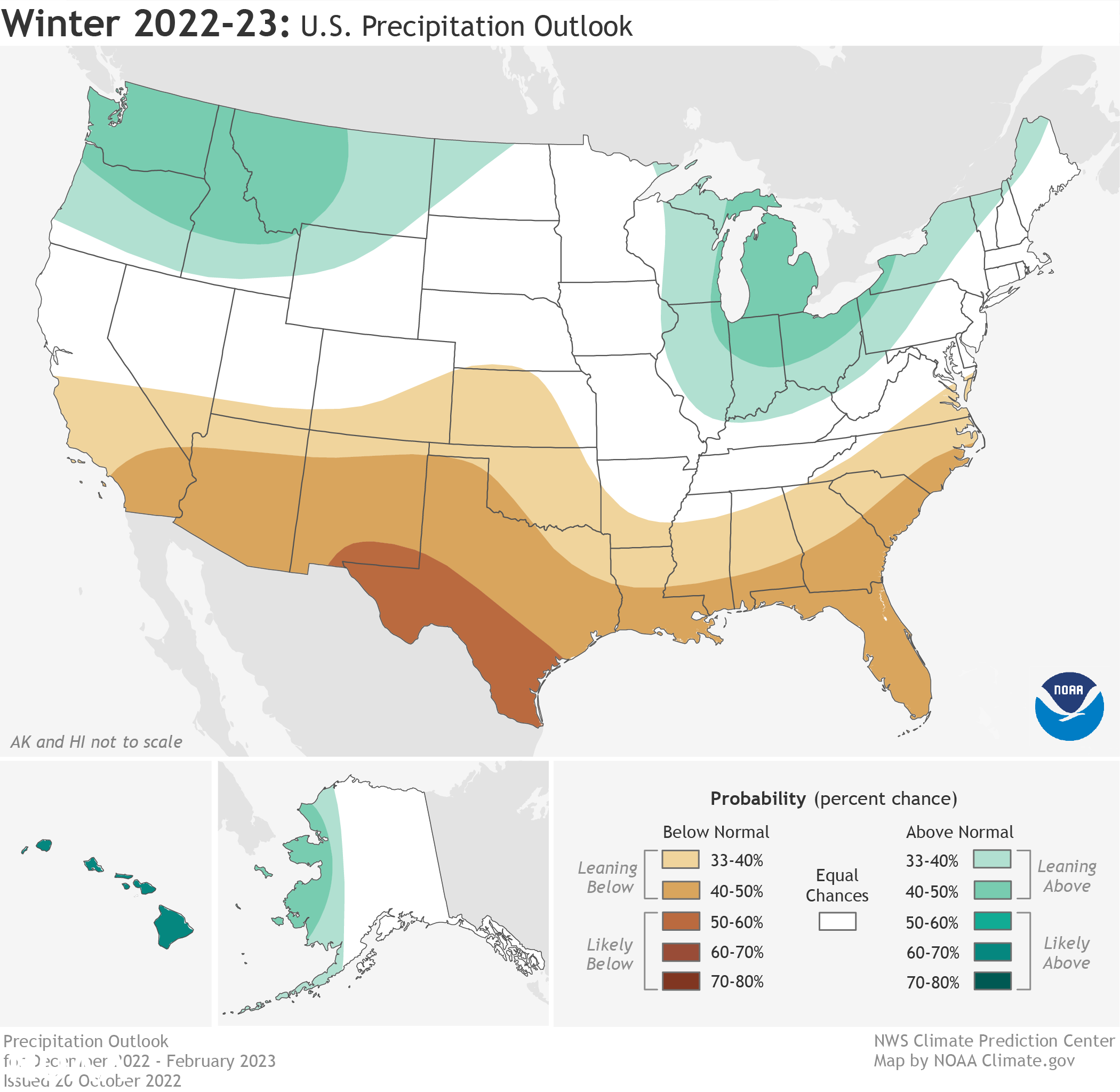
SEATTLE — Washington is one of just a handful of states where climatologists say the odds favor a cooler, wetter winter this year. As the first snow begins to grace the Cascades, the National Oceanic and Atmospheric Administration has released its official U.S. Winter Outlook, examining the probabilities for how the season will shake out between December and February.
A La Niña climate pattern holding on for the third consecutive winter is driving warmer-than-average temperatures for the Southwest and along the Gulf Coast and Eastern Seaboard, according to the outlook. Below-normal temperatures are favored from the Pacific Northwest eastward to the western Great Lakes and the Alaska Panhandle.
With temperatures likely trending colder, Washington may have another good shot at healthy snow accumulation this year, too. The predictions call for wetter-than-average conditions for the Pacific Northwest, northern Rockies, Great Lakes, and areas of the Ohio Valley.
Find out what's happening in Seattlefor free with the latest updates from Patch.
Drought conditions are present across about 60 percent of the country, and the La Niña climate pattern may extend the drought to the Gulf Coast, Jon Gottschalck, of NOAA’s Climate Prediction Center, said in a news release. Parts of the western U.S. and southern Great Plains will be the hardest hit by the dry weather, he said.
La Niña's effects on precipitation and temperatures vary from year to year. Both its strength and other seasonal variables play a role, too.
Find out what's happening in Seattlefor free with the latest updates from Patch.
While no two La Niñas are the same, the pattern was in place in February 2021, when Seattle logged its snowiest day in more than 50 years, and again last December when snow blanketed Western Washington in the days after Christmas. Low-temperature records fell throughout the week. By January, Snoqualmie Pass recorded its highest snowfall in 20 years, and winter storms continued to pummel the mountain passes into April.
NOAA's official round of predictions reached similar conclusions as AccuWeather's forecasters earlier this month, who favored cooler temperatures and above-average snowfall in the mountains this winter.
The Climate Prediction Center will next update its three-month seasonal outlooks on Nov. 17.
Get more local news delivered straight to your inbox. Sign up for free Patch newsletters and alerts.
