Weather
Snowpocalypse Not Over: Expect Strong Winds On Saturday
Heavy snow fell across Puget Sound Friday, but strong winds were expected to sweep through Saturday.


SEATTLE, WA - Heavy, wet snow fell across the Seattle area on Friday, leaving some areas under 4 or more inches of snow, and other areas with much less. But there was more in store for Saturday, with wind gusts expected as high as 40 MPH in the Seattle area.
Many cities in the Seattle area saw snow fall fast and hard between around noon and 6 p.m. South Seattle and Renton had totals up to 8 inches by Friday night, while Bellevue saw just above 2 inches, according to the National Weather Service.
The storm was spread across the entire state, however, leaving places like Sequim with more than 12 inches of snow. Gov. Jay Inslee declared a state of emergency on Friday afternoon, freeing up state resources for local cities to deal the storm's aftermath.
Find out what's happening in Seattlefor free with the latest updates from Patch.
"Weather forecasters predict this may be a storm unlike one we've seen in many years. I encourage everyone to stay off the roads if possible and plan ahead if you must travel," Inslee said Friday in a statement.
In the Puget Sound area, driving was, as usual, one of the biggest problems. Rush hour hit in the early afternoon, leaving most highways mostly empty by 5:30 p.m. There were plenty of crashes and slide offs, however, and SR 18 in Issaquah had to be closed for a period Friday night due to a crash.
Find out what's happening in Seattlefor free with the latest updates from Patch.
Local officials urged people not to drive to keep roads clear for plows and emergency vehicles.
"If you do not have to travel during the course of this weather event, please don't do that," Seattle fire Chief Harold Scoggins said.
But the snow was slowing public transportation, too.
On Friday evening, King County Metro put its Emergency Snow Network plan in place effective 4 a.m. Saturday. Under that plan, the bus system drops to just 60 "core routes" that travel along well-plowed streets with few hills. You can see a list of those routes here.
WSDOT advised anyone who feels the need to drive to do so slowly, even Subaru owners.
"Other than not traveling at all, there is no better way to be safe in these conditions than lowering your speed and being cautious. And remember, 4-wheel drive and all-wheel drive doesn't mean you can steer or stop better on ice," WSDOT wrote on its blog.
>>>What can you do for homeless people during the storm? Find shelter resources here
Sound Transit's Link light rail was touted as the best bet for getting around. Sound Transit CEO Peter Rogoff highlighted that the person in charge of Link worked for the Minneapolis light rail system.
"We are very confident in our ability to keep light rail moving," he said.
At Sea-Tac airport, hundreds of flights were canceled. The airport had mobilized its fleet of plows, friction-testers, and deicing trucks, but travelers were urged to check their flight status before leaving home.
Pedestrians were also warned to be careful. The King County Fire Chiefs Association recommended reflective clothing, shoes with good tread, and not walking in roadways.
Here are some preliminary snow totals as of 9 p.m. Friday
- Northeast Renton - 8 inches
- Burien - 6 inches
- Covington - 4-1/2 inches
- Normandy Park - 4-1/2 inches
- Issaquah - 4 inches
- SeaTac - 3 inches
- Southwest Seattle - 2-1/2 inches
- Bellevue - 2-1/2 inches
For Saturday, Puget Sound residents should expect wind gusts as high as 40 MPH, according to the National Weather Service. Winds will be lighter farther east along I-90, topping out at about 25 MPH near North Bend.
The region will be under a winter storm warning until 4 p.m. Saturday. Snow will continue to fall, but not as heavy as Friday afternoon.
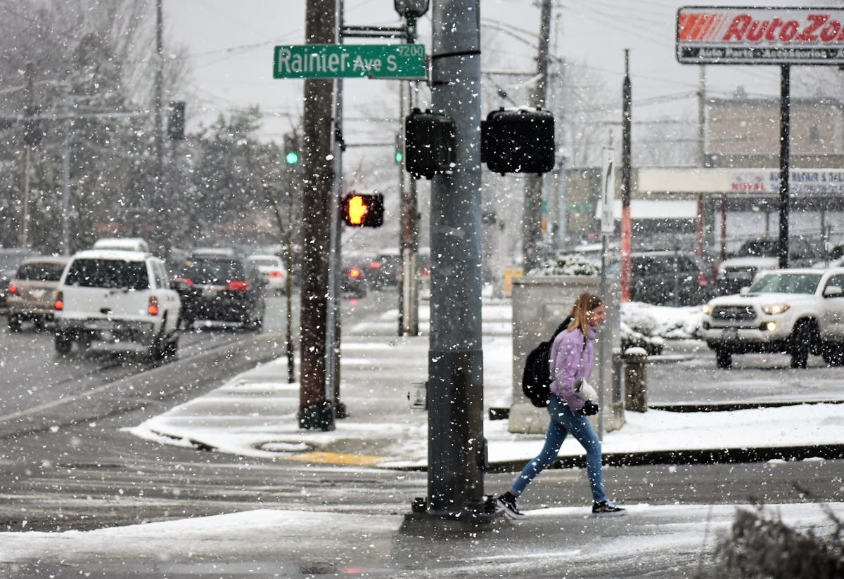
Caption: A pedestrian crosses Rainier Avenue in south Seattle during heavy snowfall Friday, Feb. 8.
Photos by Neal McNamara/Patch
Get more local news delivered straight to your inbox. Sign up for free Patch newsletters and alerts.
