Weather
Some Smoke Possible As Cooler Weather Prevails In Puget Sound
The forecast calls for a few more days of cooler weather in Western Washington and a couple of chances for rain before a weekend warm-up.


SEATTLE — The unseasonably cool weather will be sticking around for a few more days and should bring another couple of chances for rain by late in the week, according to the National Weather Service. After a hot start to the month, temperatures have kept below normal in the latter half of August, and Friday and Saturday brought two full days of cloud cover to the Seattle area for the first time in five months.
While plenty of sunshine is in the forecast through Wednesday, afternoon temperatures should peak in the mid-70s. Thursday and Friday bring back the cloud cover, with fresh chances for showers, before the skies clear up in time for a warm and sunny weekend.
Average Seattle high temp... August 1st thru 15th...83.6° ( 5.0° above normal ) August 16th thru 22nd...72.1° ( 5.3° below normal ) Cooler weather continuing this week with a chance of showers Thursday & Friday. Temperatures warming back to above normal over the weekend. #wawx pic.twitter.com/zXv2VibrqR
— NWS Seattle (@NWSSeattle) August 23, 2021
One hitch in the otherwise pleasant outlook is the potential for some wildfire smoke returning from Central Washington. While forecasters are hopeful Puget Sound will steer clear of significant impacts, there is a chance for a brief brush with smoke Tuesday.
Find out what's happening in Seattlefor free with the latest updates from Patch.
NWS Seattle writes:
"Regarding smoke and air quality, current smoke models show a little smoke aloft and near the surface creeping west across the Cascades and into Western Washington east of Puget Sound on Tuesday. Low level flow is very weakly onshore so it's hard to imagine very much smoke moving in. For now, significantly degraded air quality is not expected but this will need to be monitored. Any smoke that does settle over the area on Tuesday should get pushed east out of the area Wednesday and Thursday as stronger onshore flow develops."
The Puget Sound Clean Air Agency said air quality could degrade to the "moderate" range Tuesday, but strong westerly winds should clear up anything that arrives by Wednesday.
Find out what's happening in Seattlefor free with the latest updates from Patch.
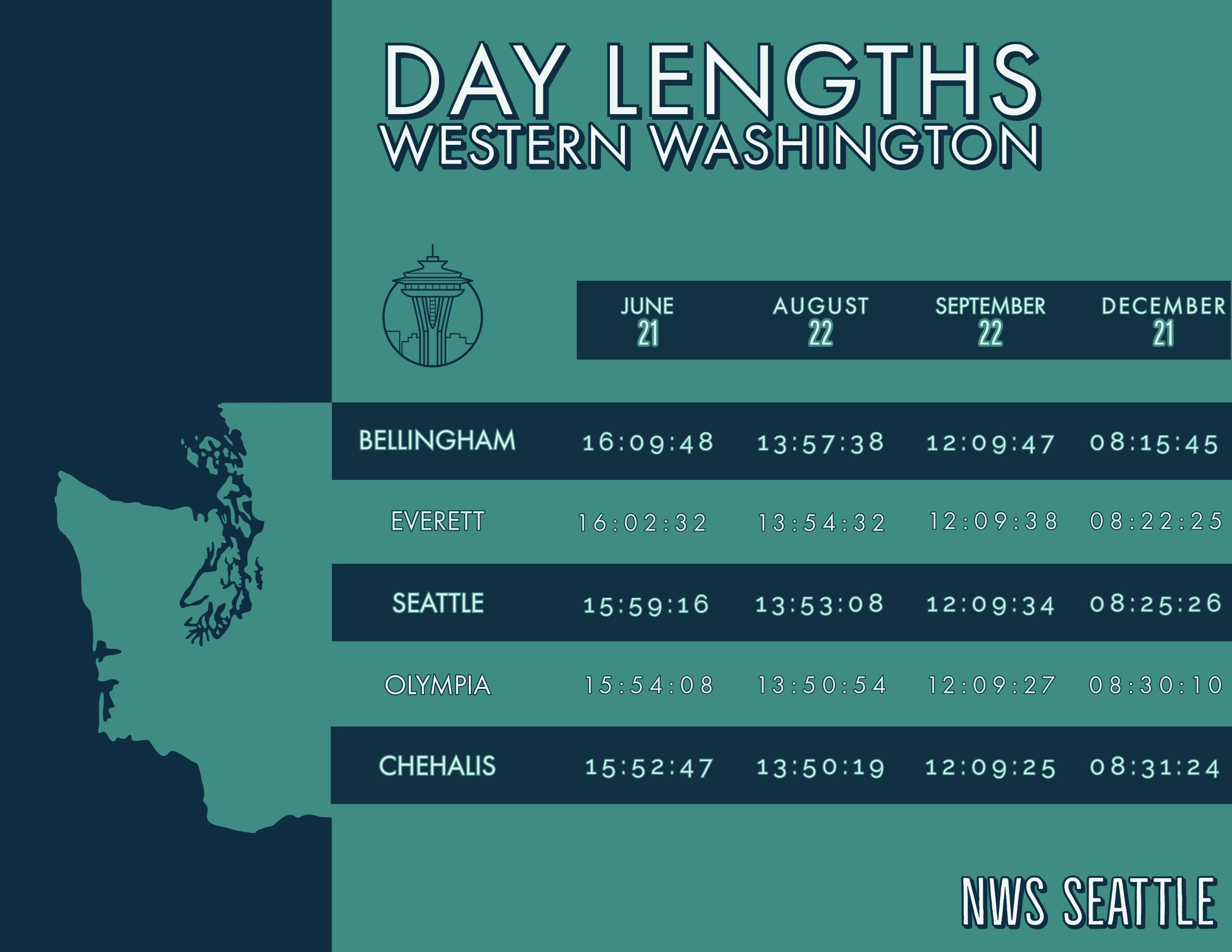
As Washington marches toward the autumnal equinox, fans of the sunshine should get out and enjoy it while they can: The Seattle area will shed more than 100 minutes of daylight by Sept. 22. Early indications of another La Niña winter are holding firm, with the latest climatology outlook now showing a 70 percent probability of its emergence by November. For the Pacific Northwest, La Niña winters typically bring cooler, wetter and snowier conditions.
Get more local news delivered straight to your inbox. Sign up for free Patch newsletters and alerts.
