Weather
Sweater Weather Is Here: Cold, Wet Days Ahead For Puget Sound
Snow levels could drop to 3,000 feet by Sunday evening, and early next week promises the coldest days Puget Sound has seen in months.

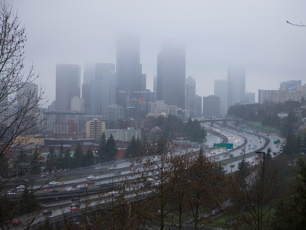
SEATTLE — The October slide has arrived, and temperatures are on track to tumble into next week, bringing Puget Sound its coldest days in months and, for some, overnight lows flirting with freezing. Forecasters expect below-average temperatures will linger through at least all of next week, as Washington joins the entire West in welcoming the return of "sweater weather."
If "sweater weather" isn't your thing, avert your eyes! A weather system this weekend will usher in the coolest temperatures of the season thus far. And a pattern of cooler and wetter than normal looks to continue well into next week. 🍵☕️❄️🌨️ #wawx pic.twitter.com/81KLa5UnX2
— NWS Seattle (@NWSSeattle) October 6, 2021
First, let's talk about the cold
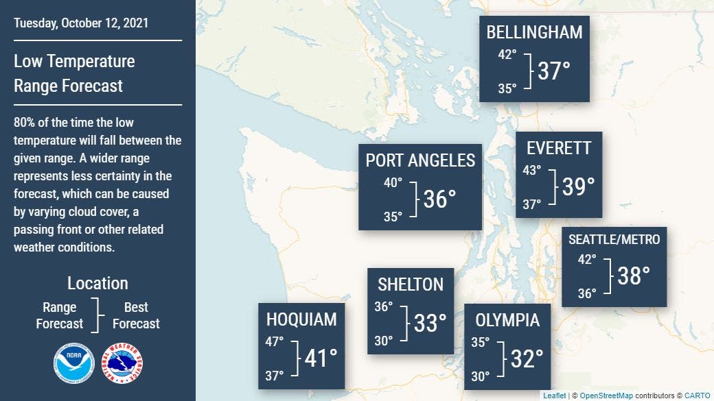
While things have already taken a chillier turn in recent days, the slide is just getting started. Monday could bring the Seattle area its coolest afternoon in nearly six months, with a high of just 53 degrees. Forecasters expect Tuesday morning will be the coldest of the season so far, with lows in the 30s across Puget Sound, from Bellingham down to Olympia.
Find out what's happening in Seattlefor free with the latest updates from Patch.
In the South Sound, Thurston and Lewis counties will likely see their first freeze.
A wet weekend in the lowlands, with snow for Snoqualmie and Stevens
Find out what's happening in Seattlefor free with the latest updates from Patch.
Temperatures will stay a tad warmer for the weekend, but things will get wetter and windier. The National Weather Service expects southerly winds will pick up Saturday, with gusts for most between 20 and 35 mph. Stronger rains should begin to push inland late Saturday afternoon before peaking overnight. Sunday looks to be more showery, with a slight chance for a few thunderstorms, especially around the convergence zone.
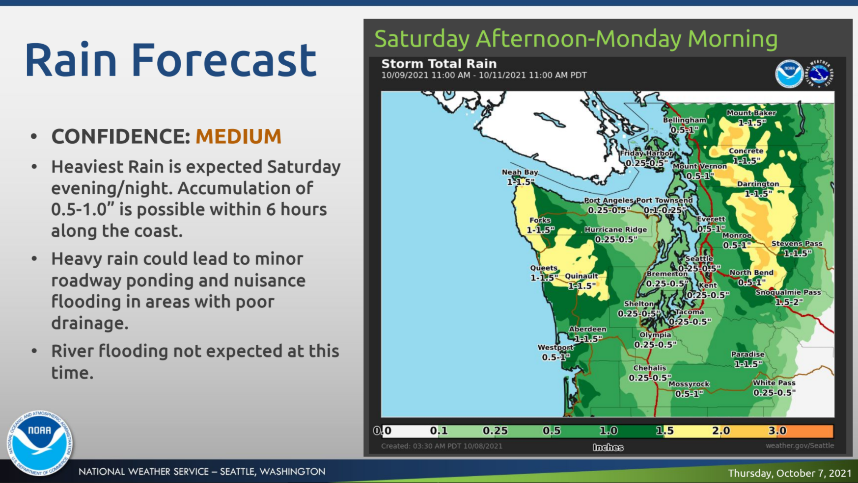
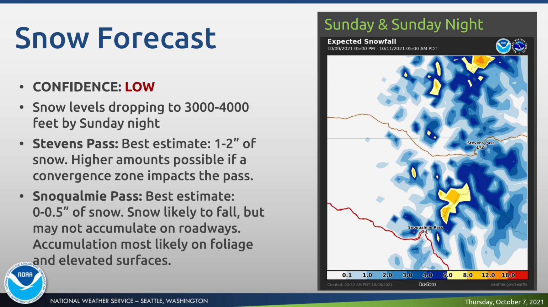
Snow levels in the Cascades could drop as low as 3,000 feet by Sunday night, potentially allowing for some accumulation at both Snoqualmie and Stevens passes.
"Most areas in the mountains will accumulate light amounts (under 2"), however potential convective banding Sunday into Sunday night may increase snow amounts in the central Cascades, focused on the Cascades of Snohomish/King counties," NWS Seattle wrote Friday. "This area will need to be monitored for locally higher amounts of snow, with the current forecast of 1-2" for Stevens Pass and up to 1" for Snoqualmie Pass."
The current forecasts show rain showers easing through Monday morning and clearer skies by Tuesday, coinciding with the coldest temperatures. Another front is due Wednesday, with another not far behind, bringing more rain into late next week. Temperatures around the region look unlikely to break out of the 50s any time in the near future.
Get more local news delivered straight to your inbox. Sign up for free Patch newsletters and alerts.
