Weather
Temperatures Poised To Reach The 90s In Washington Monday
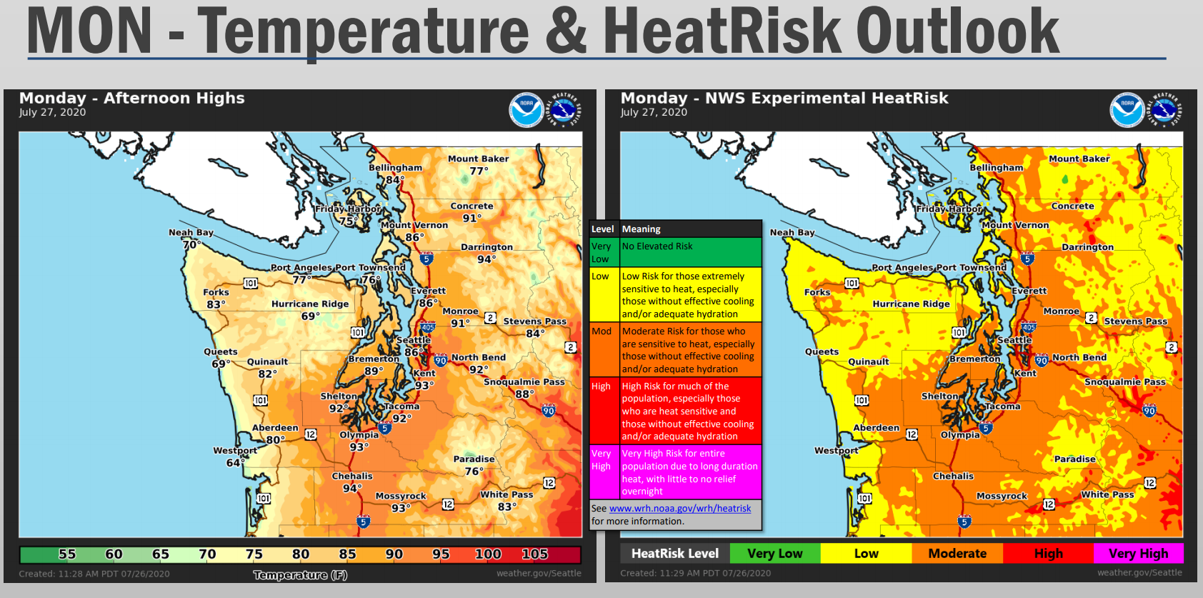
Monday is expected to by the warmest day of the recent dry streak. Heat advisories will be in place until 8 p.m.


SEATTLE, WA — A run of pleasant, summer weather in Western Washington will continue Monday, forecasters say, with afternoon temperatures on-track to reach the mid-90s in some areas.
Cooler, cloudy weather gave way to the sunshine Saturday and brought temperatures into the 80s for most by Sunday. Monday is poised to be the warmest day in the heat streak before temperatures begin to taper off.
The warmest weather is expected around Tacoma, the lower Chehalis Valley and along the Southwest Interior.
Find out what's happening in Seattlefor free with the latest updates from Patch.
Find out what's happening in Seattlefor free with the latest updates from Patch.
| Location | Highs | Lows |
| Seattle area | 86° - 93° | 62° |
| Tacoma/Olympia | 90° - 95° | 58° |
| Everett | 83° | 60° |
Residents are reminded to drink plenty of fluids, and ensure children and pets are not left unattended in vehicles for any period of time.
According to the National Weather Service, Tuesday and Wednesday will be one or two degrees cooler on average, before a much more noticeable shift in the latter half of the week, bringing along a chance for rain.
Heating up today with a few more degrees added on for Monday! Make sure to take precautions especially if you're sensitive to the heat! #wawx pic.twitter.com/4blwH3hRMf
— NWS Seattle (@NWSSeattle) July 26, 2020
Get more local news delivered straight to your inbox. Sign up for free Patch newsletters and alerts.